
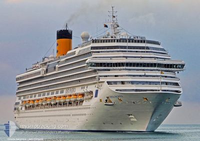
COSTA PACIFICA
Passenger
Current Trip
| Trip Time | 11 h, 20 mins |
|---|---|
| Trip Distance | 132.77 nm |
| AVG Speed | 10.1 Knots |
| MAX Speed | 13.7 Knots |
| Dybgang | 8 m |
| AVG Wind | 12 knots |
| MAX Wind | 13.7 knots |
| MIN Temp | 25.7°C / 78.26°F |
| MAX Temp | 26.5°C / 79.7°F |
| Position Modtaget | 3 m siden |
Current Position
| Longitude | --- |
|---|---|
| Latitude | --- |
| Status | Moored |
| Fart | |
| Kurs | 306° |
| Område | Caribbean Sea |
| Station | T-AIS |
| Position Modtaget | 3 m siden |
Info
Information
The current position of COSTA PACIFICA is in Caribbean Sea with coordinates 18.42204° / -64.61316° as reported on 2026-01-10 13:15 by AIS to our vessel tracker app. The vessel's current speed is 0 Knots and is currently inside the port of ROAD TOWN.
The vessel COSTA PACIFICA (MMSI: 247258100) is a Passenger It's sailing under the flag of [IT] Italy.
In this page you can find informations about the vessels current position, last detected port calls, and current voyage information. If the vessels is not in coverage by AIS you will find the latest position.
The current position of COSTA PACIFICA is detected by our AIS receivers and we are not responsible for the reliability of the data. The last position was recorded while the vessel was in Coverage by the Ais receivers of our vessel tracking app.
The current draught of COSTA PACIFICA as reported by AIS is 8 meters
Weather
| Temperature | 25.6°C / 78.08°F |
|---|---|
| Wind Speed | 12 knots |
| Direction | 67° ENE |
| Pressure | 1017.4 hPa |
| Humidity | 74.6 % |
| Cloud Coverage | 11 % |
Featured Company
Last Port Calls
| Port | Arrival | Departure | Time In Port |
|---|---|---|---|
| 2026-01-10 10:34 | |||
| 2026-01-09 12:11 | 2026-01-09 23:14 | 11 h | |
| 2026-01-08 12:27 | 2026-01-09 03:54 | 15 h | |
| 2026-01-06 12:03 | 2026-01-08 01:09 | 1 d | |
| 2026-01-04 11:02 | 2026-01-05 04:28 | 17 h | |
| 2026-01-03 11:45 | 2026-01-03 22:26 | 10 h | |
| 2026-01-01 11:20 | 2026-01-01 22:11 | 10 h | |
| 2025-12-31 13:13 | 2026-01-01 00:07 | 10 h | |
| 2025-12-28 11:13 | 2025-12-29 05:13 | 17 h | |
| 2025-12-27 09:55 | 2025-12-27 18:31 | 8 h |
Most Visited Ports (Last year)
| Port | Arrivals | |
|---|---|---|
| 32 | ||
| 27 | ||
| 25 | ||
| 25 | ||
| 23 | ||
| 20 |
Last Trips
| Origin | Departure | Destination | Arrival | Distance | |
|---|---|---|---|---|---|
| 2026-01-09 19:14 | 2026-01-10 06:34 | 132.77 nm | |||
| 2026-01-08 23:54 | 2026-01-09 08:11 | 135.56 nm | |||
| 2026-01-07 21:09 | 2026-01-08 08:27 | 147.55 nm | |||
| 2026-01-05 00:28 | 2026-01-06 08:03 | 536.82 nm | |||
| 2026-01-03 18:26 | 2026-01-04 07:02 | 205.09 nm | |||
| 2026-01-01 18:11 | 2026-01-03 07:45 | 473.49 nm | |||
| 2025-12-31 19:07 | 2026-01-01 07:20 | 128.20 nm | |||
| 2025-12-29 01:13 | 2025-12-31 08:13 | 484.03 nm | |||
| 2025-12-27 14:31 | 2025-12-28 07:13 | 290.16 nm | |||
| 2025-12-26 19:04 | 2025-12-27 05:55 | 131.98 nm |
Events
| Tid | Hændelsen | Detaljer | Position / Dest | Info |
|---|---|---|---|---|
| 2026-01-10 10:48 | Status er ændret | Moored Under way using engine |
18.42203 / -64.61315
[VG] ROAD TOWN
|
Fart: 0.1 kn Kurs: 307° |
| 2026-01-10 10:42 | STOP Sejllads |
18.42176 / -64.61290
[VG] ROAD TOWN
|
Fart: 0.3 kn Kurs: 307° |
|
| 2026-01-10 10:34 | Skibe i havn |
|
18.41994 / -64.61033
[VG] ROAD TOWN
|
Fart: 2.7 kn Kurs: 305° |
| 2026-01-10 07:30 | Ændre havområde | British Virgin Islands part of the Caribbean Sea Saba part of the Caribbean Sea |
18.16180 / -64.10161
Caribbean Sea
|
Fart: 11.9 kn Kurs: 288.3° |
| 2026-01-10 07:30 | Status er ændret | Under way using engine Default |
18.16180 / -64.10161
GPPTP - POINTE A PIT
|
Fart: 11.9 kn Kurs: 288° |
| 2026-01-10 07:25 | Indenfor Dækning |
18.16180 / -64.10161
Caribbean Sea
|
Fart: 11.9 kn Kurs: 288.3° |
|
| 2026-01-10 04:57 | Status er ændret | Default Under way using engine |
17.89678 / -63.68234
GPPTP - POINTE A PIT
|
Fart: 11.8 kn Kurs: 297.3° |
| 2026-01-10 04:53 | Udenfor Dækning |
17.89025 / -63.66877
Caribbean Sea
|
Fart: 11.8 kn Kurs: 297.3° |
|
| 2026-01-10 03:57 | Status er ændret | Under way using engine Default |
17.81772 / -63.48690
GPPTP - POINTE A PIT
|
Fart: 12 kn Kurs: 294° |
| 2026-01-10 03:50 | Status er ændret | Default Under way using engine |
17.80833 / -63.46500
GPPTP - POINTE A PIT
|
Fart: 12.1 kn Kurs: 296.8° |