

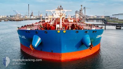
COSFLOURISH LAKE
Tanker

Current Trip
HIGH SEA
| Time Travelled | 25 days |
|---|---|
| Remaining Time | --- |
| Distance Travelled | 1398.85 nm |
| Remaining Distance | --- |
| AVG Speed | 7.3 Knots |
| MAX Speed | 16.2 Knots |
| AVG Wind | 9.7 knots |
| MAX Wind | 25.9 knots |
| MIN Temp | 10.5°C / 50.9°F |
| MAX Temp | 17.3°C / 63.14°F |
| Dybgang | 11.6 m |
| Position Modtaget | 3 h, 49 m siden |
Current Position
| Longitude | --- |
|---|---|
| Latitude | --- |
| Status | At anchor |
| Fart | 0.1 Knots |
| Kurs | 84° |
| Område | North Atlantic Ocean |
| Station | T-AIS |
| Position Modtaget | 3 h, 49 m siden |
Information
The current position of COSFLOURISH LAKE is in North Atlantic Ocean with coordinates 36.08340° / -6.29480° as reported on 2025-03-04 11:48 by AIS to our vessel tracker app. The vessel's current speed is 0.1 Knots
The vessel COSFLOURISH LAKE (IMO: 9783356, MMSI: 477142100) is a Tanker It's sailing under the flag of [HK] Hong Kong.
In this page you can find informations about the vessels current position, last detected port calls, and current voyage information. If the vessels is not in coverage by AIS you will find the latest position.
The current position of COSFLOURISH LAKE is detected by our AIS receivers and we are not responsible for the reliability of the data. The last position was recorded while the vessel was in Coverage by the Ais receivers of our vessel tracking app.
The current draught of COSFLOURISH LAKE as reported by AIS is 11.6 meters
Weather
| Temperature | 16.4°C / 61.52°F |
|---|---|
| Wind Speed | 20 knots |
| Direction | 104° ESE |
| Pressure | 1009.6 hPa |
| Humidity | 85.4 % |
| Cloud Coverage | 70 % |


Featured Company
Events
| Tid | Hændelsen | Detaljer | Position / Dest | Info |
|---|---|---|---|---|
| 2025-03-04 11:54 | Status er ændret | Default At anchor |
36.08333 / -6.29479
HIGH SEA
|
Fart: 0.1 kn Kurs: 84° |
| 2025-03-04 11:48 | Udenfor Dækning |
36.08340 / -6.29480
North Atlantic Ocean
|
Fart: 0.1 kn Kurs: 198.1° |
|
| 2025-03-04 11:42 | Status er ændret | At anchor Default |
36.08344 / -6.29475
HIGH SEA
|
Fart: 0.1 kn Kurs: 83° |
| 2025-03-04 11:33 | Indenfor Dækning |
36.08344 / -6.29475
North Atlantic Ocean
|
Fart: Kurs: 214.1° |
|
| 2025-03-04 10:45 | Status er ændret | Default At anchor |
36.08292 / -6.29415
HIGH SEA
|
Fart: 0.1 kn Kurs: 59° |
| 2025-03-04 10:39 | Udenfor Dækning |
36.08272 / -6.29398
North Atlantic Ocean
|
Fart: 0.1 kn Kurs: 348° |
|
| 2025-03-04 10:36 | Status er ændret | At anchor Default |
36.08258 / -6.29391
HIGH SEA
|
Fart: Kurs: 52° |
| 2025-03-04 10:33 | Status er ændret | Default At anchor |
36.08241 / -6.29385
HIGH SEA
|
Fart: 0.1 kn Kurs: 50° |
| 2025-03-04 10:24 | Status er ændret | At anchor Default |
36.08216 / -6.29381
HIGH SEA
|
Fart: Kurs: 47° |
| 2025-03-04 09:18 | Udenfor Dækning |
36.08231 / -6.29516
North Atlantic Ocean
|
Fart: 0.3 kn Kurs: 224° |