

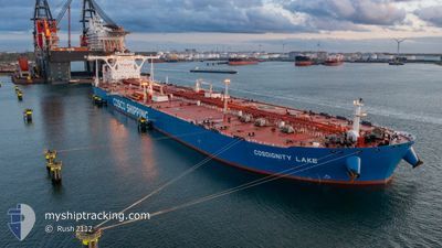
COSDIGNITY LAKE
Tanker

Current Trip
| Time Travelled | 1 day |
|---|---|
| Remaining Time | 3 days |
| Distance Travelled | 494.87 nm |
| Remaining Distance | 1167.74 nm |
| AVG Speed | 12.5 Knots |
| MAX Speed | 15.4 Knots |
| AVG Wind | 22.2 knots |
| MAX Wind | 31.2 knots |
| MIN Temp | 8°C / 46.4°F |
| MAX Temp | 17.9°C / 64.22°F |
| Dybgang | 19.8 m |
| Position Modtaget | 2025-01-22 20:03 |
Current Position
| Longitude | --- |
|---|---|
| Latitude | --- |
| Status | Under way using engine |
| Fart | 11.9 Knots |
| Kurs | 114.1° |
| Område | South Atlantic Ocean |
| Station | T-AIS |
| Position Modtaget | 2025-01-22 20:03 |
Information
The current position of COSDIGNITY LAKE is in South Atlantic Ocean with coordinates -35.03404° / 18.51952° as reported on 2025-01-22 20:03 by AIS to our vessel tracker app. The vessel's current speed is 11.9 Knots and is heading at the port of TIANJIN. The estimated time of arrival as calculated by MyShipTracking vessel tracking app is 2025-03-21 12:47 LT
The vessel COSDIGNITY LAKE (IMO: 9727209, MMSI: 477884300) is a Tanker It's sailing under the flag of [HK] Hong Kong.
In this page you can find informations about the vessels current position, last detected port calls, and current voyage information. If the vessels is not in coverage by AIS you will find the latest position.
The current position of COSDIGNITY LAKE is detected by our AIS receivers and we are not responsible for the reliability of the data. The last position was recorded while the vessel was in Coverage by the Ais receivers of our vessel tracking app.
The current draught of COSDIGNITY LAKE as reported by AIS is 19.8 meters
Weather
| Temperature | 18.7°C / 65.66°F |
|---|---|
| Wind Speed | 15 knots |
| Direction | 43° NE |
| Pressure | 1020.3 hPa |
| Humidity | 71.2 % |
| Cloud Coverage | 100 % |


Featured Company
Events
| Tid | Hændelsen | Detaljer | Position / Dest | Info |
|---|---|---|---|---|
| 2025-03-15 23:46 | START Sejllads | 1.53 nm, North West of NINGBO |
29.95817 / 121.82195
TIANJIN
|
Fart: 5.2 kn Kurs: 66° |
| 2025-03-15 23:46 | Afsejlet fra sidste havn |
|
29.95817 / 121.82195
TIANJIN
|
Fart: 2.3 kn Kurs: 357° |
| 2025-03-14 09:36 | Skibe i havn |
|
29.95320 / 121.81828
[CN] NINGBO
|
Fart: 0.3 kn Kurs: 301° |
| 2025-03-14 09:06 | STOP Sejllads | 1.56 nm, West of NINGBO |
29.95410 / 121.81889
TIANJIN
|
Fart: 0.3 kn Kurs: 301° |
| 2025-03-14 07:02 | START Sejllads | 7.55 nm, East of NINGBO |
29.93311 / 121.99097
TIANJIN
|
Fart: 4.1 kn Kurs: 10° |
| 2025-03-13 05:22 | STOP Sejllads | 7.64 nm, East of NINGBO |
29.92796 / 121.99204
TIANJIN
|
Fart: 0.2 kn Kurs: 301° |
| 2025-03-12 23:13 | START Sejllads |
29.73902 / 122.55084
TIANJIN
|
Fart: 3.3 kn Kurs: 135° |
|
| 2025-03-10 05:02 | STOP Sejllads |
29.74073 / 122.55273
TIANJIN
|
Fart: Kurs: 340° |
|
| 2025-03-08 07:34 | START Sejllads | 5.83 nm, South East of GWANGYANG |
34.84292 / 127.79224
TIANJIN
|
Fart: 4.2 kn Kurs: 140° |