
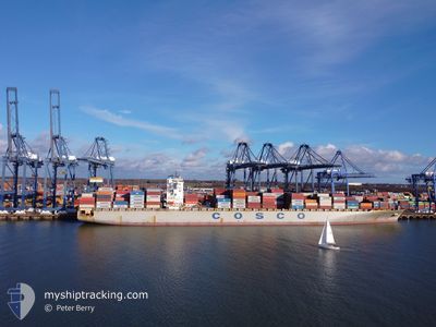
COSCO INDONESIA
Container Ship
Current Trip
| Time Travelled | 2 days |
|---|---|
| Remaining Time | 4 days |
| Distance Travelled | 1172.37 nm |
| Remaining Distance | 1852.50 nm |
| AVG Speed | 18.4 Knots |
| MAX Speed | 19.7 Knots |
| AVG Wind | 11 knots |
| MAX Wind | 20.9 knots |
| MIN Temp | 20.1°C / 68.18°F |
| MAX Temp | 25.8°C / 78.44°F |
| Dybgang | 13.2 m |
| Position Modtaget | Nu |
Current Position
| Longitude | 4.50336° |
|---|---|
| Latitude | 37.74834° |
| Status | Under way using engine |
| Fart | 17.9 Knots |
| Kurs | 264° |
| Område | Mediterranean Sea - Western Basin |
| Station | T-AIS |
| Position Modtaget | Nu |
Info
Information
The current position of COSCO INDONESIA is in Mediterranean Sea - Western Basin with coordinates 37.74834° / 4.50336° as reported on 2024-06-17 16:11 by AIS to our vessel tracker app. The vessel's current speed is 17.9 Knots and is heading at the port of FELIXSTOWE. The estimated time of arrival as calculated by MyShipTracking vessel tracking app is 2024-06-21 20:08 LT
The vessel COSCO INDONESIA (IMO: 9448786, MMSI: 477831200) is a Container Ship that was built in 2010 ( 14 år gamle ). It's sailing under the flag of [HK] Hong Kong.
In this page you can find informations about the vessels current position, last detected port calls, and current voyage information. If the vessels is not in coverage by AIS you will find the latest position.
The current position of COSCO INDONESIA is detected by our AIS receivers and we are not responsible for the reliability of the data. The last position was recorded while the vessel was in Coverage by the Ais receivers of our vessel tracking app.
The current draught of COSCO INDONESIA as reported by AIS is 13.2 meters
Weather
| Temperature | 23.1°C / 73.58°F |
|---|---|
| Wind Speed | 13 knots |
| Direction | 89° E |
| Pressure | 1010.3 hPa |
| Humidity | 87.9 % |
| Cloud Coverage | --- |
Featured Company
Last Port Calls
| Port | Arrival | Departure | Time In Port |
|---|---|---|---|
| 2024-06-12 18:11 | 2024-06-15 00:28 | 2 d | |
| 2024-06-10 06:44 | 2024-06-11 16:57 | 1 d | |
| 2024-06-07 19:19 | 2024-06-10 01:41 | 2 d | |
| 2024-06-05 21:36 | 2024-06-06 16:55 | 19 h | |
| 2024-06-02 20:06 | 2024-06-04 04:54 | 1 d | |
| 2024-05-25 01:43 | 2024-05-26 13:45 | 1 d | |
| 2024-05-22 23:39 | 2024-05-24 00:01 | 1 d | |
| 2024-05-20 03:01 | 2024-05-22 05:41 | 2 d | |
| 2024-05-17 21:20 | 2024-05-19 01:42 | 1 d | |
| 2024-05-07 20:26 | 2024-05-09 09:21 | 1 d |
Most Visited Ports (Last year)
| Port | Arrivals | |
|---|---|---|
| 11 | ||
| 11 | ||
| 10 | ||
| 10 | ||
| 10 | ||
| 10 |
Last Trips
| Origin | Departure | Destination | Arrival | Distance | |
|---|---|---|---|---|---|
| 2024-06-11 19:57 | 2024-06-12 21:11 | 265.39 nm | |||
| 2024-06-10 04:41 | 2024-06-10 09:44 | 51.50 nm | |||
| 2024-06-06 19:55 | 2024-06-07 22:19 | 78.61 nm | |||
| 2024-06-04 07:54 | 2024-06-06 00:36 | 389.07 nm | |||
| 2024-05-26 15:45 | 2024-06-02 23:06 | 2958.12 nm | |||
| 2024-05-24 02:01 | 2024-05-25 03:43 | 399.16 nm | |||
| 2024-05-22 07:41 | 2024-05-23 01:39 | 143.71 nm | |||
| 2024-05-19 02:42 | 2024-05-20 05:01 | 400.30 nm | |||
| 2024-05-09 12:21 | 2024-05-17 22:20 | 3043.97 nm | |||
| 2024-05-06 20:24 | 2024-05-07 23:26 | 304.13 nm |
Events
| Tid | Hændelsen | Detaljer | Position / Dest | Info |
|---|---|---|---|---|
| 2024-06-17 15:35 | Dybgangen er ændret | 13.2 13 |
37.76154 / 4.72929
GBFXT
|
Fart: 18.2 kn Kurs: 267.4° |
| 2024-06-17 15:35 | ETA er ændret | 2024/06/21 20:00 |
37.76154 / 4.72929
GBFXT
|
Fart: 18.2 kn Kurs: 267.4° |
| 2024-06-17 14:59 | Dybgangen er ændret | 13 13.2 |
37.77109 / 4.95787
GBFXT
|
Fart: 17.9 kn Kurs: 266° |
| 2024-06-17 11:53 | Status er ændret | Under way using engine Default |
37.81605 / 6.16496
GBFXT
|
Fart: 19.1 kn Kurs: 273° |
| 2024-06-17 11:46 | Status er ændret | Default Under way using engine |
37.81363 / 6.21654
GBFXT
|
Fart: 19.1 kn Kurs: 273.1° |
| 2024-06-17 11:41 | Status er ændret | Under way using engine Default |
37.81210 / 6.24997
GBFXT
|
Fart: 19.1 kn Kurs: 273° |
| 2024-06-17 11:37 | Indenfor Dækning |
37.81210 / 6.24997
Mediterranean Sea - Western Basin
GBFXT
|
Fart: 19.1 kn Kurs: 273.1° |
|
| 2024-06-17 10:49 | Status er ændret | Default Under way using engine |
37.80156 / 6.59496
GBFXT
|
Fart: 19.7 kn Kurs: 272.7° |
| 2024-06-17 10:41 | Udenfor Dækning |
37.79998 / 6.65135
Mediterranean Sea - Western Basin
GBFXT
|
Fart: 19.7 kn Kurs: 272.7° |
|
| 2024-06-17 08:46 | Status er ændret | Under way using engine Default |
37.80722 / 7.43995
GBFXT
|
Fart: 19.4 kn Kurs: 267° |