
CORSAIR
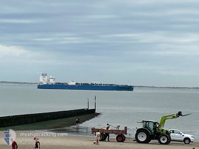
Tanker
Current Trip
| Time Travelled | 45 days |
|---|---|
| Remaining Time | --- |
| Distance Travelled | 6996.77 nm |
| Remaining Distance | --- |
| AVG Speed | 11.1 Knots |
| MAX Speed | 17 Knots |
| AVG Wind | 13.8 knots |
| MAX Wind | 31 knots |
| MIN Temp | 6.4°C / 43.52°F |
| MAX Temp | 27.8°C / 82.04°F |
| Dybgang | 8.3 m |
| Position Modtaget | 10 m siden |
Current Position
| Longitude | --- |
|---|---|
| Latitude | --- |
| Status | At anchor |
| Fart | |
| Kurs | 133° |
| Område | Gulf of Mexico |
| Station | T-AIS |
| Position Modtaget | 10 m siden |
Info
Information
The current position of CORSAIR is in Gulf of Mexico with coordinates 29.38730° / -93.62492° as reported on 2026-01-05 19:57 by AIS to our vessel tracker app. The vessel's current speed is 0 Knots and is heading at the port of SUNOCO LOGISTICS. The estimated time of arrival as calculated by MyShipTracking vessel tracking app is 2025-12-25 06:00 LT
The vessel CORSAIR (IMO: 9689926, MMSI: 311000252) is a Tanker It's sailing under the flag of [BS] Bahamas.
In this page you can find informations about the vessels current position, last detected port calls, and current voyage information. If the vessels is not in coverage by AIS you will find the latest position.
The current position of CORSAIR is detected by our AIS receivers and we are not responsible for the reliability of the data. The last position was recorded while the vessel was in Coverage by the Ais receivers of our vessel tracking app.
The current draught of CORSAIR as reported by AIS is 8.3 meters
Weather
| Temperature | 18.4°C / 65.12°F |
|---|---|
| Wind Speed | 5 knots |
| Direction | 167° SSE |
| Pressure | 1016.4 hPa |
| Humidity | 82.5 % |
| Cloud Coverage | 100 % |
Featured Company
Last Port Calls
| Port | Arrival | Departure | Time In Port |
|---|---|---|---|
| 2025-11-21 09:04 | 2025-11-21 12:02 | 2 h |
Most Visited Ports (Last year)
| Port | Arrivals | |
|---|---|---|
| 5 | ||
| 5 | ||
| 1 | ||
| 1 | ||
| 1 | ||
| 1 |
Last Trips
| Origin | Departure | Destination | Arrival | Distance | |
|---|---|---|---|---|---|
| 2025-09-16 21:42 | 2025-11-21 09:04 | 13574.67 nm |
Events
| Tid | Hændelsen | Detaljer | Position / Dest | Info |
|---|---|---|---|---|
| 2026-01-05 20:06 | Status er ændret | Default At anchor |
29.38735 / -93.62484
MUPLU>USNDX
|
Fart: Kurs: 133° |
| 2026-01-05 19:57 | Status er ændret | At anchor Default |
29.38730 / -93.62492
MUPLU>USNDX
|
Fart: Kurs: 134° |
| 2026-01-05 19:44 | Status er ændret | Default At anchor |
29.38667 / -93.62334
MUPLU>USNDX
|
Fart: Kurs: 133° |
| 2026-01-05 19:42 | Status er ændret | At anchor Default |
29.38727 / -93.62493
MUPLU>USNDX
|
Fart: Kurs: 132° |
| 2026-01-05 19:21 | Status er ændret | Default At anchor |
29.38720 / -93.62501
MUPLU>USNDX
|
Fart: Kurs: 129° |
| 2026-01-05 19:18 | Status er ændret | At anchor Default |
29.38718 / -93.62499
MUPLU>USNDX
|
Fart: Kurs: -1° |
| 2026-01-05 19:06 | Status er ændret | Default At anchor |
29.38711 / -93.62505
MUPLU>USNDX
|
Fart: Kurs: 124° |
| 2026-01-05 19:00 | Status er ændret | At anchor Default |
29.38707 / -93.62508
MUPLU>USNDX
|
Fart: Kurs: 126° |
| 2026-01-05 18:42 | Status er ændret | Default At anchor |
29.38697 / -93.62512
MUPLU>USNDX
|
Fart: Kurs: 119° |
| 2026-01-05 18:12 | Status er ændret | At anchor Default |
29.38683 / -93.62518
MUPLU>USNDX
|
Fart: Kurs: 116° |