
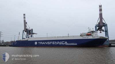
CORONA SEA
Vehicles Carrier
Current Trip
| Time Travelled | 1 day |
|---|---|
| Remaining Time | 8 h, 57 mins |
| Distance Travelled | 424.38 nm |
| Remaining Distance | 132.62 nm |
| AVG Speed | 12.9 Knots |
| MAX Speed | 17 Knots |
| AVG Wind | 15.7 knots |
| MAX Wind | 22 knots |
| MIN Temp | 3.5°C / 38.3°F |
| MAX Temp | 7°C / 44.6°F |
| Dybgang | 6.4 m |
| Position Modtaget | 2 h, 40 m siden |
Current Position
| Longitude | --- |
|---|---|
| Latitude | --- |
| Status | Under way using engine |
| Fart | 14.2 Knots |
| Kurs | 38.6° |
| Område | Baltic Sea |
| Station | T-AIS |
| Position Modtaget | 2 h, 40 m siden |
Info
Information
The current position of CORONA SEA is in Baltic Sea with coordinates 57.70355° / 19.76100° as reported on 2024-12-02 16:50 by AIS to our vessel tracker app. The vessel's current speed is 14.2 Knots and is heading at the port of HANKO. The estimated time of arrival as calculated by MyShipTracking vessel tracking app is 2024-12-03 04:28 LT
The vessel CORONA SEA (IMO: 9357597, MMSI: 255814000) is a Vehicles Carrier that was built in 2008 ( 16 år gamle ). It's sailing under the flag of [PT] Portugal.
In this page you can find informations about the vessels current position, last detected port calls, and current voyage information. If the vessels is not in coverage by AIS you will find the latest position.
The current position of CORONA SEA is detected by our AIS receivers and we are not responsible for the reliability of the data. The last position was recorded while the vessel was in Coverage by the Ais receivers of our vessel tracking app.
The current draught of CORONA SEA as reported by AIS is 6.4 meters
Weather
| Temperature | 7°C / 44.6°F |
|---|---|
| Wind Speed | 18 knots |
| Direction | 220° SW |
| Pressure | 1006.5 hPa |
| Humidity | 94.9 % |
| Cloud Coverage | 100 % |
Featured Company
Last Port Calls
| Port | Arrival | Departure | Time In Port |
|---|---|---|---|
| 2024-12-01 05:23 | 2024-12-01 13:37 | 8 h | |
| 2024-11-29 07:31 | 2024-11-29 19:48 | 12 h | |
| 2024-11-27 05:20 | 2024-11-28 02:06 | 20 h | |
| 2024-11-24 23:58 | 2024-11-25 20:47 | 20 h | |
| 2024-11-24 16:33 | 2024-11-24 19:41 | 3 h | |
| 2024-11-24 06:18 | 2024-11-24 14:02 | 7 h | |
| 2024-11-22 05:08 | 2024-11-23 00:40 | 19 h | |
| 2024-11-20 09:36 | 2024-11-20 19:54 | 10 h | |
| 2024-11-18 18:17 | 2024-11-19 18:03 | 23 h | |
| 2024-11-18 04:24 | 2024-11-18 09:28 | 5 h |
Last Trips
| Origin | Departure | Destination | Arrival | Distance | |
|---|---|---|---|---|---|
| 2024-11-29 21:48 | 2024-12-01 06:23 | 559.01 nm | |||
| 2024-11-28 03:06 | 2024-11-29 09:31 | 553.55 nm | |||
| 2024-11-25 22:47 | 2024-11-27 06:20 | 558.63 nm | |||
| 2024-11-24 21:41 | 2024-11-25 01:58 | 49.98 nm | |||
| 2024-11-24 16:02 | 2024-11-24 18:33 | 45.23 nm | |||
| 2024-11-23 01:40 | 2024-11-24 08:18 | 554.13 nm | |||
| 2024-11-20 21:54 | 2024-11-22 06:08 | 555.12 nm | |||
| 2024-11-19 20:03 | 2024-11-20 11:36 | 138.10 nm | |||
| 2024-11-18 11:28 | 2024-11-18 20:17 | 138.69 nm | |||
| 2024-11-16 16:12 | 2024-11-18 06:24 | 561.45 nm |
Events
| Tid | Hændelsen | Detaljer | Position / Dest | Info |
|---|---|---|---|---|
| 2024-12-02 16:57 | Status er ændret | Default Under way using engine |
57.72458 / 19.79173
FIHKO
|
Fart: 14.2 kn Kurs: 38.6° |
| 2024-12-02 16:50 | Udenfor Dækning |
57.70355 / 19.76100
Baltic Sea
FIHKO
|
Fart: 14.2 kn Kurs: 38.6° |
|
| 2024-12-02 16:50 | Status er ændret | Under way using engine Default |
57.70324 / 19.76054
FIHKO
|
Fart: 14.3 kn Kurs: 38° |
| 2024-12-02 16:49 | Status er ændret | Default Under way using engine |
57.69947 / 19.75509
FIHKO
|
Fart: 14.4 kn Kurs: 37.9° |
| 2024-12-02 15:54 | Status er ændret | Under way using engine Default |
57.52845 / 19.50541
FIHKO
|
Fart: 14.3 kn Kurs: 39° |
| 2024-12-02 15:53 | Status er ændret | Default Under way using engine |
57.52358 / 19.49806
FIHKO
|
Fart: 13.9 kn Kurs: 39.4° |
| 2024-12-02 15:46 | Status er ændret | Under way using engine Default |
57.50476 / 19.46980
FIHKO
|
Fart: 13.9 kn Kurs: 38° |
| 2024-12-02 15:33 | Status er ændret | Default Under way using engine |
57.46342 / 19.40611
FIHKO
|
Fart: 14.4 kn Kurs: 39° |
| 2024-12-02 13:34 | Status er ændret | Under way using engine Default |
57.09002 / 18.87189
FIHKO
|
Fart: 14.5 kn Kurs: 38° |
| 2024-12-02 13:21 | Indenfor Dækning |
57.09029 / 18.87228
Baltic Sea
FIHKO
|
Fart: 14.5 kn Kurs: 38.6° |