
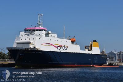
COMMODORE GOODWILL
Ro-Ro Cargo
Current Trip
JERSEY
| Time Travelled | 3 h, 41 mins |
|---|---|
| Remaining Time | --- |
| Distance Travelled | 22.40 nm |
| Remaining Distance | --- |
| AVG Speed | 6.4 Knots |
| MAX Speed | 19.9 Knots |
| AVG Wind | 17.9 knots |
| MAX Wind | 21.7 knots |
| MIN Temp | 11.7°C / 53.06°F |
| MAX Temp | 13.3°C / 55.94°F |
| Dybgang | 4.8 m |
| Position Modtaget | 4 m siden |
Current Position
| Longitude | --- |
|---|---|
| Latitude | --- |
| Status | Under way using engine |
| Fart | 3.9 Knots |
| Kurs | 306° |
| Område | English Channel |
| Station | T-AIS |
| Position Modtaget | 4 m siden |
Info
Information
The current position of COMMODORE GOODWILL is in English Channel with coordinates 49.17350° / -1.90450° as reported on 2024-11-25 01:52 by AIS to our vessel tracker app. The vessel's current speed is 3.9 Knots
The vessel COMMODORE GOODWILL (IMO: 9117985, MMSI: 309536000) is a Ro-Ro Cargo that was built in 1996 ( 28 år gamle ). It's sailing under the flag of [BS] Bahamas.
In this page you can find informations about the vessels current position, last detected port calls, and current voyage information. If the vessels is not in coverage by AIS you will find the latest position.
The current position of COMMODORE GOODWILL is detected by our AIS receivers and we are not responsible for the reliability of the data. The last position was recorded while the vessel was in Coverage by the Ais receivers of our vessel tracking app.
The current draught of COMMODORE GOODWILL as reported by AIS is 4.8 meters
Weather
| Temperature | 11.6°C / 52.88°F |
|---|---|
| Wind Speed | 22 knots |
| Direction | 274° W |
| Pressure | 998 hPa |
| Humidity | 89.6 % |
| Cloud Coverage | 100 % |
Featured Company
Last Port Calls
| Port | Arrival | Departure | Time In Port |
|---|---|---|---|
| 2024-11-24 20:45 | 2024-11-24 22:15 | 1 h | |
| 2024-11-23 00:08 | 2024-11-24 19:02 | 1 d | |
| 2024-11-22 15:08 | 2024-11-22 17:51 | 2 h | |
| 2024-11-22 05:54 | 2024-11-22 08:36 | 2 h | |
| 2024-11-22 02:53 | 2024-11-22 04:18 | 1 h | |
| 2024-11-21 15:57 | 2024-11-21 20:15 | 4 h | |
| 2024-11-21 06:18 | 2024-11-21 08:51 | 2 h | |
| 2024-11-21 02:51 | 2024-11-21 04:31 | 1 h | |
| 2024-11-20 16:08 | 2024-11-20 19:34 | 3 h | |
| 2024-11-20 05:26 | 2024-11-20 09:00 | 3 h |
Most Visited Ports (Last year)
| Port | Arrivals | |
|---|---|---|
| 255 | ||
| 252 | ||
| 200 | ||
| 44 | ||
| 3 | ||
| 2 |
Last Trips
| Origin | Departure | Destination | Arrival | Distance | |
|---|---|---|---|---|---|
| 2024-11-24 19:02 | 2024-11-24 20:45 | 29.65 nm | |||
| 2024-11-22 17:51 | 2024-11-23 00:08 | 105.60 nm | |||
| 2024-11-22 08:36 | 2024-11-22 15:08 | 121.82 nm | |||
| 2024-11-22 04:18 | 2024-11-22 05:54 | 28.11 nm | |||
| 2024-11-21 20:15 | 2024-11-22 02:53 | 107.59 nm | |||
| 2024-11-21 08:51 | 2024-11-21 15:57 | 123.83 nm | |||
| 2024-11-21 04:31 | 2024-11-21 06:18 | 27.55 nm | |||
| 2024-11-20 19:34 | 2024-11-21 02:51 | 107.25 nm | |||
| 2024-11-20 09:00 | 2024-11-20 16:08 | 122.38 nm | |||
| 2024-11-20 03:57 | 2024-11-20 05:26 | 27.17 nm |
Events
| Tid | Hændelsen | Detaljer | Position / Dest | Info |
|---|---|---|---|---|
| 2024-11-25 01:48 | Status er ændret | Under way using engine Default |
49.17017 / -1.90217
JERSEY
|
Fart: 3.1 kn Kurs: 131° |
| 2024-11-25 01:42 | Status er ændret | Default Under way using engine |
49.16733 / -1.90583
JERSEY
|
Fart: 3.1 kn Kurs: 153° |
| 2024-11-25 01:42 | Status er ændret | Under way using engine Default |
49.16767 / -1.90650
JERSEY
|
Fart: 3.4 kn Kurs: 169° |
| 2024-11-25 01:34 | Status er ændret | Default Under way using engine |
49.17417 / -1.91067
JERSEY
|
Fart: 3.2 kn Kurs: 165° |
| 2024-11-25 01:28 | Status er ændret | Under way using engine Default |
49.17967 / -1.91383
JERSEY
|
Fart: 3.6 kn Kurs: 149° |
| 2024-11-25 01:04 | Status er ændret | Default Under way using engine |
49.20050 / -1.94217
JERSEY
|
Fart: 3.1 kn Kurs: 260° |
| 2024-11-25 00:55 | Status er ændret | Under way using engine Default |
49.20167 / -1.94000
JERSEY
|
Fart: 4.8 kn Kurs: 306° |
| 2024-11-25 00:51 | Status er ændret | Default Under way using engine |
49.19800 / -1.93417
JERSEY
|
Fart: 4.7 kn Kurs: 306° |
| 2024-11-25 00:43 | Status er ændret | Under way using engine Default |
49.19050 / -1.92283
JERSEY
|
Fart: 4.6 kn Kurs: 306° |
| 2024-11-25 00:26 | Status er ændret | Default Under way using engine |
49.17600 / -1.90117
JERSEY
|
Fart: 2.5 kn Kurs: 330° |