

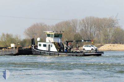
COLIN F
Other Type

Current Trip
MAASBRACHT
Unknown Port
ETA*
2025-11-23 18:11 UTC
| Time Travelled | 1 day |
|---|---|
| Remaining Time | --- |
| Distance Travelled | 77.71 nm |
| Remaining Distance | --- |
| AVG Speed | 7.4 Knots |
| MAX Speed | 10.6 Knots |
| AVG Wind | 9.1 knots |
| MAX Wind | 14 knots |
| MIN Temp | 3.7°C / 38.66°F |
| MAX Temp | 14.7°C / 58.46°F |
| Dybgang | 0 m |
| Position Modtaget | 11 m siden |
Current Position
| Longitude | --- |
|---|---|
| Latitude | --- |
| Status | Under way using engine |
| Fart | 0.8 Knots |
| Kurs | --- |
| Område | North Sea |
| Station | T-AIS |
| Position Modtaget | 11 m siden |
Information
The current position of COLIN F is in North Sea with coordinates 51.16888° / 5.94433° as reported on 2025-04-02 07:12 by AIS to our vessel tracker app. The vessel's current speed is 0.8 Knots
The vessel COLIN F (MMSI: 244700237) is a Other Type It's sailing under the flag of [NL] Netherlands.
In this page you can find informations about the vessels current position, last detected port calls, and current voyage information. If the vessels is not in coverage by AIS you will find the latest position.
The current position of COLIN F is detected by our AIS receivers and we are not responsible for the reliability of the data. The last position was recorded while the vessel was in Coverage by the Ais receivers of our vessel tracking app.
Weather
| Temperature | 7.8°C / 46.04°F |
|---|---|
| Wind Speed | 9 knots |
| Direction | 62° ENE |
| Pressure | 1024 hPa |
| Humidity | 70.8 % |
| Cloud Coverage | 100 % |


Featured Company
Limited time offer - Install a base station receiver to your area and list your company on MyShipTracking Free forever!
Last Port Calls
| Port | Arrival | Departure | Time In Port |
|---|---|---|---|
| 2025-03-29 13:10 | 2025-03-31 11:57 | 1 d | |
| 2025-03-28 08:22 | 2025-03-28 08:40 | 17 m | |
| 2025-03-24 09:17 | 2025-03-24 09:31 | 14 m | |
| 2025-03-14 15:30 | 2025-03-17 06:03 | 2 d | |
| 2025-03-11 15:45 | 2025-03-11 15:56 | 11 m | |
| 2025-03-07 11:34 | 2025-03-07 11:42 | 8 m | |
| 2025-03-04 14:13 | 2025-03-04 14:39 | 26 m | |
| 2025-03-04 08:56 | 2025-03-04 09:16 | 20 m | |
| 2025-03-03 09:57 | 2025-03-03 10:31 | 34 m | |
| 2025-03-02 16:40 | 2025-03-03 09:32 | 16 h |
Most Visited Ports (Last year)
| Port | Arrivals | |
|---|---|---|
| 16 | ||
| 10 | ||
| 9 | ||
| 2 | ||
| 2 | ||
| 2 |
Last Trips
| Origin | Departure | Destination | Arrival | Distance | |
|---|---|---|---|---|---|
| 2025-03-28 08:40 | 2025-03-29 13:10 | 50.38 nm | |||
| 2025-03-24 09:31 | 2025-03-28 08:22 | 127.31 nm | |||
| 2025-03-17 06:03 | 2025-03-24 09:17 | 169.44 nm | |||
| 2025-03-11 15:56 | 2025-03-14 15:30 | 102.66 nm | |||
| 2025-03-07 11:42 | 2025-03-11 15:45 | 86.73 nm | |||
| 2025-03-04 14:39 | 2025-03-07 11:34 | 107.08 nm | |||
| 2025-03-04 09:16 | 2025-03-04 14:13 | 14.73 nm | |||
| 2025-03-03 10:31 | 2025-03-04 08:56 | 27.07 nm | |||
| 2025-03-03 09:32 | 2025-03-03 09:57 | 1.02 nm | |||
| 2025-02-28 13:53 | 2025-03-02 16:40 | 41.56 nm |
Events
| Tid | Hændelsen | Detaljer | Position / Dest | Info |
|---|---|---|---|---|
| 2025-04-02 07:11 | Indenfor Dækning |
51.16888 / 5.94433
North Sea
|
Fart: 0.8 kn Kurs: 82.6° |
|
| 2025-04-02 05:52 | Udenfor Dækning |
51.16830 / 5.94497
North Sea
|
Fart: 2.8 kn Kurs: 30.6° |
|
| 2025-04-02 05:50 | START Sejllads | 1.22 nm, South West of HERTEN |
51.16941 / 5.94183
MAASBRACHT
|
Fart: 7 kn Kurs: 136.2° |
| 2025-04-02 05:47 | STOP Sejllads | 1.18 nm, South West of HERTEN |
51.17123 / 5.94045
MAASBRACHT
|
Fart: Kurs: 511° |
| 2025-04-02 05:42 | START Sejllads | 1.3 nm, South West of HERTEN |
51.17070 / 5.93722
MAASBRACHT
|
Fart: 7.6 kn Kurs: 111.5° |
| 2025-04-02 05:37 | STOP Sejllads | 1.57 nm, South West of HERTEN |
51.17180 / 5.92717
MAASBRACHT
|
Fart: 0.2 kn Kurs: 511° |
| 2025-04-02 05:30 | START Sejllads | 1.34 nm, South West of HERTEN |
51.17475 / 5.93182
MAASBRACHT
|
Fart: 8.1 kn Kurs: 121.8° |
| 2025-04-02 05:17 | STOP Sejllads | 1.48 nm, South West of OOLDERHUUSKE |
51.17560 / 5.92400
MAASBRACHT
|
Fart: Kurs: 511° |
| 2025-04-02 05:03 | START Sejllads | 0.69 nm, North East of WESSEM |
51.16483 / 5.89351
MAASBRACHT
|
Fart: 8.7 kn Kurs: 113° |
| 2025-04-02 04:58 | STOP Sejllads | 0.65 nm, North East of WESSEM |
51.16570 / 5.88976
MAASBRACHT
|
Fart: Kurs: 511° |