
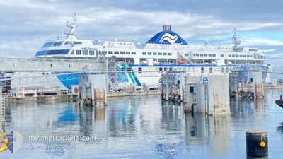
COASTAL RENAISSANCE
Ro-Ro/Passenger Ship
Current Trip
| Time Travelled | 3 h, 3 mins |
|---|---|
| Remaining Time | --- |
| Distance Travelled | 44.43 nm |
| Remaining Distance | --- |
| AVG Speed | 18.3 Knots |
| MAX Speed | 20.2 Knots |
| AVG Wind | 4.7 knots |
| MAX Wind | 14.3 knots |
| MIN Temp | 3.7°C / 38.66°F |
| MAX Temp | 6°C / 42.8°F |
| Dybgang | 5.3 m |
| Position Modtaget | 1 m siden |
Current Position
| Longitude | --- |
|---|---|
| Latitude | --- |
| Status | Under way using engine |
| Fart | 18.7 Knots |
| Kurs | 125.1° |
| Område | The Coastal Waters of Southeast Alaska and British Columbia |
| Station | T-AIS |
| Position Modtaget | 1 m siden |
Info
Information
The current position of COASTAL RENAISSANCE is in The Coastal Waters of Southeast Alaska and British Columbia with coordinates 49.16456° / -123.63710° as reported on 2025-03-13 17:57 by AIS to our vessel tracker app. The vessel's current speed is 18.7 Knots
The vessel COASTAL RENAISSANCE (IMO: 9332755, MMSI: 316011407) is a Ro-Ro/Passenger Ship that was built in 2007 ( 18 år gamle ). It's sailing under the flag of [CA] Canada.
In this page you can find informations about the vessels current position, last detected port calls, and current voyage information. If the vessels is not in coverage by AIS you will find the latest position.
The current position of COASTAL RENAISSANCE is detected by our AIS receivers and we are not responsible for the reliability of the data. The last position was recorded while the vessel was in Coverage by the Ais receivers of our vessel tracking app.
The current draught of COASTAL RENAISSANCE as reported by AIS is 5.3 meters
Weather
| Temperature | 5.3°C / 41.54°F |
|---|---|
| Wind Speed | 6 knots |
| Direction | 277° W |
| Pressure | 999 hPa |
| Humidity | 74.5 % |
| Cloud Coverage | 80 % |
Featured Company
Last Port Calls
| Port | Arrival | Departure | Time In Port |
|---|---|---|---|
| 2025-03-13 14:09 | 2025-03-13 14:56 | 47 m | |
| 2025-03-13 05:13 | 2025-03-13 05:59 | 45 m | |
| 2025-03-13 00:21 | 2025-03-13 01:07 | 46 m | |
| 2025-03-12 19:07 | 2025-03-12 19:51 | 43 m | |
| 2025-03-12 14:11 | 2025-03-12 14:57 | 46 m | |
| 2025-03-12 05:17 | 2025-03-12 05:57 | 40 m | |
| 2025-03-12 00:16 | 2025-03-12 01:08 | 51 m | |
| 2025-03-11 19:10 | 2025-03-11 19:53 | 43 m | |
| 2025-03-11 14:08 | 2025-03-11 14:53 | 45 m | |
| 2025-03-11 05:07 | 2025-03-11 05:59 | 51 m |
Most Visited Ports (Last year)
| Port | Arrivals | |
|---|---|---|
| 1049 | ||
| 282 | ||
| 1 |
Last Trips
| Origin | Departure | Destination | Arrival | Distance | |
|---|---|---|---|---|---|
| 2025-03-12 22:59 | 2025-03-13 07:09 | 70.01 nm | |||
| 2025-03-12 18:07 | 2025-03-12 22:13 | 69.79 nm | |||
| 2025-03-12 12:51 | 2025-03-12 17:21 | 69.03 nm | |||
| 2025-03-12 07:57 | 2025-03-12 12:07 | 69.29 nm | |||
| 2025-03-11 22:57 | 2025-03-12 07:11 | 68.90 nm | |||
| 2025-03-11 18:08 | 2025-03-11 22:17 | 70.25 nm | |||
| 2025-03-11 12:53 | 2025-03-11 17:16 | 70.91 nm | |||
| 2025-03-11 07:53 | 2025-03-11 12:10 | 69.77 nm | |||
| 2025-03-10 22:59 | 2025-03-11 07:08 | 68.58 nm | |||
| 2025-03-10 18:02 | 2025-03-10 22:07 | 68.90 nm |
Events
| Tid | Hændelsen | Detaljer | Position / Dest | Info |
|---|---|---|---|---|
| 2025-03-13 17:15 | START Sejllads | 2.12 nm, North West of NANAIMO |
49.16483 / -123.89050
DUKE PT <> TSA
|
Fart: 5.9 kn Kurs: 8.6° |
| 2025-03-13 16:46 | STOP Sejllads | 2.05 nm, North West of NANAIMO |
49.16280 / -123.89093
DUKE PT <> TSA
|
Fart: 0.2 kn Kurs: 183° |
| 2025-03-13 14:56 | Afsejlet fra sidste havn |
|
49.00168 / -123.16130
DUKE PT <> TSA
|
Fart: 17.7 kn Kurs: 272° |
| 2025-03-13 14:51 | START Sejllads |
49.00469 / -123.13507
[CA] TSAWWASSEN
|
Fart: 6.6 kn Kurs: 225° |
|
| 2025-03-13 14:18 | STOP Sejllads |
49.00638 / -123.13272
[CA] TSAWWASSEN
|
Fart: 0.3 kn Kurs: 44° |
|
| 2025-03-13 14:10 | Ændre havområde | Canadian part of the The Coastal Waters of Southeast Alaska and British Columbia United States part of the The Coastal Waters of Southeast Alaska and British Columbia |
49.00147 / -123.14173
The Coastal Waters of Southeast Alaska and British Columbia
|
Fart: 9.8 kn Kurs: 63.1° |
| 2025-03-13 14:09 | Skibe i havn |
|
48.99972 / -123.14812
[CA] TSAWWASSEN
|
Fart: 13.6 kn Kurs: 73.9° |
| 2025-03-13 14:01 | Ændre havområde | United States part of the The Coastal Waters of Southeast Alaska and British Columbia Canadian part of the The Coastal Waters of Southeast Alaska and British Columbia |
48.99934 / -123.20821
The Coastal Waters of Southeast Alaska and British Columbia
|
Fart: 19.8 kn Kurs: 96.8° |
| 2025-03-13 12:15 | START Sejllads | 2.1 nm, North West of NANAIMO |
49.16471 / -123.89026
DUKE PT <> TSA
|
Fart: 5.9 kn Kurs: 15° |
| 2025-03-13 11:24 | Status er ændret | Under way using engine Moored |
49.16277 / -123.89095
DUKE PT <> TSA
|
Fart: Kurs: 182° |