

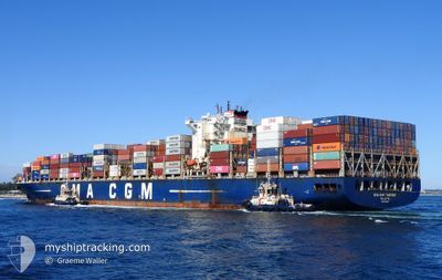
CMA CGM TANCREDI
Container Ship

Current Trip
| Time Travelled | 5 days |
|---|---|
| Remaining Time | --- |
| Distance Travelled | 1373.36 nm |
| Remaining Distance | 9.86 nm |
| AVG Speed | 11.8 Knots |
| MAX Speed | 20.7 Knots |
| AVG Wind | 15.3 knots |
| MAX Wind | 25 knots |
| MIN Temp | 17°C / 62.6°F |
| MAX Temp | 23.3°C / 73.94°F |
| Dybgang | 13 m |
| Position Modtaget | 3 m siden |
Current Position
| Longitude | --- |
|---|---|
| Latitude | --- |
| Status | At anchor |
| Fart | 0.4 Knots |
| Kurs | 188° |
| Område | Indian Ocean |
| Station | T-AIS |
| Position Modtaget | 3 m siden |
Information
The current position of CMA CGM TANCREDI is in Indian Ocean with coordinates -31.92570° / 115.66562° as reported on 2025-03-08 11:27 by AIS to our vessel tracker app. The vessel's current speed is 0.4 Knots and is heading at the port of FREMANTLE. The estimated time of arrival as calculated by MyShipTracking vessel tracking app is 2025-03-09 02:00 LT
The vessel CMA CGM TANCREDI (IMO: 9436355, MMSI: 256300000) is a Container Ship that was built in 2011 ( 14 år gamle ). It's sailing under the flag of [MT] Malta.
In this page you can find informations about the vessels current position, last detected port calls, and current voyage information. If the vessels is not in coverage by AIS you will find the latest position.
The current position of CMA CGM TANCREDI is detected by our AIS receivers and we are not responsible for the reliability of the data. The last position was recorded while the vessel was in Coverage by the Ais receivers of our vessel tracking app.
The current draught of CMA CGM TANCREDI as reported by AIS is 13 meters
Weather
| Temperature | 21.3°C / 70.34°F |
|---|---|
| Wind Speed | 20 knots |
| Direction | 196° SSW |
| Pressure | 1010.5 hPa |
| Humidity | 69.6 % |
| Cloud Coverage | 17 % |


Featured Company
Last Port Calls
| Port | Arrival | Departure | Time In Port |
|---|---|---|---|
| 2025-03-01 19:35 | 2025-03-03 10:01 | 1 d | |
| 2025-02-24 10:02 | 2025-02-26 17:32 | 2 d | |
| 2025-02-18 12:34 | 2025-02-21 07:20 | 2 d | |
| 2025-02-06 01:01 | 2025-02-07 10:26 | 1 d | |
| 2025-02-04 08:21 | 2025-02-06 00:03 | 1 d | |
| 2025-02-01 11:45 | 2025-02-02 09:53 | 22 h | |
| 2025-01-30 22:49 | 2025-01-31 20:45 | 21 h | |
| 2025-01-20 06:04 | 2025-01-22 00:40 | 1 d | |
| 2025-01-15 01:16 | 2025-01-16 22:10 | 1 d | |
| 2025-01-09 16:52 | 2025-01-12 14:29 | 2 d |
Most Visited Ports (Last year)
| Port | Arrivals | |
|---|---|---|
| 11 | ||
| 7 | ||
| 7 | ||
| 7 | ||
| 7 | ||
| 6 |
Last Trips
| Origin | Departure | Destination | Arrival | Distance | |
|---|---|---|---|---|---|
| 2025-02-27 04:32 | 2025-03-02 06:05 | 978.87 nm | |||
| 2025-02-21 18:20 | 2025-02-24 21:02 | 683.77 nm | |||
| 2025-02-07 18:26 | 2025-02-18 23:34 | 3976.52 nm | |||
| 2025-02-06 08:03 | 2025-02-06 09:01 | 3.19 nm | |||
| 2025-02-02 17:53 | 2025-02-04 16:21 | 271.39 nm | |||
| 2025-02-01 04:45 | 2025-02-01 19:45 | 188.94 nm | |||
| 2025-01-22 08:40 | 2025-01-31 06:49 | 2519.58 nm | |||
| 2025-01-17 08:40 | 2025-01-20 14:04 | 1378.35 nm | |||
| 2025-01-13 01:29 | 2025-01-15 11:46 | 977.92 nm | |||
| 2025-01-05 03:33 | 2025-01-10 03:52 | 830.08 nm |
Events
| Tid | Hændelsen | Detaljer | Position / Dest | Info |
|---|---|---|---|---|
| 2025-03-08 10:57 | Status er ændret | At anchor Default |
-31.92600 / 115.66595
AUFRE
|
Fart: 0.5 kn Kurs: 223° |
| 2025-03-08 10:54 | Status er ændret | Default At anchor |
-31.92622 / 115.66638
AUFRE
|
Fart: 0.3 kn Kurs: 224° |
| 2025-03-08 10:33 | Status er ændret | At anchor Default |
-31.92595 / 115.66573
AUFRE
|
Fart: 0.5 kn Kurs: 218° |
| 2025-03-08 10:30 | Status er ændret | Default At anchor |
-31.92613 / 115.66615
AUFRE
|
Fart: 0.4 kn Kurs: 225° |
| 2025-03-08 10:18 | Status er ændret | At anchor Default |
-31.92620 / 115.66653
AUFRE
|
Fart: 0.4 kn Kurs: 193° |
| 2025-03-08 10:15 | Status er ændret | Default At anchor |
-31.92608 / 115.66612
AUFRE
|
Fart: 0.1 kn Kurs: 194° |
| 2025-03-08 09:33 | Status er ændret | At anchor Default |
-31.92617 / 115.66653
AUFRE
|
Fart: Kurs: 214° |
| 2025-03-08 09:30 | Status er ændret | Default At anchor |
-31.92612 / 115.66665
AUFRE
|
Fart: 0.1 kn Kurs: 205° |
| 2025-03-08 08:45 | Status er ændret | At anchor Default |
-31.92613 / 115.66633
AUFRE
|
Fart: 0.1 kn Kurs: 214° |
| 2025-03-08 08:42 | Status er ændret | Default At anchor |
-31.92610 / 115.66655
AUFRE
|
Fart: 0.2 kn Kurs: 207° |