
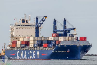
CMA CGM SINNAMARY
Cargo A
Current Trip
| Time Travelled | 8 days |
|---|---|
| Remaining Time | -6 mins |
| Distance Travelled | 3683.29 nm |
| Remaining Distance | 2.61 nm |
| AVG Speed | 17.7 Knots |
| MAX Speed | 20.3 Knots |
| AVG Wind | 13.8 knots |
| MAX Wind | 27.8 knots |
| MIN Temp | 3.7°C / 38.66°F |
| MAX Temp | 25.6°C / 78.08°F |
| Dybgang | 9 m |
| Position Modtaget | 1 m siden |
Current Position
| Longitude | --- |
|---|---|
| Latitude | --- |
| Status | Under way using engine |
| Fart | 7.9 Knots |
| Kurs | 350.7° |
| Område | Caribbean Sea |
| Station | T-AIS |
| Position Modtaget | 1 m siden |
Info
Information
The current position of CMA CGM SINNAMARY is in Caribbean Sea with coordinates 17.97089° / -63.08067° as reported on 2025-02-17 13:05 by AIS to our vessel tracker app. The vessel's current speed is 7.9 Knots and is heading at the port of PHILIPSBURG. The estimated time of arrival as calculated by MyShipTracking vessel tracking app is 2025-02-17 13:00 LT
The vessel CMA CGM SINNAMARY (IMO: 9845673, MMSI: 228403700) is a Cargo A It's sailing under the flag of [FR] France.
In this page you can find informations about the vessels current position, last detected port calls, and current voyage information. If the vessels is not in coverage by AIS you will find the latest position.
The current position of CMA CGM SINNAMARY is detected by our AIS receivers and we are not responsible for the reliability of the data. The last position was recorded while the vessel was in Coverage by the Ais receivers of our vessel tracking app.
The current draught of CMA CGM SINNAMARY as reported by AIS is 9 meters
Weather
| Temperature | 25.6°C / 78.08°F |
|---|---|
| Wind Speed | 19 knots |
| Direction | 94° E |
| Pressure | 1019 hPa |
| Humidity | 71.6 % |
| Cloud Coverage | 22 % |
Featured Company
Last Port Calls
| Port | Arrival | Departure | Time In Port |
|---|---|---|---|
| 2025-02-06 08:42 | 2025-02-08 20:43 | 2 d | |
| 2025-02-04 23:23 | 2025-02-05 18:25 | 19 h | |
| 2025-02-01 18:53 | 2025-02-03 05:30 | 1 d | |
| 2025-01-30 07:23 | 2025-01-30 12:15 | 4 h | |
| 2025-01-24 11:24 | 2025-01-25 04:34 | 17 h | |
| 2025-01-12 12:35 | 2025-01-16 11:20 | 3 d | |
| 2025-01-02 23:12 | 2025-01-09 03:13 | 6 d | |
| 2024-12-28 16:57 | 2024-12-31 08:15 | 2 d | |
| 2024-12-26 14:04 | 2024-12-27 02:53 | 12 h | |
| 2024-12-15 23:56 | 2024-12-17 03:17 | 1 d |
Most Visited Ports (Last year)
| Port | Arrivals | |
|---|---|---|
| 9 | ||
| 8 | ||
| 8 | ||
| 8 | ||
| 7 | ||
| 7 |
Last Trips
| Origin | Departure | Destination | Arrival | Distance | |
|---|---|---|---|---|---|
| 2025-02-05 18:25 | 2025-02-06 09:42 | 196.13 nm | |||
| 2025-02-03 06:30 | 2025-02-04 23:23 | 197.27 nm | |||
| 2025-01-30 13:15 | 2025-02-01 19:53 | 896.98 nm | |||
| 2025-01-25 05:34 | 2025-01-30 08:23 | 47.84 nm | |||
| 2025-01-16 08:20 | 2025-01-24 12:24 | 3249.55 nm | |||
| 2025-01-09 00:13 | 2025-01-12 09:35 | 1025.56 nm | |||
| 2024-12-31 04:15 | 2025-01-02 20:12 | 726.11 nm | |||
| 2024-12-26 22:53 | 2024-12-28 12:57 | 466.60 nm | |||
| 2024-12-17 04:17 | 2024-12-26 10:04 | 3741.84 nm | |||
| 2024-12-14 19:36 | 2024-12-16 00:56 | 198.74 nm |
Events
| Tid | Hændelsen | Detaljer | Position / Dest | Info |
|---|---|---|---|---|
| 2025-02-17 12:46 | Ændre havområde | Sint-Maarten part of the Caribbean Sea Saint-Martin part of the Caribbean Sea |
17.96674 / -63.00998
Caribbean Sea
ANPHI
|
Fart: 15.2 kn Kurs: 262.3° |
| 2025-02-17 12:12 | Ændre havområde | Saint-Martin part of the Caribbean Sea Portuguese (Azores) part of the North Atlantic Ocean |
18.03860 / -62.86696
Caribbean Sea
ANPHI
|
Fart: 16.8 kn Kurs: 240.1° |
| 2025-02-17 12:12 | Status er ændret | Under way using engine Default |
18.03860 / -62.86696
ANPHI
|
Fart: 16.8 kn Kurs: 241° |
| 2025-02-17 11:57 | Indenfor Dækning |
18.03860 / -62.86696
Caribbean Sea
ANPHI
|
Fart: 16.8 kn Kurs: 240.1° |
|
| 2025-02-12 05:41 | Status er ændret | Default Under way using engine |
36.15715 / -26.22988
ANPHI
|
Fart: 17.6 kn Kurs: 240.5° |
| 2025-02-12 05:38 | Status er ændret | Under way using engine Default |
36.16454 / -26.21353
ANPHI
|
Fart: 17.4 kn Kurs: 241° |
| 2025-02-12 05:38 | Udenfor Dækning |
36.16454 / -26.21353
North Atlantic Ocean
ANPHI
|
Fart: 17.6 kn Kurs: 240.5° |
|
| 2025-02-12 05:02 | Status er ændret | Default Under way using engine |
36.25231 / -26.02578
ANPHI
|
Fart: 17.3 kn Kurs: 240.5° |
| 2025-02-12 00:51 | ETA er ændret | 2025/02/17 11:00 2025/02/17 15:00 |
36.87634 / -24.72579
ANPHI
|
Fart: 17.8 kn Kurs: 224° |
| 2025-02-11 21:38 | ETA er ændret | 2025/02/17 15:00 2025/02/17 11:00 |
37.56068 / -23.88287
ANPHI
|
Fart: 17.8 kn Kurs: 226° |