
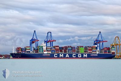
CMA CGM SCANDOLA
Cargo
Current Trip
| Time Travelled | 1 day |
|---|---|
| Remaining Time | --- |
| Distance Travelled | 640.67 nm |
| Remaining Distance | --- |
| AVG Speed | 16.1 Knots |
| MAX Speed | 19.5 Knots |
| AVG Wind | 15.3 knots |
| MAX Wind | 27.5 knots |
| MIN Temp | 14.2°C / 57.56°F |
| MAX Temp | 18.1°C / 64.58°F |
| Dybgang | 12.3 m |
| Position Modtaget | 1 d siden |
Current Position
| Longitude | --- |
|---|---|
| Latitude | --- |
| Status | Under way using engine |
| Fart | 18.8 Knots |
| Kurs | 238.7° |
| Område | North Atlantic Ocean |
| Station | T-AIS |
| Position Modtaget | 1 d siden |
Info
Information
The current position of CMA CGM SCANDOLA is in North Atlantic Ocean with coordinates 35.75787° / -6.35520° as reported on 2025-03-16 20:28 by AIS to our vessel tracker app. The vessel's current speed is 18.8 Knots and is heading at the port of PORT KLANG. The estimated time of arrival as calculated by MyShipTracking vessel tracking app is 2025-04-15 08:00 LT
The vessel CMA CGM SCANDOLA (IMO: 9859129, MMSI: 215839000) is a Cargo It's sailing under the flag of [MT] Malta.
In this page you can find informations about the vessels current position, last detected port calls, and current voyage information. If the vessels is not in coverage by AIS you will find the latest position.
The current position of CMA CGM SCANDOLA is detected by our AIS receivers and we are not responsible for the reliability of the data. The last position was recorded while the vessel was in Coverage by the Ais receivers of our vessel tracking app.
The current draught of CMA CGM SCANDOLA as reported by AIS is 12.3 meters
Weather
| Temperature | 17.8°C / 64.04°F |
|---|---|
| Wind Speed | 14 knots |
| Direction | 342° NNW |
| Pressure | 1019.3 hPa |
| Humidity | 73.5 % |
| Cloud Coverage | --- |
Featured Company
Last Port Calls
| Port | Arrival | Departure | Time In Port |
|---|---|---|---|
| 2025-03-15 20:32 | 2025-03-16 17:43 | 21 h | |
| 2025-03-09 10:46 | 2025-03-12 12:02 | 3 d | |
| 2025-03-05 01:49 | 2025-03-07 03:44 | 2 d | |
| 2025-03-01 06:44 | 2025-03-04 08:20 | 3 d | |
| 2025-02-26 15:55 | 2025-02-28 14:53 | 1 d | |
| 2025-01-31 02:30 | 2025-02-01 06:19 | 1 d | |
| 2025-01-26 20:25 | 2025-01-27 20:28 | 1 d | |
| 2025-01-24 03:29 | 2025-01-26 14:13 | 2 d | |
| 2025-01-14 14:14 | 2025-01-15 20:40 | 1 d | |
| 2025-01-11 01:57 | 2025-01-12 12:41 | 1 d |
Most Visited Ports (Last year)
| Port | Arrivals | |
|---|---|---|
| 5 | ||
| 4 | ||
| 4 | ||
| 3 | ||
| 3 | ||
| 3 |
Last Trips
| Origin | Departure | Destination | Arrival | Distance | |
|---|---|---|---|---|---|
| 2025-03-12 12:02 | 2025-03-15 20:32 | 1051.97 nm | |||
| 2025-03-07 03:44 | 2025-03-09 10:46 | 679.88 nm | |||
| 2025-03-04 08:20 | 2025-03-05 01:49 | 193.33 nm | |||
| 2025-02-28 14:53 | 2025-03-01 06:44 | 178.24 nm | |||
| 2025-02-01 06:19 | 2025-02-26 15:55 | 11181.09 nm | |||
| 2025-01-27 20:28 | 2025-01-31 02:30 | 1459.58 nm | |||
| 2025-01-26 14:13 | 2025-01-26 20:25 | 59.78 nm | |||
| 2025-01-15 20:40 | 2025-01-24 03:29 | 1025.47 nm | |||
| 2025-01-12 12:41 | 2025-01-14 14:14 | 496.43 nm | |||
| 2025-01-09 19:53 | 2025-01-11 01:57 | 504.31 nm |
Events
| Tid | Hændelsen | Detaljer | Position / Dest | Info |
|---|---|---|---|---|
| 2025-03-16 20:35 | Status er ændret | Default Under way using engine |
35.73930 / -6.39334
ESALG>MYPKG
|
Fart: 18.8 kn Kurs: 238.7° |
| 2025-03-16 20:28 | Status er ændret | Under way using engine Default |
35.75787 / -6.35520
ESALG>MYPKG
|
Fart: 18.7 kn Kurs: 241° |
| 2025-03-16 20:28 | Udenfor Dækning |
35.75787 / -6.35520
North Atlantic Ocean
ESALG>MYPKG
|
Fart: 18.8 kn Kurs: 238.7° |
|
| 2025-03-16 20:20 | Status er ændret | Default Under way using engine |
35.77747 / -6.31062
ESALG>MYPKG
|
Fart: 18.4 kn Kurs: 249.2° |
| 2025-03-16 20:14 | Status er ændret | Under way using engine Default |
35.78969 / -6.27500
ESALG>MYPKG
|
Fart: 18.3 kn Kurs: 250° |
| 2025-03-16 20:00 | Status er ændret | Default Under way using engine |
35.81500 / -6.19295
ESALG>MYPKG
|
Fart: 18.1 kn Kurs: 248.9° |
| 2025-03-16 19:16 | Ændre havområde | Moroccan part of the North Atlantic Ocean Moroccan part of the Strait of Gibraltar |
35.89312 / -5.95067
North Atlantic Ocean
ESALG>MYPKG
|
Fart: 16.9 kn Kurs: 248.5° |
| 2025-03-16 18:51 | Ændre havområde | Moroccan part of the Strait of Gibraltar Spanish part of the Strait of Gibraltar |
35.93946 / -5.81564
Strait of Gibraltar
ESALG>MYPKG
|
Fart: 16 kn Kurs: 246.3° |
| 2025-03-16 16:43 | Afsejlet fra sidste havn |
|
36.14122 / -5.41805
ESALG>MYPKG
|
Fart: 5.3 kn Kurs: 67° |
| 2025-03-16 16:38 | START Sejllads |
36.13340 / -5.42178
[ES] ALGECIRAS
|
Fart: 4.2 kn Kurs: 4° |