
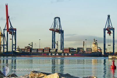
CMA CGM PEMBA
Container Ship
Current Trip
| Time Travelled | 2 days |
|---|---|
| Remaining Time | --- |
| Distance Travelled | 511.03 nm |
| Remaining Distance | --- |
| AVG Speed | 11.3 Knots |
| MAX Speed | 13.6 Knots |
| AVG Wind | 11.8 knots |
| MAX Wind | 16 knots |
| MIN Temp | 24.4°C / 75.92°F |
| MAX Temp | 28.1°C / 82.58°F |
| Dybgang | 8.9 m |
| Position Modtaget | 2 d siden |
Current Position
| Longitude | --- |
|---|---|
| Latitude | --- |
| Status | Under way using engine |
| Fart | 12.9 Knots |
| Kurs | 352.8° |
| Område | Caribbean Sea |
| Station | T-AIS |
| Position Modtaget | 2 d siden |
Info
Information
The current position of CMA CGM PEMBA is in Caribbean Sea with coordinates 10.89305° / -75.83611° as reported on 2026-01-06 00:44 by AIS to our vessel tracker app. The vessel's current speed is 12.9 Knots
The vessel CMA CGM PEMBA (IMO: 9374442, MMSI: 229956000) is a Container Ship that was built in 2008 ( 18 år gamle ). It's sailing under the flag of [MT] Malta.
In this page you can find informations about the vessels current position, last detected port calls, and current voyage information. If the vessels is not in coverage by AIS you will find the latest position.
The current position of CMA CGM PEMBA is detected by our AIS receivers and we are not responsible for the reliability of the data. The last position was recorded while the vessel was in Coverage by the Ais receivers of our vessel tracking app.
The current draught of CMA CGM PEMBA as reported by AIS is 8.9 meters
Weather
| Temperature | 24.6°C / 76.28°F |
|---|---|
| Wind Speed | 5 knots |
| Direction | 24° NNE |
| Pressure | 1014.4 hPa |
| Humidity | 77 % |
| Cloud Coverage | 1 % |
Featured Company
Last Port Calls
| Port | Arrival | Departure | Time In Port |
|---|---|---|---|
| 2026-01-04 19:38 | 2026-01-05 16:07 | 20 h | |
| 2025-12-24 18:28 | 2025-12-27 21:06 | 3 d | |
| 2025-12-23 12:16 | 2025-12-24 13:39 | 1 d | |
| 2025-12-18 15:53 | 2025-12-20 11:41 | 1 d | |
| 2025-12-13 06:39 | 2025-12-15 00:36 | 1 d | |
| 2025-12-11 20:28 | 2025-12-13 01:51 | 1 d | |
| 2025-12-06 13:55 | 2025-12-08 06:31 | 1 d | |
| 2025-12-03 21:05 | 2025-12-04 18:37 | 21 h | |
| 2025-11-27 01:11 | 2025-11-29 10:07 | 2 d | |
| 2025-11-25 14:27 | 2025-11-26 18:39 | 1 d |
Most Visited Ports (Last year)
| Port | Arrivals | |
|---|---|---|
| 16 | ||
| 12 | ||
| 10 | ||
| 10 | ||
| 7 | ||
| 7 |
Last Trips
| Origin | Departure | Destination | Arrival | Distance | |
|---|---|---|---|---|---|
| 2025-12-27 21:06 | 2026-01-04 19:38 | 1152.54 nm | |||
| 2025-12-24 13:39 | 2025-12-24 18:28 | 60.80 nm | |||
| 2025-12-20 11:41 | 2025-12-23 12:16 | 1051.22 nm | |||
| 2025-12-15 00:36 | 2025-12-18 15:53 | 1100.93 nm | |||
| 2025-12-13 01:51 | 2025-12-13 06:39 | 61.34 nm | |||
| 2025-12-08 06:31 | 2025-12-11 20:28 | 703.14 nm | |||
| 2025-12-04 18:37 | 2025-12-06 13:55 | 478.43 nm | |||
| 2025-11-29 10:07 | 2025-12-03 21:05 | 975.37 nm | |||
| 2025-11-26 18:39 | 2025-11-27 01:11 | 63.72 nm | |||
| 2025-11-22 14:33 | 2025-11-25 14:27 | 1052.42 nm |
Events
| Tid | Hændelsen | Detaljer | Position / Dest | Info |
|---|---|---|---|---|
| 2026-01-08 03:30 | START Sejllads | 11.17 nm, South of PORT ROYAL |
17.75837 / -76.79667
COCTG
|
Fart: 4.8 kn Kurs: 106° |
| 2026-01-08 01:13 | STOP Sejllads | 11.77 nm, South East of PORT ROYAL |
17.75833 / -76.76334
COCTG
|
Fart: Kurs: -1° |
| 2026-01-07 21:07 | START Sejllads | 8.33 nm, South East of KINGSTON (JM) |
17.86844 / -76.70236
COCTG
|
Fart: 6.4 kn Kurs: 182° |
| 2026-01-07 18:49 | STOP Sejllads | 10.6 nm, South East of KINGSTON (JM) |
17.85167 / -76.66500
COCTG
|
Fart: Kurs: -1° |
| 2026-01-07 17:46 | START Sejllads | 7.66 nm, South East of PORT ROYAL |
17.83403 / -76.76764
COCTG
|
Fart: 3.2 kn Kurs: 48° |
| 2026-01-07 11:54 | STOP Sejllads | 10.17 nm, South East of KINGSTON (JM) |
17.82760 / -76.70215
COCTG
|
Fart: 0.3 kn Kurs: 65° |
| 2026-01-06 00:49 | Status er ændret | Default Under way using engine |
10.91333 / -75.83833
COCTG
|
Fart: 12.9 kn Kurs: 352.8° |
| 2026-01-06 00:44 | Udenfor Dækning |
10.89305 / -75.83611
Caribbean Sea
|
Fart: 12.9 kn Kurs: 352.8° |
|
| 2026-01-06 00:40 | Status er ændret | Under way using engine Default |
10.88282 / -75.83476
COCTG
|
Fart: 13 kn Kurs: 353° |
| 2026-01-06 00:29 | Status er ændret | Default Under way using engine |
10.84210 / -75.82965
COCTG
|
Fart: 12.9 kn Kurs: 352.8° |