
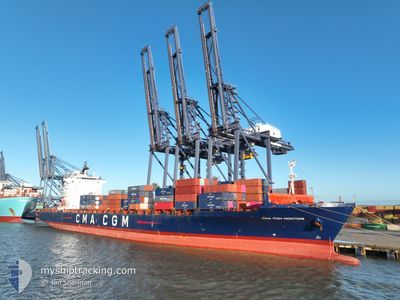
CMA CGM MONTOIR
Container Ship
Current Trip
| Time Travelled | 1 day |
|---|---|
| Remaining Time | 11 h, 7 mins |
| Distance Travelled | 676.33 nm |
| Remaining Distance | 162.42 nm |
| AVG Speed | 14.4 Knots |
| MAX Speed | 15.3 Knots |
| AVG Wind | 10.1 knots |
| MAX Wind | 17.4 knots |
| MIN Temp | 17°C / 62.6°F |
| MAX Temp | 20.7°C / 69.26°F |
| Dybgang | 11.6 m |
| Position Modtaget | 1 m siden |
Current Position
| Longitude | 25.79312° |
|---|---|
| Latitude | 39.73598° |
| Status | Under way using engine |
| Fart | 14.3 Knots |
| Kurs | 29.2° |
| Område | Aegean Sea |
| Station | T-AIS |
| Position Modtaget | 1 m siden |
Info
Information
The current position of CMA CGM MONTOIR is in Aegean Sea with coordinates 39.73598° / 25.79312° as reported on 2024-05-21 08:07 by AIS to our vessel tracker app. The vessel's current speed is 14.3 Knots and is heading at the port of AMBARLI. The estimated time of arrival as calculated by MyShipTracking vessel tracking app is 2024-05-21 19:16 LT
The vessel CMA CGM MONTOIR (IMO: 9348443, MMSI: 229290000) is a Container Ship that was built in 2008 ( 16 år gamle ). It's sailing under the flag of [MT] Malta.
In this page you can find informations about the vessels current position, last detected port calls, and current voyage information. If the vessels is not in coverage by AIS you will find the latest position.
The current position of CMA CGM MONTOIR is detected by our AIS receivers and we are not responsible for the reliability of the data. The last position was recorded while the vessel was in Coverage by the Ais receivers of our vessel tracking app.
The current draught of CMA CGM MONTOIR as reported by AIS is 11.6 meters
Weather
| Temperature | 17.7°C / 63.86°F |
|---|---|
| Wind Speed | 10 knots |
| Direction | 3° N |
| Pressure | 1015.4 hPa |
| Humidity | 79.1 % |
| Cloud Coverage | --- |
Featured Company
Last Port Calls
| Port | Arrival | Departure | Time In Port |
|---|---|---|---|
| 2024-05-17 19:44 | 2024-05-19 09:25 | 1 d | |
| 2024-05-08 03:01 | 2024-05-11 05:24 | 3 d | |
| 2024-05-05 08:15 | 2024-05-06 22:57 | 1 d | |
| 2024-05-03 22:13 | 2024-05-04 21:28 | 23 h | |
| 2024-04-29 12:38 | 2024-04-30 09:43 | 21 h | |
| 2024-04-24 03:23 | 2024-04-26 11:47 | 2 d | |
| 2024-04-17 19:51 | 2024-04-19 05:53 | 1 d | |
| 2024-04-10 03:50 | 2024-04-11 00:20 | 20 h | |
| 2024-04-08 01:28 | 2024-04-09 17:16 | 1 d | |
| 2024-04-05 10:48 | 2024-04-06 19:25 | 1 d |
Most Visited Ports (Last year)
| Port | Arrivals | |
|---|---|---|
| 9 | ||
| 6 | ||
| 6 | ||
| 6 | ||
| 6 | ||
| 6 |
Last Trips
| Origin | Departure | Destination | Arrival | Distance | |
|---|---|---|---|---|---|
| 2024-05-11 07:24 | 2024-05-17 21:44 | 2723.00 nm | |||
| 2024-05-07 00:57 | 2024-05-08 05:01 | 395.79 nm | |||
| 2024-05-04 22:28 | 2024-05-05 10:15 | 159.91 nm | |||
| 2024-04-30 10:43 | 2024-05-03 23:13 | 1362.65 nm | |||
| 2024-04-26 13:47 | 2024-04-29 13:38 | 1025.72 nm | |||
| 2024-04-19 07:53 | 2024-04-24 05:23 | 48.50 nm | |||
| 2024-04-11 02:20 | 2024-04-17 21:51 | 2481.95 nm | |||
| 2024-04-09 19:16 | 2024-04-10 05:50 | 120.79 nm | |||
| 2024-04-06 21:25 | 2024-04-08 03:28 | 411.19 nm | |||
| 2024-04-04 12:52 | 2024-04-05 12:48 | 381.96 nm |
Events
| Tid | Hændelsen | Detaljer | Position / Dest | Info |
|---|---|---|---|---|
| 2024-05-20 21:02 | Dybgangen er ændret | 11.6 12.3 |
37.47997 / 24.10015
TRAMB
|
Fart: 13.5 kn Kurs: 45.4° |
| 2024-05-20 21:02 | Destination er ændret | TRAMB MTMAR |
37.47997 / 24.10015
TRAMB
|
Fart: 13.5 kn Kurs: 45.4° |
| 2024-05-20 21:02 | ETA er ændret | 2024/05/21 20:00 2024/05/17 13:30 |
37.47997 / 24.10015
TRAMB
|
Fart: 13.5 kn Kurs: 45.4° |
| 2024-05-20 15:31 | Status er ændret | Under way using engine Default |
36.29334 / 23.35997
MTMAR
|
Fart: 14.6 kn Kurs: 28° |
| 2024-05-20 15:17 | Status er ændret | Default Under way using engine |
36.24408 / 23.32554
MTMAR
|
Fart: 14.6 kn Kurs: 28.1° |
| 2024-05-20 15:03 | Status er ændret | Under way using engine Default |
36.19341 / 23.29218
MTMAR
|
Fart: 14.5 kn Kurs: 28° |
| 2024-05-20 14:53 | Status er ændret | Default Under way using engine |
36.15681 / 23.26794
MTMAR
|
Fart: 14.3 kn Kurs: 28.6° |
| 2024-05-20 14:16 | Ændre havområde | Greek part of the Aegean Sea Greek part of the Mediterranean Sea - Eastern Basin |
36.02966 / 23.17207
Aegean Sea
|
Fart: 14.9 kn Kurs: 61° |
| 2024-05-20 13:32 | Status er ændret | Under way using engine Default |
36.01092 / 22.94952
MTMAR
|
Fart: 13.8 kn Kurs: 87° |
| 2024-05-20 13:17 | Status er ændret | Default Under way using engine |
36.00748 / 22.87725
MTMAR
|
Fart: 13.8 kn Kurs: 86.6° |