
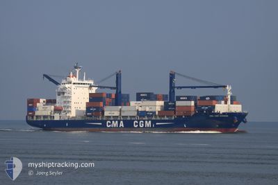
CMA CGM HOMERE
Container Ship
Current Trip
AOLAD
| Time Travelled | 1 day |
|---|---|
| Remaining Time | --- |
| Distance Travelled | 94.52 nm |
| Remaining Distance | --- |
| AVG Speed | 13.7 Knots |
| MAX Speed | 17.2 Knots |
| AVG Wind | 9 knots |
| MAX Wind | 13.7 knots |
| MIN Temp | 27.8°C / 82.04°F |
| MAX Temp | 31.7°C / 89.06°F |
| Dybgang | 9.3 m |
| Position Modtaget | 2022-11-29 11:20 |
Current Position
| Longitude | 18.03015° |
|---|---|
| Latitude | -34.30769° |
| Status | Under way using engine |
| Fart | 16.5 Knots |
| Kurs | 326.7° |
| Område | South Atlantic Ocean |
| Station | T-AIS |
| Position Modtaget | 2022-11-29 11:20 |
Info
Information
The current position of CMA CGM HOMERE is in South Atlantic Ocean with coordinates -34.30769° / 18.03015° as reported on 2022-11-29 11:20 by AIS to our vessel tracker app. The vessel's current speed is 16.5 Knots
The vessel CMA CGM HOMERE (IMO: 9362322, MMSI: 525119170) is a Container Ship that was built in 2007 ( 17 år gamle ). It's sailing under the flag of [ID] Indonesia.
In this page you can find informations about the vessels current position, last detected port calls, and current voyage information. If the vessels is not in coverage by AIS you will find the latest position.
The current position of CMA CGM HOMERE is detected by our AIS receivers and we are not responsible for the reliability of the data. The last position was recorded while the vessel was in Coverage by the Ais receivers of our vessel tracking app.
The current draught of CMA CGM HOMERE as reported by AIS is 9.3 meters
Weather
| Temperature | 29.1°C / 84.38°F |
|---|---|
| Wind Speed | 9 knots |
| Direction | 246° WSW |
| Pressure | 1008.1 hPa |
| Humidity | 81.9 % |
| Cloud Coverage | 100 % |
Featured Company
Last Port Calls
| Port | Arrival | Departure | Time In Port |
|---|---|---|---|
| 2024-05-01 22:07 | 2024-05-04 14:52 | 2 d | |
| 2024-04-22 04:48 | 2024-04-24 16:16 | 2 d | |
| 2024-04-10 20:21 | 2024-04-12 19:21 | 1 d | |
| 2024-04-05 16:01 | 2024-04-08 04:27 | 2 d | |
| 2024-03-30 20:47 | 2024-04-02 21:01 | 3 d | |
| 2024-03-20 16:44 | 2024-03-23 03:44 | 2 d | |
| 2024-03-09 03:58 |
Most Visited Ports (Last year)
| Port | Arrivals | |
|---|---|---|
| 36 | ||
| 3 | ||
| 2 | ||
| 2 | ||
| 2 |
Last Trips
| Origin | Departure | Destination | Arrival | Distance | |
|---|---|---|---|---|---|
| 2024-04-24 17:16 | 2024-05-01 23:07 | 216.61 nm | |||
| 2024-04-12 20:21 | 2024-04-22 05:48 | 1312.08 nm | |||
| 2024-04-08 05:27 | 2024-04-10 21:21 | 197.39 nm | |||
| 2024-04-02 22:01 | 2024-04-05 17:01 | 198.51 nm | |||
| 2024-03-23 04:44 | 2024-03-30 21:47 | 227.66 nm | |||
| 2024-03-09 04:58 | 2024-03-20 17:44 | 217.68 nm |
Events
| Tid | Hændelsen | Detaljer | Position / Dest | Info |
|---|---|---|---|---|
| 2024-05-04 22:26 | STOP Sejllads | 15.61 nm, South West of KRIBI |
2.72833 / 9.75167
AOLAD
|
Fart: Kurs: -1° |
| 2024-05-04 14:52 | Afsejlet fra sidste havn |
|
4.03273 / 9.65826
AOLAD
|
Fart: 6.2 kn Kurs: 236° |
| 2024-05-04 14:44 | START Sejllads |
4.03980 / 9.66915
[CM] DOUALA
|
Fart: 5.3 kn Kurs: 237° |
|
| 2024-05-01 22:19 | STOP Sejllads |
4.04201 / 9.67749
[CM] DOUALA
|
Fart: 0.1 kn Kurs: 55° |
|
| 2024-05-01 22:07 | Skibe i havn |
|
4.04247 / 9.67493
[CM] DOUALA
|
Fart: 4.3 kn Kurs: 54° |
| 2024-05-01 19:52 | START Sejllads | 17.41 nm, South West of DOUALA |
3.85698 / 9.47715
AOLAD
|
Fart: 6.6 kn Kurs: 68° |
| 2024-04-30 15:41 | STOP Sejllads | 17.65 nm, South West of DOUALA |
3.85697 / 9.47172
AOLAD
|
Fart: 0.2 kn Kurs: 114° |
| 2024-04-29 00:52 | STOP Sejllads | 12.91 nm, South of KRIBI |
2.72714 / 9.86074
AOLAD
|
Fart: 0.1 kn Kurs: 45° |
| 2024-04-29 00:04 | START Sejllads | 12.15 nm, South of KRIBI |
2.74500 / 9.84333
AOLAD
|
Fart: 8 kn Kurs: 127° |
| 2024-04-28 23:43 | STOP Sejllads | 12.02 nm, South of KRIBI |
2.75167 / 9.83167
AOLAD
|
Fart: Kurs: -1° |