
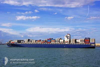
CMA CGM DON PASCUALE
Container Ship
Current Trip
| Trip Time | 2 days |
|---|---|
| Trip Distance | 945.76 nm |
| AVG Speed | 16.3 Knots |
| MAX Speed | 19.4 Knots |
| Dybgang | 14.4 m |
| AVG Wind | 9.6 knots |
| MAX Wind | 18 knots |
| MIN Temp | 16.8°C / 62.24°F |
| MAX Temp | 27.4°C / 81.32°F |
| Position Modtaget | 23 d siden |
Current Position
| Longitude | 17.96656° |
|---|---|
| Latitude | -34.26384° |
| Status | Under way using engine |
| Fart | 16.1 Knots |
| Kurs | 329.3° |
| Område | South Atlantic Ocean |
| Station | T-AIS |
| Position Modtaget | 23 d siden |
Info
Information
The current position of CMA CGM DON PASCUALE is in South Atlantic Ocean with coordinates -34.26384° / 17.96656° as reported on 2024-04-26 23:15 by AIS to our vessel tracker app. The vessel's current speed is 16.1 Knots and is currently inside the port of WALVIS BAY.
The vessel CMA CGM DON PASCUALE (IMO: 9318101, MMSI: 229331000) is a Container Ship that was built in 2007 ( 17 år gamle ). It's sailing under the flag of [MT] Malta.
In this page you can find informations about the vessels current position, last detected port calls, and current voyage information. If the vessels is not in coverage by AIS you will find the latest position.
The current position of CMA CGM DON PASCUALE is detected by our AIS receivers and we are not responsible for the reliability of the data. The last position was recorded while the vessel was in Coverage by the Ais receivers of our vessel tracking app.
The current draught of CMA CGM DON PASCUALE as reported by AIS is 14.4 meters
Weather
| Temperature | 23.1°C / 73.58°F |
|---|---|
| Wind Speed | 8 knots |
| Direction | 80° E |
| Pressure | 1013.9 hPa |
| Humidity | 21.2 % |
| Cloud Coverage | --- |
Featured Company
Last Port Calls
| Port | Arrival | Departure | Time In Port |
|---|---|---|---|
| 2024-05-19 03:55 | |||
| 2024-05-12 05:33 | 2024-05-16 11:55 | 4 d | |
| 2024-05-03 18:07 | 2024-05-05 16:51 | 1 d | |
| 2024-04-12 18:10 | 2024-04-13 14:32 | 20 h | |
| 2024-04-08 03:48 | 2024-04-09 02:37 | 22 h | |
| 2024-04-02 20:01 | 2024-04-03 12:45 | 16 h | |
| 2024-03-29 14:11 | 2024-03-30 02:54 | 12 h | |
| 2024-03-26 22:36 | 2024-03-27 17:48 | 19 h | |
| 2024-03-18 16:22 | 2024-03-19 03:15 | 10 h | |
| 2024-03-02 21:41 |
Most Visited Ports (Last year)
| Port | Arrivals | |
|---|---|---|
| 9 | ||
| 3 | ||
| 3 | ||
| 3 | ||
| 2 | ||
| 2 |
Last Trips
| Origin | Departure | Destination | Arrival | Distance | |
|---|---|---|---|---|---|
| 2024-05-16 11:55 | 2024-05-19 03:55 | 945.76 nm | |||
| 2024-05-05 16:51 | 2024-05-12 05:33 | 1450.63 nm | |||
| 2024-04-13 14:32 | 2024-05-03 18:07 | 7492.52 nm | |||
| 2024-04-09 02:37 | 2024-04-12 18:10 | 321.27 nm | |||
| 2024-04-03 12:45 | 2024-04-08 03:48 | 1487.95 nm | |||
| 2024-03-30 02:54 | 2024-04-02 20:01 | 1069.33 nm | |||
| 2024-03-27 17:48 | 2024-03-29 14:11 | 407.17 nm | |||
| 2024-03-19 03:15 | 2024-03-26 22:36 | 2810.23 nm | |||
| 2024-03-02 21:41 | 2024-03-18 16:22 | 6040.77 nm |
Events
| Tid | Hændelsen | Detaljer | Position / Dest | Info |
|---|---|---|---|---|
| 2024-05-19 02:27 | STOP Sejllads |
-22.95014 / 14.48633
[NA] WALVIS BAY
|
Fart: 0.3 kn Kurs: 22° |
|
| 2024-05-19 01:55 | Skibe i havn |
|
-22.94070 / 14.49672
[NA] WALVIS BAY
|
Fart: 5.9 kn Kurs: 183° |
| 2024-05-19 00:48 | START Sejllads | 6.51 nm, North of WALVIS BAY |
-22.83083 / 14.50400
CGPNR
|
Fart: 4.1 kn Kurs: 220° |
| 2024-05-18 20:15 | STOP Sejllads | 6.76 nm, North of WALVIS BAY |
-22.82681 / 14.50912
CGPNR
|
Fart: 0.2 kn Kurs: 161° |
| 2024-05-16 10:55 | Afsejlet fra sidste havn |
|
-8.75973 / 13.27454
CGPNR
|
Fart: 6.8 kn Kurs: 30° |
| 2024-05-16 10:28 | START Sejllads |
-8.79384 / 13.24818
[AO] LUANDA
|
Fart: 4.3 kn Kurs: 23° |
|
| 2024-05-14 01:19 | STOP Sejllads |
-8.78833 / 13.25167
[AO] LUANDA
|
Fart: Kurs: -1° |
|
| 2024-05-14 00:58 | START Sejllads |
-8.78356 / 13.26281
[AO] LUANDA
|
Fart: 3.3 kn Kurs: 255° |
|
| 2024-05-12 05:15 | STOP Sejllads |
-8.78667 / 13.27167
[AO] LUANDA
|
Fart: Kurs: -1° |
|
| 2024-05-12 04:33 | Skibe i havn |
|
-8.76649 / 13.27121
[AO] LUANDA
|
Fart: 5.4 kn Kurs: 212° |