
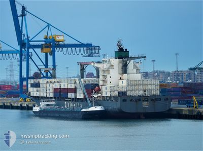
CMA CGM BEIRA
Container Ship
Current Trip
CLSAI
| Time Travelled | 3 days |
|---|---|
| Remaining Time | --- |
| Distance Travelled | 1506.30 nm |
| Remaining Distance | --- |
| AVG Speed | 16.2 Knots |
| MAX Speed | 20.3 Knots |
| AVG Wind | 15.2 knots |
| MAX Wind | 28 knots |
| MIN Temp | 9.2°C / 48.56°F |
| MAX Temp | 27.9°C / 82.22°F |
| Dybgang | 10.2 m |
| Position Modtaget | 1 d siden |
Current Position
| Longitude | -74.35265° |
|---|---|
| Latitude | 19.39540° |
| Status | Under way using engine |
| Fart | 18.7 Knots |
| Kurs | 205° |
| Område | Caribbean Sea |
| Station | T-AIS |
| Position Modtaget | 1 d siden |
Info
Information
The current position of CMA CGM BEIRA is in Caribbean Sea with coordinates 19.39540° / -74.35265° as reported on 2024-04-25 06:44 by AIS to our vessel tracker app. The vessel's current speed is 18.7 Knots
The vessel CMA CGM BEIRA (IMO: 9302956, MMSI: 215891000) is a Container Ship that was built in 2006 ( 18 år gamle ). It's sailing under the flag of [MT] Malta.
In this page you can find informations about the vessels current position, last detected port calls, and current voyage information. If the vessels is not in coverage by AIS you will find the latest position.
The current position of CMA CGM BEIRA is detected by our AIS receivers and we are not responsible for the reliability of the data. The last position was recorded while the vessel was in Coverage by the Ais receivers of our vessel tracking app.
The current draught of CMA CGM BEIRA as reported by AIS is 10.2 meters
Weather
| Temperature | 27.3°C / 81.14°F |
|---|---|
| Wind Speed | 16 knots |
| Direction | 58° ENE |
| Pressure | 1011.8 hPa |
| Humidity | 86.2 % |
| Cloud Coverage | 100 % |
Featured Company
Last Port Calls
| Port | Arrival | Departure | Time In Port |
|---|---|---|---|
| 2024-04-21 00:14 | 2024-04-22 16:26 | 1 d | |
| 2024-04-16 19:07 | 2024-04-17 05:27 | 10 h | |
| 2024-04-13 14:27 | 2024-04-14 03:03 | 12 h | |
| 2024-04-10 08:53 | 2024-04-10 21:39 | 12 h | |
| 2024-04-05 10:32 | 2024-04-06 07:17 | 20 h | |
| 2024-04-03 06:38 | 2024-04-03 15:00 | 8 h | |
| 2024-03-28 15:21 | 2024-03-30 02:44 | 1 d | |
| 2024-03-24 16:50 | 2024-03-25 01:53 | 9 h | |
| 2024-03-21 18:38 | 2024-03-22 23:11 | 1 d | |
| 2024-03-15 08:40 | 2024-03-16 00:10 | 15 h |
Most Visited Ports (Last year)
| Port | Arrivals | |
|---|---|---|
| 16 | ||
| 15 | ||
| 14 | ||
| 12 | ||
| 10 | ||
| 9 |
Last Trips
| Origin | Departure | Destination | Arrival | Distance | |
|---|---|---|---|---|---|
| 2024-04-17 01:27 | 2024-04-20 20:14 | 582.89 nm | |||
| 2024-04-13 23:03 | 2024-04-16 15:07 | 933.25 nm | |||
| 2024-04-10 16:39 | 2024-04-13 10:27 | 1151.36 nm | |||
| 2024-04-06 02:17 | 2024-04-10 03:53 | 1116.34 nm | |||
| 2024-04-03 10:00 | 2024-04-05 05:32 | 721.67 nm | |||
| 2024-03-29 23:44 | 2024-04-03 01:38 | 1336.58 nm | |||
| 2024-03-24 20:53 | 2024-03-28 12:21 | 1353.51 nm | |||
| 2024-03-22 18:11 | 2024-03-24 11:50 | 722.74 nm | |||
| 2024-03-15 19:10 | 2024-03-21 13:38 | 1116.94 nm | |||
| 2024-03-09 23:15 | 2024-03-15 03:40 | 1666.73 nm |
Events
| Tid | Hændelsen | Detaljer | Position / Dest | Info |
|---|---|---|---|---|
| 2024-04-25 06:49 | Status er ændret | Default Under way using engine |
19.37127 / -74.36487
CLSAI
|
Fart: 18.7 kn Kurs: 205° |
| 2024-04-25 06:44 | Status er ændret | Under way using engine Default |
19.39540 / -74.35265
CLSAI
|
Fart: 18.6 kn Kurs: 205° |
| 2024-04-25 06:44 | Indenfor Dækning |
19.39540 / -74.35265
Caribbean Sea
|
Fart: 18.7 kn Kurs: 205° |
|
| 2024-04-25 06:44 | Udenfor Dækning |
19.39540 / -74.35265
Caribbean Sea
|
Fart: 18.7 kn Kurs: 205° |
|
| 2024-04-25 04:44 | Status er ændret | Default Under way using engine |
19.94762 / -74.09062
CLSAI
|
Fart: 18.6 kn Kurs: 207.1° |
| 2024-04-25 04:41 | Ændre havområde | Cuban part of the Caribbean Sea Cuban part of the North Atlantic Ocean |
19.96255 / -74.08264
Caribbean Sea
|
Fart: 18.6 kn Kurs: 207.1° |
| 2024-04-25 04:41 | Udenfor Dækning |
19.96255 / -74.08264
Caribbean Sea
|
Fart: 18.6 kn Kurs: 207.1° |
|
| 2024-04-25 04:41 | Status er ændret | Under way using engine Default |
19.96448 / -74.08161
CLSAI
|
Fart: 18.5 kn Kurs: 206° |
| 2024-04-25 04:37 | Status er ændret | Default Under way using engine |
19.98153 / -74.07259
CLSAI
|
Fart: 18.5 kn Kurs: 207.1° |
| 2024-04-25 04:28 | Status er ændret | Under way using engine Default |
20.02267 / -74.05081
CLSAI
|
Fart: 18.5 kn Kurs: 208° |