
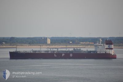
CLIPPER JUPITER
Tanker
Current Trip
| Time Travelled | 18 days |
|---|---|
| Remaining Time | 1 day |
| Distance Travelled | 5807.53 nm |
| Remaining Distance | 410.86 nm |
| AVG Speed | 12.6 Knots |
| MAX Speed | 17.8 Knots |
| AVG Wind | 13 knots |
| MAX Wind | 29.8 knots |
| MIN Temp | 2.2°C / 35.96°F |
| MAX Temp | 28.2°C / 82.76°F |
| Dybgang | 6.8 m |
| Position Modtaget | 1 d siden |
Current Position
| Longitude | -80.72517° |
|---|---|
| Latitude | 24.10532° |
| Status | Under way using engine |
| Fart | 11.9 Knots |
| Kurs | 240.7° |
| Område | North Atlantic Ocean |
| Station | T-AIS |
| Position Modtaget | 1 d siden |
Info
Information
The current position of CLIPPER JUPITER is in North Atlantic Ocean with coordinates 24.10532° / -80.72517° as reported on 2024-05-12 03:41 by AIS to our vessel tracker app. The vessel's current speed is 11.9 Knots and is heading at the port of HOUSTON. The estimated time of arrival as calculated by MyShipTracking vessel tracking app is 2024-05-14 22:51 LT
The vessel CLIPPER JUPITER (IMO: 9699505, MMSI: 257694000) is a Tanker It's sailing under the flag of [NO] Norway.
In this page you can find informations about the vessels current position, last detected port calls, and current voyage information. If the vessels is not in coverage by AIS you will find the latest position.
The current position of CLIPPER JUPITER is detected by our AIS receivers and we are not responsible for the reliability of the data. The last position was recorded while the vessel was in Coverage by the Ais receivers of our vessel tracking app.
The current draught of CLIPPER JUPITER as reported by AIS is 6.8 meters
Weather
| Temperature | 27.2°C / 80.96°F |
|---|---|
| Wind Speed | 15 knots |
| Direction | 162° SSE |
| Pressure | 1011.3 hPa |
| Humidity | 87 % |
| Cloud Coverage | 29 % |
Featured Company
Last Port Calls
| Port | Arrival | Departure | Time In Port |
|---|---|---|---|
| 2024-04-22 22:16 | 2024-04-24 23:37 | 2 d | |
| 2024-04-02 15:55 | 2024-04-04 17:34 | 2 d | |
| 2024-03-13 01:28 | 2024-03-16 10:01 | 3 d | |
| 2024-03-09 15:50 | 2024-03-10 21:10 | 1 d | |
| 2024-03-06 11:44 | 2024-03-08 07:38 | 1 d | |
| 2024-03-02 16:39 | 2024-03-03 16:54 | 1 d | |
| 2024-03-01 08:32 | 2024-03-02 14:16 | 1 d |
Last Trips
| Origin | Departure | Destination | Arrival | Distance | |
|---|---|---|---|---|---|
| 2024-04-04 12:34 | 2024-04-23 00:16 | 6133.24 nm | |||
| 2024-03-16 11:01 | 2024-04-02 10:55 | 5628.56 nm | |||
| 2024-03-10 22:10 | 2024-03-13 02:28 | 570.18 nm | |||
| 2024-03-08 08:38 | 2024-03-09 16:50 | 313.48 nm | |||
| 2024-03-03 17:54 | 2024-03-06 12:44 | 428.60 nm | |||
| 2024-03-02 15:16 | 2024-03-02 17:39 | 22.46 nm | |||
| 2024-02-28 07:20 | 2024-03-01 09:32 | 535.54 nm |
Events
| Tid | Hændelsen | Detaljer | Position / Dest | Info |
|---|---|---|---|---|
| 2024-05-12 03:54 | Status er ændret | Default Under way using engine |
24.08500 / -80.76334
SE GOT>US HOU
|
Fart: 11.9 kn Kurs: 240.7° |
| 2024-05-12 03:41 | Udenfor Dækning |
24.10532 / -80.72517
North Atlantic Ocean
SE GOT>US HOU
|
Fart: 11.9 kn Kurs: 240.7° |
|
| 2024-05-12 03:10 | Status er ændret | Under way using engine Default |
24.15504 / -80.62468
SE GOT>US HOU
|
Fart: 12.4 kn Kurs: 243° |
| 2024-05-12 02:49 | Status er ændret | Default Under way using engine |
24.18779 / -80.55639
SE GOT>US HOU
|
Fart: 12.4 kn Kurs: 242.5° |
| 2024-05-12 01:24 | ETA er ændret | 2024/05/15 03:00 2024/05/12 16:00 |
24.32392 / -80.28410
SE GOT>US HOU
|
Fart: 11.2 kn Kurs: 240.1° |
| 2024-05-12 01:02 | Status er ændret | Under way using engine Default |
24.35545 / -80.21855
SE GOT>US HOU
|
Fart: 11.9 kn Kurs: 240° |
| 2024-05-12 01:02 | Indenfor Dækning |
24.35545 / -80.21855
North Atlantic Ocean
SE GOT>US HOU
|
Fart: 11.3 kn Kurs: 243.4° |
|
| 2024-05-11 22:20 | Status er ændret | Default Under way using engine |
24.61333 / -79.69334
SE GOT>US HOU
|
Fart: 12.3 kn Kurs: 242.2° |
| 2024-05-11 22:16 | Ændre havområde | Bahamas part of the North Atlantic Ocean Portuguese (Azores) part of the North Atlantic Ocean |
24.62198 / -79.68084
North Atlantic Ocean
SE GOT>US HOU
|
Fart: 12.3 kn Kurs: 242.2° |
| 2024-05-11 22:16 | Udenfor Dækning |
24.62198 / -79.68084
North Atlantic Ocean
SE GOT>US HOU
|
Fart: 12.3 kn Kurs: 242.2° |