
CHRONOS
Yacht
Current Trip
| Time Travelled | 7 days |
|---|---|
| Remaining Time | --- |
| Distance Travelled | 248.26 nm |
| Remaining Distance | 5.12 nm |
| AVG Speed | 6.3 Knots |
| MAX Speed | 10.8 Knots |
| AVG Wind | 14.8 knots |
| MAX Wind | 31.3 knots |
| MIN Temp | 14.3°C / 57.74°F |
| MAX Temp | 24.7°C / 76.46°F |
| Dybgang | 4.2 m |
| Position Modtaget | 30 m siden |
Current Position
| Longitude | --- |
|---|---|
| Latitude | --- |
| Status | Under way using engine |
| Fart | 5.9 Knots |
| Kurs | 201.3° |
| Område | Mediterranean Sea - Western Basin |
| Station | T-AIS |
| Position Modtaget | 30 m siden |
Info
Information
The current position of CHRONOS is in Mediterranean Sea - Western Basin with coordinates 43.26223° / 6.72123° as reported on 2024-09-30 08:52 by AIS to our vessel tracker app. The vessel's current speed is 5.9 Knots and is heading at the port of SAINT TROPEZ. The estimated time of arrival as calculated by MyShipTracking vessel tracking app is 2024-09-30 09:22 LT
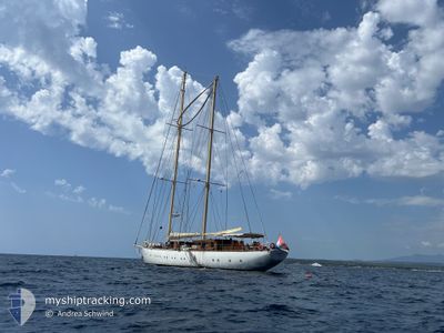
The vessel CHRONOS (IMO: 9687007, MMSI: 244790610) is a Yacht that was built in 2013 ( 11 år gamle ). It's sailing under the flag of [NL] Netherlands.
In this page you can find informations about the vessels current position, last detected port calls, and current voyage information. If the vessels is not in coverage by AIS you will find the latest position.
The current position of CHRONOS is detected by our AIS receivers and we are not responsible for the reliability of the data. The last position was recorded while the vessel was in Coverage by the Ais receivers of our vessel tracking app.
The current draught of CHRONOS as reported by AIS is 4.2 meters
Weather
| Temperature | 17.8°C / 64.04°F |
|---|---|
| Wind Speed | 3 knots |
| Direction | 297° WNW |
| Pressure | 1021.4 hPa |
| Humidity | 69.4 % |
| Cloud Coverage | 24 % |
Featured Company
Most Visited Ports (Last year)
| Port | Arrivals | |
|---|---|---|
| 5 | ||
| 4 | ||
| 3 | ||
| 3 | ||
| 2 | ||
| 2 |
Events
| Tid | Hændelsen | Detaljer | Position / Dest | Info |
|---|---|---|---|---|
| 2024-09-30 07:29 | Indenfor Dækning |
43.38740 / 6.74155
Mediterranean Sea - Western Basin
|
Fart: 5.4 kn Kurs: 176.6° |
|
| 2024-09-30 01:46 | Udenfor Dækning |
43.40531 / 6.74164
Mediterranean Sea - Western Basin
|
Fart: Kurs: 68.3° |
|
| 2024-09-30 01:46 | Indenfor Dækning |
43.40531 / 6.74164
Mediterranean Sea - Western Basin
|
Fart: Kurs: 68.3° |
|
| 2024-09-29 14:23 | Udenfor Dækning |
43.40509 / 6.83497
Mediterranean Sea - Western Basin
|
Fart: 5.2 kn Kurs: 266.9° |
|
| 2024-09-29 12:47 | Status er ændret | Under way using engine Under way sailing |
43.48013 / 6.98200
FR STP
|
Fart: 4.3 kn Kurs: 215° |
| 2024-09-29 12:47 | Dybgangen er ændret | 4.2 4.5 |
43.48055 / 6.98248
FR STP
|
Fart: 4.3 kn Kurs: 216° |
| 2024-09-29 12:03 | Destination er ændret | FR STP FRANT |
43.49831 / 7.02165
FR STP
|
Fart: 2.7 kn Kurs: 228° |
| 2024-09-29 12:02 | Status er ændret | Under way sailing Under way using engine |
43.49883 / 7.02242
FRANT
|
Fart: 2.6 kn Kurs: 224° |
| 2024-09-29 11:40 | START Sejllads | 2.09 nm, South of CANNES |
43.50897 / 7.03159
FRANT
|
Fart: 4 kn Kurs: 184° |
| 2024-09-29 11:29 | Status er ændret | Under way using engine At anchor |
43.51150 / 7.03100
FRANT
|
Fart: Kurs: 125° |