
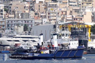
CHRISTOS XLI
Tug
Current Trip
GRPIR
| Time Travelled | 17 h, 43 mins |
|---|---|
| Remaining Time | --- |
| Distance Travelled | 2.94 nm |
| Remaining Distance | --- |
| AVG Speed | 7.4 Knots |
| MAX Speed | 7.5 Knots |
| AVG Wind | 3.6 knots |
| MAX Wind | 3.8 knots |
| MIN Temp | 10.3°C / 50.54°F |
| MAX Temp | 10.7°C / 51.26°F |
| Dybgang | 5 m |
| Position Modtaget | 16 h, 54 m siden |
Current Position
| Longitude | --- |
|---|---|
| Latitude | --- |
| Status | Under way using engine |
| Fart | 0.1 Knots |
| Kurs | --- |
| Område | Aegean Sea |
| Station | T-AIS |
| Position Modtaget | 16 h, 54 m siden |
Info
Information
The current position of CHRISTOS XLI is in Aegean Sea with coordinates 37.95389° / 23.55182° as reported on 2025-03-01 06:20 by AIS to our vessel tracker app. The vessel's current speed is 0.1 Knots
The vessel CHRISTOS XLI (IMO: 8127919, MMSI: 241567000) is a Tug that was built in 1983 ( 42 år gamle ). It's sailing under the flag of [GR] Greece.
In this page you can find informations about the vessels current position, last detected port calls, and current voyage information. If the vessels is not in coverage by AIS you will find the latest position.
The current position of CHRISTOS XLI is detected by our AIS receivers and we are not responsible for the reliability of the data. The last position was recorded while the vessel was in Coverage by the Ais receivers of our vessel tracking app.
The current draught of CHRISTOS XLI as reported by AIS is 5 meters
Weather
| Temperature | 10.8°C / 51.44°F |
|---|---|
| Wind Speed | 4 knots |
| Direction | 27° NNE |
| Pressure | 1022.5 hPa |
| Humidity | 73.1 % |
| Cloud Coverage | 26 % |
Featured Company
Last Port Calls
| Port | Arrival | Departure | Time In Port |
|---|---|---|---|
| 2025-02-27 21:19 | 2025-03-01 05:32 | 1 d | |
| 2025-02-27 19:52 | 2025-02-27 21:01 | 1 h | |
| 2025-02-27 18:54 | 2025-02-27 19:30 | 36 m | |
| 2025-02-26 22:40 | 2025-02-27 18:34 | 19 h | |
| 2025-02-25 18:39 | 2025-02-26 12:41 | 18 h | |
| 2025-02-25 15:11 | 2025-02-25 18:28 | 3 h | |
| 2025-02-24 19:13 | 2025-02-25 14:27 | 19 h | |
| 2025-02-24 18:46 | 2025-02-24 18:59 | 12 m | |
| 2025-02-24 17:22 | 2025-02-24 17:36 | 14 m | |
| 2025-02-24 15:42 | 2025-02-24 17:05 | 1 h |
Most Visited Ports (Last year)
| Port | Arrivals | |
|---|---|---|
| 969 | ||
| 186 | ||
| 24 | ||
| 19 | ||
| 12 | ||
| 2 |
Last Trips
| Origin | Departure | Destination | Arrival | Distance | |
|---|---|---|---|---|---|
| 2025-02-27 23:01 | 2025-02-27 23:19 | 2.05 nm | |||
| 2025-02-27 21:30 | 2025-02-27 21:52 | 0.54 nm | |||
| 2025-02-27 20:34 | 2025-02-27 20:54 | 2.15 nm | |||
| 2025-02-26 14:41 | 2025-02-27 00:40 | 21.37 nm | |||
| 2025-02-25 20:28 | 2025-02-25 20:39 | 1.30 nm | |||
| 2025-02-25 16:27 | 2025-02-25 17:11 | 4.02 nm | |||
| 2025-02-24 20:59 | 2025-02-24 21:13 | 1.71 nm | |||
| 2025-02-24 19:36 | 2025-02-24 20:46 | 4.30 nm | |||
| 2025-02-24 19:05 | 2025-02-24 19:22 | 1.61 nm | |||
| 2025-02-24 14:45 | 2025-02-24 17:42 | 7.90 nm |
Events
| Tid | Hændelsen | Detaljer | Position / Dest | Info |
|---|---|---|---|---|
| 2025-03-01 06:20 | Udenfor Dækning |
37.95389 / 23.55182
Aegean Sea
|
Fart: 0.1 kn Kurs: 511° |
|
| 2025-03-01 06:01 | STOP Sejllads | 0.72 nm, South West of PERAMA |
37.95392 / 23.55184
GRPIR
|
Fart: 0.2 kn Kurs: 511° |
| 2025-03-01 05:32 | Afsejlet fra sidste havn |
|
37.93894 / 23.61777
GRPIR
|
Fart: 7.5 kn Kurs: 290.1° |
| 2025-03-01 05:30 | START Sejllads |
37.93795 / 23.62231
[GR] PIRAEUS
|
Fart: 6.2 kn Kurs: 275° |
|
| 2025-03-01 02:57 | Indenfor Dækning |
37.93704 / 23.62446
Aegean Sea
[GR] PIRAEUS
|
Fart: Kurs: 511° |
|
| 2025-02-27 21:39 | Udenfor Dækning |
37.93705 / 23.62447
Aegean Sea
[GR] PIRAEUS
|
Fart: Kurs: 511° |
|
| 2025-02-27 21:19 | STOP Sejllads |
37.93703 / 23.62439
[GR] PIRAEUS
|
Fart: 0.2 kn Kurs: 511° |
|
| 2025-02-27 21:19 | Skibe i havn |
|
37.93703 / 23.62439
[GR] PIRAEUS
|
Fart: 1.6 kn Kurs: 511° |
| 2025-02-27 21:01 | Afsejlet fra sidste havn |
|
37.95041 / 23.58692
GRPIR
|
Fart: 2.6 kn Kurs: 511° |
| 2025-02-27 20:56 | START Sejllads |
37.95452 / 23.58711
[GR] PIRAEUS
|
Fart: 3.1 kn Kurs: 175.6° |