

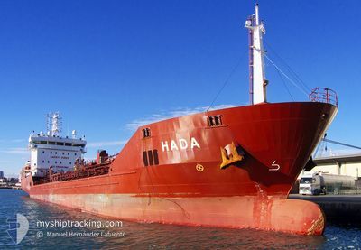
CHARLOTTA
Container Ship

Current Trip
| Time Travelled | 16 h, 19 mins |
|---|---|
| Remaining Time | --- |
| Distance Travelled | 78.48 nm |
| Remaining Distance | 5.41 nm |
| AVG Speed | 9 Knots |
| MAX Speed | 14.2 Knots |
| AVG Wind | 7.1 knots |
| MAX Wind | 9.3 knots |
| MIN Temp | 14.6°C / 58.28°F |
| MAX Temp | 17.7°C / 63.86°F |
| Dybgang | 7.4 m |
| Position Modtaget | 3 m siden |
Current Position
| Longitude | --- |
|---|---|
| Latitude | --- |
| Status | At anchor |
| Fart | 0.2 Knots |
| Kurs | 359° |
| Område | Mediterranean Sea - Eastern Basin |
| Station | T-AIS |
| Position Modtaget | 3 m siden |
Information
The current position of CHARLOTTA is in Mediterranean Sea - Eastern Basin with coordinates 32.90513° / 34.99760° as reported on 2025-02-04 09:05 by AIS to our vessel tracker app. The vessel's current speed is 0.2 Knots and is heading at the port of HAIFA. The estimated time of arrival as calculated by MyShipTracking vessel tracking app is 2025-02-03 23:30 LT
The vessel CHARLOTTA (IMO: 9429209, MMSI: 249403000) is a Container Ship that was built in 2009 ( 16 år gamle ). It's sailing under the flag of [MT] Malta.
In this page you can find informations about the vessels current position, last detected port calls, and current voyage information. If the vessels is not in coverage by AIS you will find the latest position.
The current position of CHARLOTTA is detected by our AIS receivers and we are not responsible for the reliability of the data. The last position was recorded while the vessel was in Coverage by the Ais receivers of our vessel tracking app.
The current draught of CHARLOTTA as reported by AIS is 7.4 meters
Weather
| Temperature | 16.8°C / 62.24°F |
|---|---|
| Wind Speed | 7 knots |
| Direction | 350° N |
| Pressure | 1017.4 hPa |
| Humidity | 66.2 % |
| Cloud Coverage | --- |


Featured Company
Last Port Calls
| Port | Arrival | Departure | Time In Port |
|---|---|---|---|
| 2025-02-02 18:15 | 2025-02-03 16:50 | 22 h | |
| 2025-01-28 07:32 | 2025-01-29 04:37 | 21 h | |
| 2025-01-26 11:27 | 2025-01-26 21:59 | 10 h | |
| 2025-01-25 10:57 | 2025-01-25 23:03 | 12 h | |
| 2025-01-23 07:36 | 2025-01-24 02:44 | 19 h | |
| 2025-01-21 11:13 | 2025-01-21 17:12 | 5 h | |
| 2025-01-18 15:02 | 2025-01-19 03:11 | 12 h |
Last Trips
| Origin | Departure | Destination | Arrival | Distance | |
|---|---|---|---|---|---|
| 2025-01-29 05:37 | 2025-02-02 20:15 | 1531.24 nm | |||
| 2025-01-26 22:59 | 2025-01-28 08:32 | 486.90 nm | |||
| 2025-01-26 00:03 | 2025-01-26 12:27 | 130.46 nm | |||
| 2025-01-24 03:44 | 2025-01-25 11:57 | 192.79 nm | |||
| 2025-01-21 18:12 | 2025-01-23 08:36 | 490.16 nm | |||
| 2025-01-19 06:11 | 2025-01-21 12:13 | 801.42 nm |
Events
| Tid | Hændelsen | Detaljer | Position / Dest | Info |
|---|---|---|---|---|
| 2025-02-04 08:50 | Status er ændret | At anchor Default |
32.90553 / 34.99643
ILHFA
|
Fart: 0.2 kn Kurs: 52° |
| 2025-02-04 08:47 | Status er ændret | Default At anchor |
32.90570 / 34.99628
ILHFA
|
Fart: 0.2 kn Kurs: 62° |
| 2025-02-03 23:44 | Status er ændret | At anchor Under way using engine |
32.90625 / 34.99592
ILHFA
|
Fart: 0.1 kn Kurs: 78° |
| 2025-02-03 23:42 | STOP Sejllads | 3.88 nm, West of ACRE |
32.90617 / 34.99587
ILHFA
|
Fart: 0.3 kn Kurs: 76° |
| 2025-02-03 19:40 | Status er ændret | Under way using engine Default |
32.32378 / 34.62650
ILHFA
|
Fart: 11.8 kn Kurs: 17° |
| 2025-02-03 19:40 | Indenfor Dækning |
32.32378 / 34.62650
Mediterranean Sea - Eastern Basin
ILHFA
|
Fart: 11.6 kn Kurs: 16° |
|
| 2025-02-03 18:17 | Status er ændret | Default Under way using engine |
32.06270 / 34.53990
ILHFA
|
Fart: 11.9 kn Kurs: 11.3° |
| 2025-02-03 18:06 | Udenfor Dækning |
32.02632 / 34.52990
Mediterranean Sea - Eastern Basin
ILHFA
|
Fart: 11.9 kn Kurs: 11.3° |
|
| 2025-02-03 17:54 | Status er ændret | Under way using engine Default |
31.98847 / 34.52083
ILHFA
|
Fart: 12.1 kn Kurs: 11° |
| 2025-02-03 17:47 | Status er ændret | Default Under way using engine |
31.96380 / 34.51518
ILHFA
|
Fart: 11 kn Kurs: 3° |