
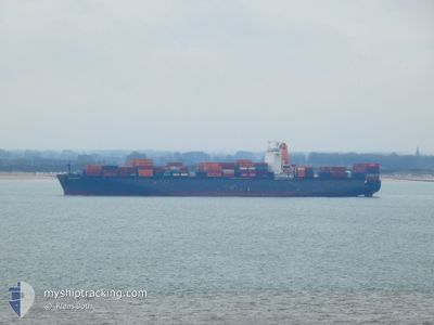
CHACABUCO
Cargo
Current Trip
| Time Travelled | 1 day |
|---|---|
| Remaining Time | 1 h, 43 mins |
| Distance Travelled | 217.82 nm |
| Remaining Distance | 34.33 nm |
| AVG Speed | 12.2 Knots |
| MAX Speed | 18.7 Knots |
| AVG Wind | 7.6 knots |
| MAX Wind | 17.8 knots |
| MIN Temp | 14.2°C / 57.56°F |
| MAX Temp | 16.9°C / 62.42°F |
| Dybgang | 11.2 m |
| Position Modtaget | Nu |
Current Position
| Longitude | 1.26509° |
|---|---|
| Latitude | 51.58619° |
| Status | Under way using engine |
| Fart | 18.8 Knots |
| Kurs | 231.5° |
| Område | North Sea |
| Station | T-AIS |
| Position Modtaget | Nu |
Info
Information
The current position of CHACABUCO is in North Sea with coordinates 51.58619° / 1.26509° as reported on 2024-06-29 11:59 by AIS to our vessel tracker app. The vessel's current speed is 18.8 Knots and is heading at the port of THAMES. The estimated time of arrival as calculated by MyShipTracking vessel tracking app is 2024-06-29 14:43 LT
The vessel CHACABUCO (IMO: 92959679, MMSI: 636092679) is a Cargo It's sailing under the flag of [LR] Liberia.
In this page you can find informations about the vessels current position, last detected port calls, and current voyage information. If the vessels is not in coverage by AIS you will find the latest position.
The current position of CHACABUCO is detected by our AIS receivers and we are not responsible for the reliability of the data. The last position was recorded while the vessel was in Coverage by the Ais receivers of our vessel tracking app.
The current draught of CHACABUCO as reported by AIS is 11.2 meters
Weather
| Temperature | 16.2°C / 61.16°F |
|---|---|
| Wind Speed | 3 knots |
| Direction | 17° NNE |
| Pressure | 1014.8 hPa |
| Humidity | 67.1 % |
| Cloud Coverage | 86 % |
Featured Company
Last Port Calls
| Port | Arrival | Departure | Time In Port |
|---|---|---|---|
| 2024-06-27 12:58 | 2024-06-28 11:39 | 22 h | |
| 2024-06-13 03:15 | 2024-06-14 19:15 | 1 d | |
| 2024-06-10 06:24 | 2024-06-11 13:54 | 1 d | |
| 2024-05-25 14:56 | 2024-05-26 14:26 | 23 h | |
| 2024-05-24 04:39 | 2024-05-24 15:40 | 11 h | |
| 2024-05-20 09:53 | 2024-05-21 15:49 | 1 d | |
| 2024-05-18 04:41 | 2024-05-18 18:14 | 13 h | |
| 2024-05-16 10:36 | 2024-05-17 03:07 | 16 h | |
| 2024-04-26 11:32 | 2024-04-28 01:06 | 1 d | |
| 2024-04-23 23:00 | 2024-04-24 23:19 | 1 d |
Last Trips
| Origin | Departure | Destination | Arrival | Distance | |
|---|---|---|---|---|---|
| 2024-06-14 19:15 | 2024-06-27 12:58 | 4994.81 nm | |||
| 2024-06-11 13:54 | 2024-06-13 03:15 | 503.69 nm | |||
| 2024-05-26 14:26 | 2024-06-10 06:24 | 5626.29 nm | |||
| 2024-05-24 15:40 | 2024-05-25 14:56 | 152.25 nm | |||
| 2024-05-21 15:49 | 2024-05-24 04:39 | 337.65 nm | |||
| 2024-05-18 18:14 | 2024-05-20 09:53 | 202.19 nm | |||
| 2024-05-17 03:07 | 2024-05-18 04:41 | 265.73 nm | |||
| 2024-04-28 01:06 | 2024-05-16 10:36 | 5008.29 nm | |||
| 2024-04-24 23:19 | 2024-04-26 11:32 | 502.48 nm | |||
| 2024-04-06 13:03 | 2024-04-23 23:00 | 5833.55 nm |
Events
| Tid | Hændelsen | Detaljer | Position / Dest | Info |
|---|---|---|---|---|
| 2024-06-29 10:02 | START Sejllads | 15.09 nm, East of FELIXSTOWE |
51.89758 / 1.69367
GBLGP
|
Fart: 5.4 kn Kurs: 128.8° |
| 2024-06-29 09:54 | Status er ændret | Under way using engine At anchor |
51.90053 / 1.69221
GBLGP
|
Fart: 0.2 kn Kurs: 216° |
| 2024-06-28 23:08 | Status er ændret | At anchor Under way using engine |
51.89892 / 1.69319
GBLGP
|
Fart: 0.1 kn Kurs: 260° |
| 2024-06-28 22:59 | STOP Sejllads | 14.99 nm, East of FELIXSTOWE |
51.89894 / 1.69144
GBLGP
|
Fart: 0.3 kn Kurs: 251° |
| 2024-06-28 19:07 | Ændre havområde | United Kingdom part of the North Sea French part of the North Sea |
51.06134 / 1.61092
North Sea
GBLGP
|
Fart: 15.2 kn Kurs: 46.8° |
| 2024-06-28 18:59 | Ændre havområde | French part of the North Sea French part of the English Channel |
51.03829 / 1.57191
North Sea
GBLGP
|
Fart: 15.1 kn Kurs: 46.4° |
| 2024-06-28 18:56 | ETA er ændret | 2024/06/29 10:30 2024/06/29 09:00 |
51.02988 / 1.55794
GBLGP
|
Fart: 15.1 kn Kurs: 46.4° |
| 2024-06-28 16:59 | Status er ændret | Under way using engine Default |
50.60528 / 1.15045
GBLGP
|
Fart: 14.9 kn Kurs: 50° |
| 2024-06-28 16:46 | Status er ændret | Default Under way using engine |
50.56957 / 1.08505
GBLGP
|
Fart: 14.8 kn Kurs: 49.7° |
| 2024-06-28 16:40 | Status er ændret | Under way using engine Default |
50.55375 / 1.05583
GBLGP
|
Fart: 14.7 kn Kurs: 50° |