
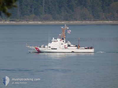
CGCANACAPA
Search and Rescue vessel
Current Trip
PANAMA
| Time Travelled | 17 days |
|---|---|
| Remaining Time | --- |
| Distance Travelled | 1764.72 nm |
| Remaining Distance | --- |
| AVG Speed | 14.4 Knots |
| MAX Speed | 15.5 Knots |
| AVG Wind | 4.5 knots |
| MAX Wind | 7.5 knots |
| MIN Temp | 25°C / 77°F |
| MAX Temp | 31.8°C / 89.24°F |
| Dybgang | 3.7 m |
| Position Modtaget | 3 d siden |
Current Position
| Longitude | -79.92205° |
|---|---|
| Latitude | 9.27757° |
| Status | Under way using engine |
| Fart | 1 Knots |
| Kurs | 19° |
| Område | North Pacific Ocean |
| Station | T-AIS |
| Position Modtaget | 3 d siden |
Info
Information
The current position of CGCANACAPA is in North Pacific Ocean with coordinates 9.27757° / -79.92205° as reported on 2024-06-04 07:54 by AIS to our vessel tracker app. The vessel's current speed is 1 Knots
The vessel CGCANACAPA (MMSI: 367947000) is a Search and Rescue vessel It's sailing under the flag of [US] USA.
In this page you can find informations about the vessels current position, last detected port calls, and current voyage information. If the vessels is not in coverage by AIS you will find the latest position.
The current position of CGCANACAPA is detected by our AIS receivers and we are not responsible for the reliability of the data. The last position was recorded while the vessel was in Coverage by the Ais receivers of our vessel tracking app.
The current draught of CGCANACAPA as reported by AIS is 3.7 meters
Weather
| Temperature | 25.8°C / 78.44°F |
|---|---|
| Wind Speed | 2 knots |
| Direction | 172° S |
| Pressure | 1007.5 hPa |
| Humidity | 92.4 % |
| Cloud Coverage | 100 % |
Featured Company
Last Port Calls
| Port | Arrival | Departure | Time In Port |
|---|---|---|---|
| 2024-05-18 09:21 | 2024-05-21 10:56 | 3 d | |
| 2024-05-12 14:14 | 2024-05-14 09:40 | 1 d | |
| 2024-05-10 10:54 | 2024-05-11 09:06 | 22 h | |
| 2024-04-23 12:53 | 2024-05-07 12:55 | 14 d | |
| 2024-04-08 15:13 | 2024-04-23 11:48 | 14 d | |
| 2024-04-08 12:42 |
Most Visited Ports (Last year)
| Port | Arrivals | |
|---|---|---|
| 9 | ||
| 2 | ||
| 1 | ||
| 1 | ||
| 1 |
Last Trips
| Origin | Departure | Destination | Arrival | Distance | |
|---|---|---|---|---|---|
| 2024-05-14 09:40 | 2024-05-18 09:21 | 998.64 nm | |||
| 2024-05-11 09:06 | 2024-05-12 14:14 | 440.85 nm | |||
| 2024-05-07 12:55 | 2024-05-10 10:54 | 732.90 nm | |||
| 2024-04-23 11:48 | 2024-04-23 12:53 | 8.02 nm | |||
| 2024-04-08 12:42 | 2024-04-08 15:13 | 26.86 nm |
Events
| Tid | Hændelsen | Detaljer | Position / Dest | Info |
|---|---|---|---|---|
| 2024-06-04 07:54 | Udenfor Dækning |
9.27757 / -79.92205
North Pacific Ocean
|
Fart: 1 kn Kurs: 15° |
|
| 2024-06-04 06:08 | STOP Sejllads | 4.53 nm, South of CRISTOBAL |
9.27168 / -79.92276
PANAMA
|
Fart: Kurs: 7° |
| 2024-06-04 04:01 | START Sejllads | 7.4 nm, North West of RODMAN |
9.05049 / -79.65356
PANAMA
|
Fart: 15 kn Kurs: 324° |
| 2024-06-04 03:30 | STOP Sejllads | 4.28 nm, North West of RODMAN |
9.01614 / -79.61218
PANAMA
|
Fart: Kurs: 307° |
| 2024-06-04 03:12 | Indenfor Dækning |
9.01462 / -79.61050
North Pacific Ocean
|
Fart: 1 kn Kurs: 309° |
|
| 2024-06-04 02:11 | Udenfor Dækning |
8.99706 / -79.59257
North Pacific Ocean
|
Fart: Kurs: 108° |
|
| 2024-06-04 01:39 | Indenfor Dækning |
8.99705 / -79.59255
North Pacific Ocean
|
Fart: Kurs: 329° |
|
| 2024-06-04 00:12 | Udenfor Dækning |
8.96327 / -79.57384
North Pacific Ocean
|
Fart: 8 kn Kurs: 333° |
|
| 2024-06-04 00:12 | Indenfor Dækning |
8.96327 / -79.57384
North Pacific Ocean
|
Fart: 8 kn Kurs: 333° |
|
| 2024-06-03 22:51 | Udenfor Dækning |
8.88250 / -79.49965
North Pacific Ocean
|
Fart: Kurs: 300° |