
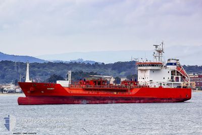
GAS ELISABETH
Lpg Tanker
Current Trip
UAIZM
| Time Travelled | 1 day |
|---|---|
| Remaining Time | --- |
| Distance Travelled | 469.69 nm |
| Remaining Distance | --- |
| AVG Speed | 10.5 Knots |
| MAX Speed | 12.6 Knots |
| AVG Wind | 5.8 knots |
| MAX Wind | 10.2 knots |
| MIN Temp | 14.5°C / 58.1°F |
| MAX Temp | 17.3°C / 63.14°F |
| Dybgang | 6.1 m |
| Position Modtaget | Nu |
Current Position
| Longitude | --- |
|---|---|
| Latitude | --- |
| Status | Under way using engine |
| Fart | 11.1 Knots |
| Kurs | 309° |
| Område | Aegean Sea |
| Station | T-AIS |
| Position Modtaget | Nu |
Info
Information
The current position of GAS ELISABETH is in Aegean Sea with coordinates 36.24717° / 27.06376° as reported on 2025-03-11 00:45 by AIS to our vessel tracker app. The vessel's current speed is 11.1 Knots
The vessel GAS ELISABETH (IMO: 9261578, MMSI: 255802440) is a Lpg Tanker that was built in 2004 ( 21 år gamle ). It's sailing under the flag of [PT] Portugal.
In this page you can find informations about the vessels current position, last detected port calls, and current voyage information. If the vessels is not in coverage by AIS you will find the latest position.
The current position of GAS ELISABETH is detected by our AIS receivers and we are not responsible for the reliability of the data. The last position was recorded while the vessel was in Coverage by the Ais receivers of our vessel tracking app.
The current draught of GAS ELISABETH as reported by AIS is 6.1 meters
Weather
| Temperature | 16.2°C / 61.16°F |
|---|---|
| Wind Speed | 10 knots |
| Direction | 162° SSE |
| Pressure | 1019.8 hPa |
| Humidity | 71.4 % |
| Cloud Coverage | 4 % |
Featured Company
Last Port Calls
| Port | Arrival | Departure | Time In Port |
|---|---|---|---|
| 2025-03-08 16:59 | 2025-03-09 10:53 | 17 h | |
| 2025-02-12 11:57 | 2025-02-13 06:57 | 18 h | |
| 2025-01-11 07:42 | 2025-01-12 01:36 | 17 h |
Most Visited Ports (Last year)
| Port | Arrivals | |
|---|---|---|
| 17 | ||
| 12 | ||
| 12 | ||
| 9 | ||
| 7 | ||
| 6 |
Last Trips
| Origin | Departure | Destination | Arrival | Distance | |
|---|---|---|---|---|---|
| 2025-02-13 06:57 | 2025-03-08 16:59 | 2516.53 nm | |||
| 2025-01-12 01:36 | 2025-02-12 11:57 | 6003.66 nm | |||
| 2024-12-29 03:49 | 2025-01-11 07:42 | 766.01 nm |
Events
| Tid | Hændelsen | Detaljer | Position / Dest | Info |
|---|---|---|---|---|
| 2025-03-11 00:32 | Status er ændret | Under way using engine Default |
36.21760 / 27.09840
UAIZM
|
Fart: 11.4 kn Kurs: 315° |
| 2025-03-11 00:19 | Status er ændret | Default Under way using engine |
36.18791 / 27.13454
UAIZM
|
Fart: 11.4 kn Kurs: 314.3° |
| 2025-03-10 21:35 | Ændre havområde | Greek part of the Aegean Sea Greek part of the Mediterranean Sea - Eastern Basin |
35.81204 / 27.59296
Aegean Sea
UAIZM
|
Fart: 11 kn Kurs: 295.4° |
| 2025-03-10 20:46 | Status er ændret | Under way using engine Default |
35.77248 / 27.77223
UAIZM
|
Fart: 11.1 kn Kurs: 269° |
| 2025-03-10 20:29 | Status er ændret | Default Under way using engine |
35.77328 / 27.83561
UAIZM
|
Fart: 11.1 kn Kurs: 269.4° |
| 2025-03-10 20:20 | Status er ændret | Under way using engine Default |
35.77349 / 27.87132
UAIZM
|
Fart: 11.3 kn Kurs: 265° |
| 2025-03-10 19:59 | Status er ændret | Default Under way using engine |
35.77783 / 27.95142
UAIZM
|
Fart: 11.4 kn Kurs: 266.3° |
| 2025-03-10 15:52 | Ændre havområde | Greek part of the Mediterranean Sea - Eastern Basin Turkish part of the Mediterranean Sea - Eastern Basin |
35.79135 / 28.77694
Mediterranean Sea - Eastern Basin
UAIZM
|
Fart: 11.8 kn Kurs: 270.7° |
| 2025-03-10 15:29 | Ændre havområde | Turkish part of the Mediterranean Sea - Eastern Basin Greek part of the Mediterranean Sea - Eastern Basin |
35.79234 / 28.86824
Mediterranean Sea - Eastern Basin
UAIZM
|
Fart: 11.9 kn Kurs: 266° |
| 2025-03-10 15:29 | Status er ændret | Under way using engine Default |
35.79245 / 28.87028
UAIZM
|
Fart: 11.9 kn Kurs: 270° |