
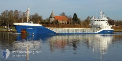
CELTIC FORTUNE
General Cargo
Current Trip
| Trip Time | 22 h, 56 mins |
|---|---|
| Trip Distance | 229.17 nm |
| AVG Speed | 10 Knots |
| MAX Speed | 12.2 Knots |
| Dybgang | 5.4 m |
| AVG Wind | 8 knots |
| MAX Wind | 20.5 knots |
| MIN Temp | 9.4°C / 48.92°F |
| MAX Temp | 13.4°C / 56.12°F |
| Position Modtaget | 2 d siden |
Current Position
| Longitude | -6.17276° |
|---|---|
| Latitude | 54.05769° |
| Status | Under way using engine |
| Fart | 8.5 Knots |
| Kurs | 298.6° |
| Område | Irish Sea and St. George's Channel |
| Station | T-AIS |
| Position Modtaget | 2 d siden |
Info
Information
The current position of CELTIC FORTUNE is in Irish Sea and St. George's Channel with coordinates 54.05769° / -6.17276° as reported on 2024-05-03 10:43 by AIS to our vessel tracker app. The vessel's current speed is 8.5 Knots and is currently inside the port of WARRENPOINT.
The vessel CELTIC FORTUNE (IMO: 9353711, MMSI: 232032365) is a General Cargo that was built in 2006 ( 18 år gamle ). It's sailing under the flag of [GB] United Kingdom.
In this page you can find informations about the vessels current position, last detected port calls, and current voyage information. If the vessels is not in coverage by AIS you will find the latest position.
The current position of CELTIC FORTUNE is detected by our AIS receivers and we are not responsible for the reliability of the data. The last position was recorded while the vessel was in Coverage by the Ais receivers of our vessel tracking app.
The current draught of CELTIC FORTUNE as reported by AIS is 5.4 meters
Weather
| Temperature | 10.7°C / 51.26°F |
|---|---|
| Wind Speed | 2 knots |
| Direction | 325° NW |
| Pressure | 1007.5 hPa |
| Humidity | 96.1 % |
| Cloud Coverage | 100 % |
Featured Company
Last Port Calls
| Port | Arrival | Departure | Time In Port |
|---|---|---|---|
| 2024-05-03 11:22 | |||
| 2024-05-02 12:26 |
Most Visited Ports (Last year)
| Port | Arrivals | |
|---|---|---|
| 3 | ||
| 3 | ||
| 3 | ||
| 2 | ||
| 2 | ||
| 2 |
Last Trips
| Origin | Departure | Destination | Arrival | Distance | |
|---|---|---|---|---|---|
| 2024-05-02 13:26 | 2024-05-03 12:22 | 229.17 nm |
Events
| Tid | Hændelsen | Detaljer | Position / Dest | Info |
|---|---|---|---|---|
| 2024-05-03 11:22 | STOP Sejllads |
54.09901 / -6.25851
[GB] WARRENPOINT
|
Fart: 0.3 kn Kurs: 37° |
|
| 2024-05-03 11:22 | Skibe i havn |
|
54.09901 / -6.25851
[GB] WARRENPOINT
|
Fart: 0.6 kn Kurs: 13° |
| 2024-05-03 10:51 | Status er ændret | Default Under way using engine |
54.06734 / -6.19720
WARRENTPOINT
|
Fart: 8.5 kn Kurs: 298.6° |
| 2024-05-03 10:43 | Udenfor Dækning |
54.05769 / -6.17276
Irish Sea and St. George's Channel
[GB] WARRENPOINT
|
Fart: 8.5 kn Kurs: 298.6° |
|
| 2024-05-03 10:43 | Status er ændret | Under way using engine Default |
54.05752 / -6.17226
WARRENTPOINT
|
Fart: 8.4 kn Kurs: 299° |
| 2024-05-03 10:38 | Status er ændret | Default Under way using engine |
54.05183 / -6.15487
WARRENTPOINT
|
Fart: 7.6 kn Kurs: 336.5° |
| 2024-05-03 10:31 | Ændre havområde | United Kingdom part of the Irish Sea and St. George's Channel Irish part of the Irish Sea and St. George's Channel |
54.04154 / -6.13604
Irish Sea and St. George's Channel
WARRENTPOINT
|
Fart: 7.6 kn Kurs: 336.5° |
| 2024-05-03 10:26 | Ændre havområde | Irish part of the Irish Sea and St. George's Channel United Kingdom part of the Irish Sea and St. George's Channel |
54.03300 / -6.12352
Irish Sea and St. George's Channel
WARRENTPOINT
|
Fart: 7.3 kn Kurs: 316° |
| 2024-05-03 09:29 | Ændre havområde | United Kingdom part of the Irish Sea and St. George's Channel Irish part of the Irish Sea and St. George's Channel |
53.93386 / -5.99970
Irish Sea and St. George's Channel
WARRENTPOINT
|
Fart: 10.3 kn Kurs: 337.2° |
| 2024-05-03 02:30 | Fundet i havområde | Irish part of the Irish Sea and St. George's Channel |
52.73119 / -5.61684
Irish Sea and St. George's Channel
WARRENTPOINT
|
Fart: 11.9 kn Kurs: 4.9° |