
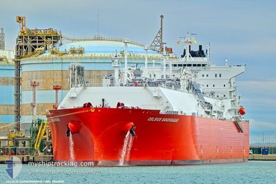
CELSIUS GANDHINAGAR
Tanker
Current Trip
| Time Travelled | 3 days |
|---|---|
| Remaining Time | --- |
| Distance Travelled | 1495.97 nm |
| Remaining Distance | --- |
| AVG Speed | 16.4 Knots |
| MAX Speed | 18.2 Knots |
| AVG Wind | 8.4 knots |
| MAX Wind | 19.8 knots |
| MIN Temp | 8.5°C / 47.3°F |
| MAX Temp | 15.4°C / 59.72°F |
| Dybgang | 9.4 m |
| Position Modtaget | Nu |
Current Position
| Longitude | --- |
|---|---|
| Latitude | --- |
| Status | Under way using engine |
| Fart | 16.4 Knots |
| Kurs | 261.4° |
| Område | Alboran Sea |
| Station | T-AIS |
| Position Modtaget | Nu |
Info
Information
The current position of CELSIUS GANDHINAGAR is in Alboran Sea with coordinates 36.39160° / -2.42155° as reported on 2025-03-02 13:21 by AIS to our vessel tracker app. The vessel's current speed is 16.4 Knots and is heading at the port of FREEPORT (TX). The estimated time of arrival as calculated by MyShipTracking vessel tracking app is 2025-03-14 16:00 LT
The vessel CELSIUS GANDHINAGAR (IMO: 9946829, MMSI: 538010614) is a Tanker It's sailing under the flag of [MH] Marshall Is.
In this page you can find informations about the vessels current position, last detected port calls, and current voyage information. If the vessels is not in coverage by AIS you will find the latest position.
The current position of CELSIUS GANDHINAGAR is detected by our AIS receivers and we are not responsible for the reliability of the data. The last position was recorded while the vessel was in Coverage by the Ais receivers of our vessel tracking app.
The current draught of CELSIUS GANDHINAGAR as reported by AIS is 9.4 meters
Weather
| Temperature | 15.4°C / 59.72°F |
|---|---|
| Wind Speed | 15 knots |
| Direction | 110° ESE |
| Pressure | 1015 hPa |
| Humidity | 80.4 % |
| Cloud Coverage | 100 % |
Featured Company
Most Visited Ports (Last year)
| Port | Arrivals | |
|---|---|---|
| 2 | ||
| 1 | ||
| 1 | ||
| 1 | ||
| 1 | ||
| 1 |
Events
| Tid | Hændelsen | Detaljer | Position / Dest | Info |
|---|---|---|---|---|
| 2025-03-02 12:46 | Fundet i havområde | Spanish part of the Alboran Sea |
36.41378 / -2.22909
Alboran Sea
TRALI>USFPO
|
Fart: 15.8 kn Kurs: 255.3° |
| 2025-03-02 12:46 | Indenfor Dækning |
36.41378 / -2.22909
Alboran Sea
TRALI>USFPO
|
Fart: 15.8 kn Kurs: 255.3° |
|
| 2025-02-28 23:31 | Udenfor Dækning |
37.65740 / 10.25509
Mediterranean Sea - Western Basin
TRALI>USFPO
|
Fart: 15.1 kn Kurs: 276.5° |
|
| 2025-02-28 23:25 | Fundet i havområde | Tunisian part of the Mediterranean Sea - Western Basin |
37.65428 / 10.28969
Mediterranean Sea - Western Basin
TRALI>USFPO
|
Fart: 15.1 kn Kurs: 276.3° |
| 2025-02-28 23:25 | Indenfor Dækning |
37.65428 / 10.28969
Mediterranean Sea - Western Basin
TRALI>USFPO
|
Fart: 15.1 kn Kurs: 276.3° |
|
| 2025-02-28 19:21 | Udenfor Dækning |
37.34709 / 11.57149
Mediterranean Sea - Eastern Basin
TRALI>USFPO
|
Fart: 16.5 kn Kurs: 285.2° |
|
| 2025-02-28 19:21 | Fundet i havområde | Tunisian part of the Mediterranean Sea - Eastern Basin |
37.34709 / 11.57149
Mediterranean Sea - Eastern Basin
TRALI>USFPO
|
Fart: 16.5 kn Kurs: 285.2° |
| 2025-02-28 19:21 | Indenfor Dækning |
37.34709 / 11.57149
Mediterranean Sea - Eastern Basin
TRALI>USFPO
|
Fart: 16.5 kn Kurs: 285.2° |
|
| 2025-02-28 11:45 | Udenfor Dækning |
36.60984 / 13.99716
Mediterranean Sea - Eastern Basin
TRALI>USFPO
|
Fart: 16.2 kn Kurs: 282.6° |
|
| 2025-02-28 10:09 | Destination er ændret | TRALI>USFPO FREEPORT |
36.43647 / 14.49279
TRALI>USFPO
|
Fart: 16.2 kn Kurs: 299.3° |