
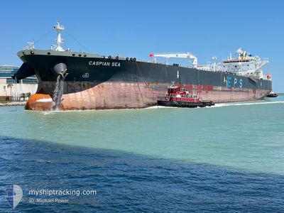
CASPIAN SEA
Tanker
Current Trip
| Time Travelled | 6 days |
|---|---|
| Remaining Time | 11 days |
| Distance Travelled | 1875.97 nm |
| Remaining Distance | 3453.85 nm |
| AVG Speed | 13 Knots |
| MAX Speed | 16.5 Knots |
| AVG Wind | 14.2 knots |
| MAX Wind | 31.3 knots |
| MIN Temp | 12.7°C / 54.86°F |
| MAX Temp | 29.7°C / 85.46°F |
| Dybgang | 8.8 m |
| Position Modtaget | 1 d siden |
Current Position
| Longitude | 141.98089° |
|---|---|
| Latitude | 41.64200° |
| Status | Under way using engine |
| Fart | 12.7 Knots |
| Kurs | 92.9° |
| Område | North Pacific Ocean |
| Station | T-AIS |
| Position Modtaget | 1 d siden |
Info
Information
The current position of CASPIAN SEA is in North Pacific Ocean with coordinates 41.64200° / 141.98089° as reported on 2024-09-14 22:26 by AIS to our vessel tracker app. The vessel's current speed is 12.7 Knots and is heading at the port of VANCOUVER. The estimated time of arrival as calculated by MyShipTracking vessel tracking app is 2024-09-28 01:34 LT
The vessel CASPIAN SEA (IMO: 9829095, MMSI: 636019071) is a Tanker It's sailing under the flag of [LR] Liberia.
In this page you can find informations about the vessels current position, last detected port calls, and current voyage information. If the vessels is not in coverage by AIS you will find the latest position.
The current position of CASPIAN SEA is detected by our AIS receivers and we are not responsible for the reliability of the data. The last position was recorded while the vessel was in Coverage by the Ais receivers of our vessel tracking app.
The current draught of CASPIAN SEA as reported by AIS is 8.8 meters
Weather
| Temperature | 13.7°C / 56.66°F |
|---|---|
| Wind Speed | 13 knots |
| Direction | 272° W |
| Pressure | 1021.4 hPa |
| Humidity | 69.1 % |
| Cloud Coverage | 100 % |
Featured Company
Events
| Tid | Hændelsen | Detaljer | Position / Dest | Info |
|---|---|---|---|---|
| 2024-09-14 22:31 | Status er ændret | Default Under way using engine |
41.64293 / 142.00322
CA VAN
|
Fart: 12.7 kn Kurs: 92.9° |
| 2024-09-14 22:26 | Status er ændret | Under way using engine Default |
41.64200 / 141.98089
CA VAN
|
Fart: 13.2 kn Kurs: 97° |
| 2024-09-14 22:26 | Udenfor Dækning |
41.64200 / 141.98089
North Pacific Ocean
CA VAN
|
Fart: 12.7 kn Kurs: 92.9° |
|
| 2024-09-14 22:21 | Status er ændret | Default Under way using engine |
41.64389 / 141.95746
CA VAN
|
Fart: 13.2 kn Kurs: 96.6° |
| 2024-09-14 22:19 | Status er ændret | Under way using engine Default |
41.64487 / 141.94607
CA VAN
|
Fart: 13.3 kn Kurs: 97° |
| 2024-09-14 22:09 | Status er ændret | Default Under way using engine |
41.64932 / 141.89511
CA VAN
|
Fart: 13.4 kn Kurs: 85.3° |
| 2024-09-14 22:02 | Status er ændret | Under way using engine Default |
41.64935 / 141.86251
CA VAN
|
Fart: 13.7 kn Kurs: 87° |
| 2024-09-14 21:59 | Status er ændret | Default Under way using engine |
41.64839 / 141.84651
CA VAN
|
Fart: 14 kn Kurs: 90.7° |
| 2024-09-14 20:10 | Ændre havområde | Japanese part of the North Pacific Ocean Japanese part of the Japan Sea |
41.64296 / 141.28281
North Pacific Ocean
CA VAN
|
Fart: 13.5 kn Kurs: 87.2° |
| 2024-09-14 17:08 | Dybgangen er ændret | 8.8 12.6 |
41.36826 / 140.38176
CA VAN
|
Fart: 14.9 kn Kurs: 53.9° |