
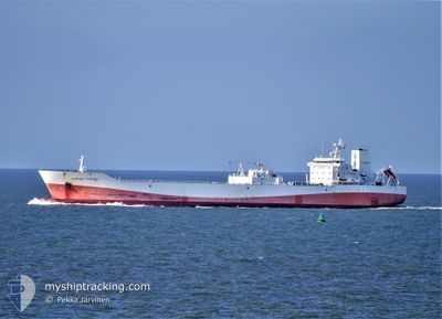
CARLOS FISCHER
Cargo
Current Trip
| Time Travelled | 12 days |
|---|---|
| Remaining Time | --- |
| Distance Travelled | 3278.53 nm |
| Remaining Distance | --- |
| AVG Speed | 17.1 Knots |
| MAX Speed | 20.5 Knots |
| AVG Wind | 9.1 knots |
| MAX Wind | 18.6 knots |
| MIN Temp | 23°C / 73.4°F |
| MAX Temp | 28.8°C / 83.84°F |
| Dybgang | 7 m |
| Position Modtaget | 8 d siden |
Current Position
| Longitude | -61.07737° |
|---|---|
| Latitude | 13.53492° |
| Status | Under way using engine |
| Fart | 15.8 Knots |
| Kurs | 120° |
| Område | Caribbean Sea |
| Station | T-AIS |
| Position Modtaget | 8 d siden |
Info
Information
The current position of CARLOS FISCHER is in Caribbean Sea with coordinates 13.53492° / -61.07737° as reported on 2024-04-21 20:10 by AIS to our vessel tracker app. The vessel's current speed is 15.8 Knots
The vessel CARLOS FISCHER (MMSI: 636011561) is a Cargo It's sailing under the flag of [LR] Liberia.
In this page you can find informations about the vessels current position, last detected port calls, and current voyage information. If the vessels is not in coverage by AIS you will find the latest position.
The current position of CARLOS FISCHER is detected by our AIS receivers and we are not responsible for the reliability of the data. The last position was recorded while the vessel was in Coverage by the Ais receivers of our vessel tracking app.
The current draught of CARLOS FISCHER as reported by AIS is 7 meters
Weather
| Temperature | 27.7°C / 81.86°F |
|---|---|
| Wind Speed | 8 knots |
| Direction | 44° NE |
| Pressure | 1011.7 hPa |
| Humidity | 77.8 % |
| Cloud Coverage | 98 % |
Featured Company
Last Port Calls
| Port | Arrival | Departure | Time In Port |
|---|---|---|---|
| 2024-04-09 14:53 | 2024-04-17 18:50 | 8 d | |
| 2024-03-24 14:34 | 2024-03-27 20:48 | 3 d | |
| 2024-03-05 22:20 | 2024-03-11 05:21 | 5 d | |
| 2024-02-19 11:51 | 2024-02-22 14:27 | 3 d | |
| 2024-02-07 09:20 |
Most Visited Ports (Last year)
| Port | Arrivals | |
|---|---|---|
| 9 | ||
| 6 | ||
| 3 | ||
| 2 | ||
| 2 | ||
| 1 |
Last Trips
| Origin | Departure | Destination | Arrival | Distance | |
|---|---|---|---|---|---|
| 2024-03-27 17:48 | 2024-04-09 10:53 | 5149.97 nm | |||
| 2024-03-11 01:21 | 2024-03-24 11:34 | 5257.25 nm | |||
| 2024-02-22 11:27 | 2024-03-05 17:20 | 5102.94 nm | |||
| 2024-02-07 04:20 | 2024-02-19 08:51 | 5169.91 nm |
Events
| Tid | Hændelsen | Detaljer | Position / Dest | Info |
|---|---|---|---|---|
| 2024-04-30 02:37 | START Sejllads |
-.09432 / -40.31984
BRSSZ
|
Fart: 5.1 kn Kurs: 151° |
|
| 2024-04-25 11:50 | STOP Sejllads |
-.16156 / -39.89709
BRSSZ
|
Fart: 0.3 kn Kurs: 80° |
|
| 2024-04-21 20:10 | Status er ændret | Default Under way using engine |
13.53357 / -61.07505
BRSSZ
|
Fart: 15.8 kn Kurs: 120° |
| 2024-04-21 20:10 | Status er ændret | Under way using engine Default |
13.53492 / -61.07737
BRSSZ
|
Fart: 15.8 kn Kurs: 120° |
| 2024-04-21 20:10 | Indenfor Dækning |
13.53492 / -61.07737
Caribbean Sea
|
Fart: 15.8 kn Kurs: 120° |
|
| 2024-04-21 20:10 | Udenfor Dækning |
13.53492 / -61.07737
Caribbean Sea
|
Fart: 15.8 kn Kurs: 120° |
|
| 2024-04-21 20:10 | Ændre havområde | Saint Vincent and the Grenadines part of the Caribbean Sea United States part of the Gulf of Mexico |
13.53492 / -61.07737
Caribbean Sea
|
Fart: 15.8 kn Kurs: 120° |