
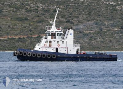
CAPTAIN DIMITRIS II
Tug
Current Trip
| Trip Time | 3 h, 34 mins |
|---|---|
| Trip Distance | 25.72 nm |
| AVG Speed | 7.1 Knots |
| MAX Speed | 11.1 Knots |
| Dybgang | 3.6 m |
| AVG Wind | 5.3 knots |
| MAX Wind | 8 knots |
| MIN Temp | 26.1°C / 78.98°F |
| MAX Temp | 27°C / 80.6°F |
| Position Modtaget | 1 m siden |
Current Position
| Longitude | 28.23081° |
|---|---|
| Latitude | 36.44580° |
| Status | Under way using engine |
| Fart | 0.2 Knots |
| Kurs | --- |
| Område | Mediterranean Sea - Eastern Basin |
| Station | T-AIS |
| Position Modtaget | 1 m siden |
Info
Information
The current position of CAPTAIN DIMITRIS II is in Mediterranean Sea - Eastern Basin with coordinates 36.44580° / 28.23081° as reported on 2024-09-09 06:09 by AIS to our vessel tracker app. The vessel's current speed is 0.2 Knots and is currently inside the port of RHODES.
The vessel CAPTAIN DIMITRIS II (IMO: 8989317, MMSI: 237584400) is a Tug It's sailing under the flag of [GR] Greece.
In this page you can find informations about the vessels current position, last detected port calls, and current voyage information. If the vessels is not in coverage by AIS you will find the latest position.
The current position of CAPTAIN DIMITRIS II is detected by our AIS receivers and we are not responsible for the reliability of the data. The last position was recorded while the vessel was in Coverage by the Ais receivers of our vessel tracking app.
The current draught of CAPTAIN DIMITRIS II as reported by AIS is 3.6 meters
Weather
| Temperature | 27°C / 80.6°F |
|---|---|
| Wind Speed | 6 knots |
| Direction | 92° E |
| Pressure | 1007.7 hPa |
| Humidity | 72 % |
| Cloud Coverage | --- |
Featured Company
Last Port Calls
| Port | Arrival | Departure | Time In Port |
|---|---|---|---|
| 2024-09-09 05:55 | |||
| 2024-09-08 20:41 | 2024-09-09 02:21 | 5 h | |
| 2024-09-08 06:05 | 2024-09-08 12:46 | 6 h | |
| 2024-09-07 13:01 | 2024-09-08 02:20 | 13 h | |
| 2024-09-06 05:08 | 2024-09-06 05:24 | 15 m | |
| 2024-09-05 04:35 | 2024-09-06 04:50 | 1 d | |
| 2024-09-04 14:37 | 2024-09-05 03:42 | 13 h | |
| 2024-09-03 19:32 | 2024-09-04 06:19 | 10 h | |
| 2024-09-03 06:45 | 2024-09-03 10:24 | 3 h | |
| 2024-09-03 05:10 | 2024-09-03 06:31 | 1 h |
Most Visited Ports (Last year)
| Port | Arrivals | |
|---|---|---|
| 248 | ||
| 19 | ||
| 2 | ||
| 1 | ||
| 1 |
Last Trips
| Origin | Departure | Destination | Arrival | Distance | |
|---|---|---|---|---|---|
| 2024-09-09 05:21 | 2024-09-09 08:55 | 25.72 nm | |||
| 2024-09-08 15:46 | 2024-09-08 23:41 | 7.55 nm | |||
| 2024-09-08 05:20 | 2024-09-08 09:05 | 30.54 nm | |||
| 2024-09-06 08:24 | 2024-09-07 16:01 | 35.57 nm | |||
| 2024-09-06 07:50 | 2024-09-06 08:08 | 0.68 nm | |||
| 2024-09-05 06:42 | 2024-09-05 07:35 | 5.98 nm | |||
| 2024-09-04 09:19 | 2024-09-04 17:37 | 7.20 nm | |||
| 2024-09-03 13:24 | 2024-09-03 22:32 | 7.35 nm | |||
| 2024-09-03 09:31 | 2024-09-03 09:45 | 0.85 nm | |||
| 2024-09-03 06:43 | 2024-09-03 08:10 | 6.98 nm |
Events
| Tid | Hændelsen | Detaljer | Position / Dest | Info |
|---|---|---|---|---|
| 2024-09-09 06:06 | STOP Sejllads |
36.44606 / 28.23075
[GR] RHODES
|
Fart: 0.3 kn Kurs: 511° |
|
| 2024-09-09 05:55 | Skibe i havn |
|
36.45114 / 28.23109
[GR] RHODES
|
Fart: 3.8 kn Kurs: 194.7° |
| 2024-09-09 05:32 | Ændre havområde | Greek part of the Mediterranean Sea - Eastern Basin Greek part of the Aegean Sea |
36.46557 / 28.22090
Mediterranean Sea - Eastern Basin
|
Fart: 5.3 kn Kurs: 123.1° |
| 2024-09-09 04:30 | Status er ændret | Under way using engine Default |
36.39802 / 28.02583
RHODES
|
Fart: 10.2 kn Kurs: 33° |
| 2024-09-09 04:26 | Status er ændret | Default Under way using engine |
36.38745 / 28.01461
RHODES
|
Fart: 1.7 kn Kurs: 511° |
| 2024-09-09 04:21 | Status er ændret | Under way using engine Default |
36.38072 / 28.01273
RHODES
|
Fart: 0.5 kn Kurs: -1° |
| 2024-09-09 04:07 | Status er ændret | Default Under way using engine |
36.38071 / 28.01145
RHODES
|
Fart: 2.9 kn Kurs: 511° |
| 2024-09-09 02:28 | Ændre havområde | Greek part of the Aegean Sea Greek part of the Mediterranean Sea - Eastern Basin |
36.46223 / 28.21158
Aegean Sea
|
Fart: 10.3 kn Kurs: 259.4° |
| 2024-09-09 02:21 | Afsejlet fra sidste havn |
|
36.45402 / 28.23172
RHODES
|
Fart: 9.3 kn Kurs: 4.4° |
| 2024-09-09 02:19 | START Sejllads |
36.44767 / 28.23121
[GR] RHODES
|
Fart: 8.3 kn Kurs: 358.4° |