
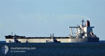
CAPE SAPPHIRE
Cargo
Current Trip
| Time Travelled | 7 days |
|---|---|
| Remaining Time | --- |
| Distance Travelled | 875.05 nm |
| Remaining Distance | --- |
| AVG Speed | 11.4 Knots |
| MAX Speed | 15.6 Knots |
| AVG Wind | 7.9 knots |
| MAX Wind | 26.5 knots |
| MIN Temp | 14.5°C / 58.1°F |
| MAX Temp | 20.6°C / 69.08°F |
| Dybgang | 11.4 m |
| Position Modtaget | 19 h, 55 m siden |
Current Position
| Longitude | 128.33341° |
|---|---|
| Latitude | 33.01581° |
| Status | Under way using engine |
| Fart | 13.8 Knots |
| Kurs | 218.9° |
| Område | Japan Sea |
| Station | T-AIS |
| Position Modtaget | 19 h, 55 m siden |
Info
Information
The current position of CAPE SAPPHIRE is in Japan Sea with coordinates 33.01581° / 128.33341° as reported on 2024-04-27 11:39 by AIS to our vessel tracker app. The vessel's current speed is 13.8 Knots and is heading at the port of NEWCASTLE. The estimated time of arrival as calculated by MyShipTracking vessel tracking app is 2024-05-10 07:00 LT
The vessel CAPE SAPPHIRE (IMO: 9832731, MMSI: 431933000) is a Cargo It's sailing under the flag of [JP] Japan.
In this page you can find informations about the vessels current position, last detected port calls, and current voyage information. If the vessels is not in coverage by AIS you will find the latest position.
The current position of CAPE SAPPHIRE is detected by our AIS receivers and we are not responsible for the reliability of the data. The last position was recorded while the vessel was in Coverage by the Ais receivers of our vessel tracking app.
The current draught of CAPE SAPPHIRE as reported by AIS is 11.4 meters
Weather
| Temperature | 24.5°C / 76.1°F |
|---|---|
| Wind Speed | 11 knots |
| Direction | 142° SE |
| Pressure | 1010.9 hPa |
| Humidity | 86 % |
| Cloud Coverage | 100 % |
Featured Company
Most Visited Ports (Last year)
| Port | Arrivals | |
|---|---|---|
| 6 | ||
| 3 | ||
| 3 | ||
| 3 | ||
| 2 | ||
| 2 |
Last Trips
| Origin | Departure | Destination | Arrival | Distance | |
|---|---|---|---|---|---|
| 2024-03-31 00:26 | 2024-04-16 22:07 | 3693.50 nm | |||
| 2024-02-20 07:44 | 2024-03-28 01:02 | 4007.20 nm | |||
| 2024-02-17 17:50 | 2024-02-17 18:59 | 4.60 nm | |||
| 2024-02-04 01:39 | 2024-02-17 17:59 | 3818.23 nm |
Events
| Tid | Hændelsen | Detaljer | Position / Dest | Info |
|---|---|---|---|---|
| 2024-04-27 11:43 | Status er ændret | Default Under way using engine |
33.00197 / 128.32120
AU NTL
|
Fart: 13.8 kn Kurs: 218.9° |
| 2024-04-27 11:39 | Status er ændret | Under way using engine Default |
33.01581 / 128.33341
AU NTL
|
Fart: 13.8 kn Kurs: 218° |
| 2024-04-27 11:39 | Udenfor Dækning |
33.01581 / 128.33341
Japan Sea
AU NTL
|
Fart: 13.8 kn Kurs: 218.9° |
|
| 2024-04-27 11:32 | Status er ændret | Default Under way using engine |
33.03531 / 128.35196
AU NTL
|
Fart: 13.9 kn Kurs: 222.6° |
| 2024-04-27 10:37 | Status er ændret | Under way using engine Default |
33.19372 / 128.52375
AU NTL
|
Fart: 14.2 kn Kurs: 224° |
| 2024-04-27 10:08 | Status er ændret | Default Under way using engine |
33.27578 / 128.61610
AU NTL
|
Fart: 14 kn Kurs: 223.1° |
| 2024-04-27 09:53 | Status er ændret | Under way using engine Default |
33.31873 / 128.66389
AU NTL
|
Fart: 13.9 kn Kurs: 223° |
| 2024-04-27 09:20 | Status er ændret | Default Under way using engine |
33.41340 / 128.76781
AU NTL
|
Fart: 14.1 kn Kurs: 224.9° |
| 2024-04-27 09:04 | Status er ændret | Under way using engine Default |
33.45995 / 128.82263
AU NTL
|
Fart: 14 kn Kurs: 227° |
| 2024-04-27 09:00 | Status er ændret | Default Under way using engine |
33.46844 / 128.83354
AU NTL
|
Fart: 13.9 kn Kurs: 226.2° |