
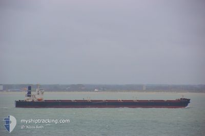
CAPE ISLAND
Bulk Carrier
Current Trip
| Time Travelled | 8 days |
|---|---|
| Remaining Time | --- |
| Distance Travelled | 1789.34 nm |
| Remaining Distance | --- |
| AVG Speed | 10.1 Knots |
| MAX Speed | 13.9 Knots |
| AVG Wind | 5.2 knots |
| MAX Wind | 19.7 knots |
| MIN Temp | 24.6°C / 76.28°F |
| MAX Temp | 30.8°C / 87.44°F |
| Dybgang | 11 m |
| Position Modtaget | 2 d siden |
Current Position
| Longitude | 103.31382° |
|---|---|
| Latitude | 1.31545° |
| Status | Under way using engine |
| Fart | 13 Knots |
| Kurs | 305° |
| Område | Malacca Strait |
| Station | T-AIS |
| Position Modtaget | 2 d siden |
Info
Information
The current position of CAPE ISLAND is in Malacca Strait with coordinates 1.31545° / 103.31382° as reported on 2024-05-25 10:28 by AIS to our vessel tracker app. The vessel's current speed is 13 Knots and is heading at the port of JARDIM CAMBURI. The estimated time of arrival as calculated by MyShipTracking vessel tracking app is 2024-06-25 07:00 LT
The vessel CAPE ISLAND (IMO: 9277711, MMSI: 212054000) is a Bulk Carrier that was built in 2004 ( 20 år gamle ). It's sailing under the flag of [CY] Cyprus.
In this page you can find informations about the vessels current position, last detected port calls, and current voyage information. If the vessels is not in coverage by AIS you will find the latest position.
The current position of CAPE ISLAND is detected by our AIS receivers and we are not responsible for the reliability of the data. The last position was recorded while the vessel was in Coverage by the Ais receivers of our vessel tracking app.
The current draught of CAPE ISLAND as reported by AIS is 11 meters
Weather
| Temperature | 31°C / 87.8°F |
|---|---|
| Wind Speed | 4 knots |
| Direction | 103° ESE |
| Pressure | 1008.7 hPa |
| Humidity | 67.9 % |
| Cloud Coverage | 60 % |
Featured Company
Events
| Tid | Hændelsen | Detaljer | Position / Dest | Info |
|---|---|---|---|---|
| 2024-05-25 10:33 | Status er ændret | Default Under way using engine |
1.32535 / 103.30005
BR TUB
|
Fart: 13 kn Kurs: 305° |
| 2024-05-25 10:28 | Status er ændret | Under way using engine Default |
1.31545 / 103.31382
BR TUB
|
Fart: 13 kn Kurs: 305° |
| 2024-05-25 10:28 | Udenfor Dækning |
1.31545 / 103.31382
Malacca Strait
|
Fart: 13 kn Kurs: 305° |
|
| 2024-05-25 09:56 | Status er ændret | Default Under way using engine |
1.24830 / 103.40505
BR TUB
|
Fart: 12.4 kn Kurs: 280° |
| 2024-05-25 09:37 | Fundet i havområde | Malaysian part of the Malacca Strait |
1.23100 / 103.46770
Malacca Strait
|
Fart: 12.6 kn Kurs: 283° |
| 2024-05-25 09:01 | Ændre havområde | Malaysian part of the Singapore Strait Indonesian part of the Singapore Strait |
1.20212 / 103.58733
Singapore Strait
|
Fart: 12.3 kn Kurs: 285° |
| 2024-05-25 08:20 | Ændre havområde | Indonesian part of the Singapore Strait Singaporean part of the Singapore Strait |
1.14752 / 103.71363
Singapore Strait
|
Fart: 11.5 kn Kurs: 298° |
| 2024-05-25 07:54 | Status er ændret | Under way using engine At anchor |
1.17120 / 103.78943
BR TUB
|
Fart: 13 kn Kurs: 246° |
| 2024-05-25 06:49 | Ændre havområde | Singaporean part of the Singapore Strait Indonesian part of the Singapore Strait |
1.25278 / 103.99223
Singapore Strait
|
Fart: 11.2 kn Kurs: 255° |
| 2024-05-25 06:37 | Ændre havområde | Indonesian part of the Singapore Strait Singaporean part of the Singapore Strait |
1.26197 / 104.02048
Singapore Strait
|
Fart: 6 kn Kurs: 227° |