
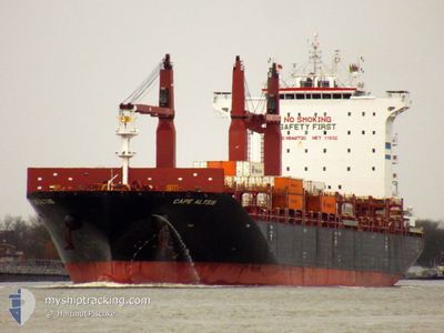
CAPE ALTIUS
Cargo
Current Trip
| Time Travelled | 3 days |
|---|---|
| Remaining Time | --- |
| Distance Travelled | 742.98 nm |
| Remaining Distance | --- |
| AVG Speed | 10.3 Knots |
| MAX Speed | 13.3 Knots |
| AVG Wind | 9.1 knots |
| MAX Wind | 21 knots |
| MIN Temp | 7.1°C / 44.78°F |
| MAX Temp | 15°C / 59°F |
| Dybgang | 8.9 m |
| Position Modtaget | Nu |
Current Position
| Longitude | -75.34838° |
|---|---|
| Latitude | 36.84628° |
| Status | Under way using engine |
| Fart | 0.4 Knots |
| Kurs | 208° |
| Område | North Atlantic Ocean |
| Station | T-AIS |
| Position Modtaget | Nu |
Info
Information
The current position of CAPE ALTIUS is in North Atlantic Ocean with coordinates 36.84628° / -75.34838° as reported on 2024-05-22 05:02 by AIS to our vessel tracker app. The vessel's current speed is 0.4 Knots
The vessel CAPE ALTIUS (IMO: 9848730, MMSI: 209888000) is a Cargo It's sailing under the flag of [CY] Cyprus.
In this page you can find informations about the vessels current position, last detected port calls, and current voyage information. If the vessels is not in coverage by AIS you will find the latest position.
The current position of CAPE ALTIUS is detected by our AIS receivers and we are not responsible for the reliability of the data. The last position was recorded while the vessel was in Coverage by the Ais receivers of our vessel tracking app.
The current draught of CAPE ALTIUS as reported by AIS is 8.9 meters
Weather
| Temperature | 14.5°C / 58.1°F |
|---|---|
| Wind Speed | 8 knots |
| Direction | 157° SSE |
| Pressure | 1017.2 hPa |
| Humidity | 92.9 % |
| Cloud Coverage | 5 % |
Featured Company
Last Port Calls
| Port | Arrival | Departure | Time In Port |
|---|---|---|---|
| 2024-05-18 09:45 | 2024-05-18 23:13 | 13 h | |
| 2024-05-08 02:38 | 2024-05-08 21:05 | 18 h | |
| 2024-05-06 20:35 | 2024-05-07 17:32 | 20 h | |
| 2024-05-04 19:15 | 2024-05-05 12:58 | 17 h | |
| 2024-05-01 21:27 | 2024-05-02 12:19 | 14 h | |
| 2024-04-30 03:37 | 2024-05-01 05:56 | 1 d | |
| 2024-04-18 22:30 | 2024-04-19 17:09 | 18 h | |
| 2024-04-12 14:19 | 2024-04-12 23:03 | 8 h | |
| 2024-04-08 13:47 | 2024-04-09 05:27 | 15 h | |
| 2024-04-04 08:17 | 2024-04-05 04:13 | 19 h |
Most Visited Ports (Last year)
| Port | Arrivals | |
|---|---|---|
| 11 | ||
| 6 | ||
| 6 | ||
| 6 | ||
| 6 | ||
| 6 |
Last Trips
| Origin | Departure | Destination | Arrival | Distance | |
|---|---|---|---|---|---|
| 2024-05-08 23:05 | 2024-05-18 06:45 | 3145.38 nm | |||
| 2024-05-07 19:32 | 2024-05-08 04:38 | 107.37 nm | |||
| 2024-05-05 14:58 | 2024-05-06 22:35 | 332.68 nm | |||
| 2024-05-02 13:19 | 2024-05-04 21:15 | 428.05 nm | |||
| 2024-05-01 07:56 | 2024-05-01 22:27 | 156.01 nm | |||
| 2024-04-19 13:09 | 2024-04-30 05:37 | 4048.82 nm | |||
| 2024-04-12 18:03 | 2024-04-18 18:30 | 1506.44 nm | |||
| 2024-04-09 00:27 | 2024-04-12 09:19 | 449.76 nm | |||
| 2024-04-05 00:13 | 2024-04-08 08:47 | 1283.27 nm | |||
| 2024-04-02 03:46 | 2024-04-04 04:17 | 755.94 nm |
Events
| Tid | Hændelsen | Detaljer | Position / Dest | Info |
|---|---|---|---|---|
| 2024-05-21 22:40 | STOP Sejllads |
36.84737 / -75.29853
USORF
|
Fart: 0.3 kn Kurs: 143° |
|
| 2024-05-21 22:05 | Status er ændret | Under way using engine Default |
36.85294 / -75.29171
USORF
|
Fart: 1 kn Kurs: -1° |
| 2024-05-21 21:54 | Status er ændret | Default Under way using engine |
36.85604 / -75.28819
USORF
|
Fart: 1.6 kn Kurs: 213° |
| 2024-05-21 14:33 | Dybgangen er ændret | 8.9 10.4 |
37.01194 / -75.21341
USORF
|
Fart: 11.2 kn Kurs: 244° |
| 2024-05-21 14:33 | Destination er ændret | USORF CASJB |
37.01194 / -75.21341
USORF
|
Fart: 11.2 kn Kurs: 244° |
| 2024-05-21 14:33 | ETA er ændret | 2024/05/21 18:00 2024/05/18 09:00 |
37.01194 / -75.21341
USORF
|
Fart: 11.2 kn Kurs: 244° |
| 2024-05-21 14:20 | Ændre havområde | United States part of the North Atlantic Ocean Irish part of the Celtic Sea |
37.03013 / -75.16588
North Atlantic Ocean
|
Fart: 11.1 kn Kurs: 244.5° |
| 2024-05-21 14:17 | Status er ændret | Under way using engine Default |
37.03317 / -75.15764
CASJB
|
Fart: 10.9 kn Kurs: 236° |
| 2024-05-21 14:02 | Indenfor Dækning |
37.03013 / -75.16588
North Atlantic Ocean
|
Fart: 11.1 kn Kurs: 244.5° |
|
| 2024-05-18 23:13 | Afsejlet fra sidste havn |
|
45.17333 / -66.06333
CASJB
|
Fart: 4.6 kn Kurs: 147° |