
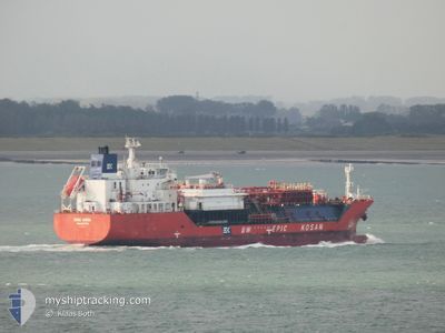
BWEK ARUBA
Lpg Tanker
Current Trip
| Time Travelled | 14 days |
|---|---|
| Remaining Time | --- |
| Distance Travelled | 3745.47 nm |
| Remaining Distance | --- |
| AVG Speed | 14.1 Knots |
| MAX Speed | 23.8 Knots |
| AVG Wind | 7.9 knots |
| MAX Wind | 19.5 knots |
| MIN Temp | 24.7°C / 76.46°F |
| MAX Temp | 43.9°C / 111.02°F |
| Dybgang | 7.3 m |
| Position Modtaget | 6 h, 36 m siden |
Current Position
| Longitude | 48.33350° |
|---|---|
| Latitude | 29.88288° |
| Status | Under way using engine |
| Fart | 15.7 Knots |
| Kurs | 134° |
| Område | Persian Gulf |
| Station | T-AIS |
| Position Modtaget | 6 h, 36 m siden |
Info
Information
The current position of BWEK ARUBA is in Persian Gulf with coordinates 29.88288° / 48.33350° as reported on 2024-05-11 13:36 by AIS to our vessel tracker app. The vessel's current speed is 15.7 Knots and is heading at the port of FUJAIRAH. The estimated time of arrival as calculated by MyShipTracking vessel tracking app is 2024-05-13 06:00 LT
The vessel BWEK ARUBA (IMO: 9383338, MMSI: 256694000) is a Lpg Tanker that was built in 2008 ( 16 år gamle ). It's sailing under the flag of [MT] Malta.
In this page you can find informations about the vessels current position, last detected port calls, and current voyage information. If the vessels is not in coverage by AIS you will find the latest position.
The current position of BWEK ARUBA is detected by our AIS receivers and we are not responsible for the reliability of the data. The last position was recorded while the vessel was in Coverage by the Ais receivers of our vessel tracking app.
The current draught of BWEK ARUBA as reported by AIS is 7.3 meters
Weather
| Temperature | 27.5°C / 81.5°F |
|---|---|
| Wind Speed | 8 knots |
| Direction | 248° WSW |
| Pressure | 1009.2 hPa |
| Humidity | 56.9 % |
| Cloud Coverage | 82 % |
Featured Company
Last Trips
| Origin | Departure | Destination | Arrival | Distance | |
|---|---|---|---|---|---|
| 2024-02-20 00:05 | 2024-04-26 13:19 | 11556.84 nm |
Events
| Tid | Hændelsen | Detaljer | Position / Dest | Info |
|---|---|---|---|---|
| 2024-05-11 13:39 | Status er ændret | Default Under way using engine |
29.87633 / 48.34615
AE FJR
|
Fart: 15.7 kn Kurs: 134° |
| 2024-05-11 13:36 | Udenfor Dækning |
29.88288 / 48.33350
Persian Gulf
AE FJR
|
Fart: 15.7 kn Kurs: 134° |
|
| 2024-05-11 13:04 | Ændre havområde | Kuwaiti part of the Persian Gulf Iraqi part of the Persian Gulf |
29.98358 / 48.22797
Persian Gulf
AE FJR
|
Fart: 14.7 kn Kurs: 136° |
| 2024-05-11 12:55 | Ændre havområde | Iraqi part of the Persian Gulf Kuwaiti part of the Persian Gulf |
30.00663 / 48.19588
Persian Gulf
AE FJR
|
Fart: 14.2 kn Kurs: 118° |
| 2024-05-11 12:49 | Ændre havområde | Kuwaiti part of the Persian Gulf Iraqi part of the Persian Gulf |
30.01910 / 48.17172
Persian Gulf
AE FJR
|
Fart: 14 kn Kurs: 120° |
| 2024-05-11 12:32 | Status er ændret | Under way using engine Default |
30.03338 / 48.09620
AE FJR
|
Fart: 13.8 kn Kurs: 77° |
| 2024-05-11 12:28 | Status er ændret | Default Under way using engine |
30.03228 / 48.08160
AE FJR
|
Fart: 14 kn Kurs: 47° |
| 2024-05-11 12:21 | Ændre havområde | Iraqi part of the Persian Gulf Kuwaiti part of the Persian Gulf |
30.02205 / 48.05038
Persian Gulf
AE FJR
|
Fart: 14 kn Kurs: 47° |
| 2024-05-11 12:13 | Ændre havområde | Kuwaiti part of the Persian Gulf Iraqi part of the Persian Gulf |
30.00285 / 48.02655
Persian Gulf
AE FJR
|
Fart: 13 kn Kurs: 46° |
| 2024-05-11 12:01 | Dybgangen er ændret | 7.3 5.3 |
29.99950 / 47.97942
AE FJR
|
Fart: 12.7 kn Kurs: 101° |