
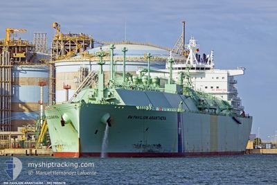
BW PAVILIONARANTHERA
Tanker C
Current Trip
| Time Travelled | --- |
|---|---|
| Remaining Time | 19 days |
| Distance Travelled | 10588.95 nm |
| Remaining Distance | 6463.69 nm |
| AVG Speed | 14.5 Knots |
| MAX Speed | 18.6 Knots |
| AVG Wind | 12.8 knots |
| MAX Wind | 29.5 knots |
| MIN Temp | 18.2°C / 64.76°F |
| MAX Temp | 29.1°C / 84.38°F |
| Dybgang | 11.4 m |
| Position Modtaget | 7 d siden |
Current Position
| Longitude | --- |
|---|---|
| Latitude | --- |
| Status | Under way using engine |
| Fart | 14.3 Knots |
| Kurs | 130.4° |
| Område | South Atlantic Ocean |
| Station | T-AIS |
| Position Modtaget | 7 d siden |
Info
Information
The current position of BW PAVILIONARANTHERA is in South Atlantic Ocean with coordinates -5.30980° / -29.70853° as reported on 2024-11-24 09:09 by AIS to our vessel tracker app. The vessel's current speed is 14.3 Knots and is heading at the port of SINGAPORE. The estimated time of arrival as calculated by MyShipTracking vessel tracking app is 2024-12-20 11:40 LT
The vessel BW PAVILIONARANTHERA (IMO: 9850678, MMSI: 563104600) is a Tanker C It's sailing under the flag of [SG] Singapore.
In this page you can find informations about the vessels current position, last detected port calls, and current voyage information. If the vessels is not in coverage by AIS you will find the latest position.
The current position of BW PAVILIONARANTHERA is detected by our AIS receivers and we are not responsible for the reliability of the data. The last position was recorded while the vessel was in Coverage by the Ais receivers of our vessel tracking app.
The current draught of BW PAVILIONARANTHERA as reported by AIS is 11.4 meters
Weather
| Temperature | 18.6°C / 65.48°F |
|---|---|
| Wind Speed | 9 knots |
| Direction | 93° E |
| Pressure | 1023.9 hPa |
| Humidity | 87.1 % |
| Cloud Coverage | --- |
Featured Company
Last Port Calls
Last Trips
| Origin | Departure | Destination | Arrival | Distance |
|---|
Events
| Tid | Hændelsen | Detaljer | Position / Dest | Info |
|---|---|---|---|---|
| 2024-11-24 09:15 | Status er ændret | Default Under way using engine |
-5.32553 / -29.69058
SGSIN
|
Fart: 14.3 kn Kurs: 130.4° |
| 2024-11-24 09:09 | Ændre havområde | Brazilian part of the South Atlantic Ocean Saint Lucia part of the Caribbean Sea |
-5.30980 / -29.70853
South Atlantic Ocean
|
Fart: 14.3 kn Kurs: 130.4° |
| 2024-11-24 09:09 | Status er ændret | Under way using engine Default |
-5.30980 / -29.70853
SGSIN
|
Fart: 14.4 kn Kurs: 133° |
| 2024-11-24 09:09 | Udenfor Dækning |
-5.30980 / -29.70853
South Atlantic Ocean
|
Fart: 14.3 kn Kurs: 130.4° |
|
| 2024-11-24 08:53 | Indenfor Dækning |
-5.30980 / -29.70853
South Atlantic Ocean
|
Fart: 14.3 kn Kurs: 130.4° |