
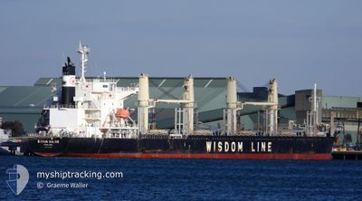
BUNUN KALON
Cargo
Current Trip
| Time Travelled | 14 days |
|---|---|
| Remaining Time | --- |
| Distance Travelled | 3355.81 nm |
| Remaining Distance | --- |
| AVG Speed | 12 Knots |
| MAX Speed | 14.6 Knots |
| AVG Wind | 8.8 knots |
| MAX Wind | 24.3 knots |
| MIN Temp | 17.5°C / 63.5°F |
| MAX Temp | 28.9°C / 84.02°F |
| Dybgang | 10.4 m |
| Position Modtaget | 6 d siden |
Current Position
| Longitude | --- |
|---|---|
| Latitude | --- |
| Status | Under way using engine |
| Fart | 11.7 Knots |
| Kurs | 96.4° |
| Område | Laccadive Sea |
| Station | T-AIS |
| Position Modtaget | 6 d siden |
Info
Information
The current position of BUNUN KALON is in Laccadive Sea with coordinates 5.70800° / 80.32620° as reported on 2025-03-11 06:53 by AIS to our vessel tracker app. The vessel's current speed is 11.7 Knots and is heading at the port of MONGLA. The estimated time of arrival as calculated by MyShipTracking vessel tracking app is 2025-03-15 03:00 LT
The vessel BUNUN KALON (IMO: 9768033, MMSI: 371576000) is a Cargo It's sailing under the flag of [PA] Panama.
In this page you can find informations about the vessels current position, last detected port calls, and current voyage information. If the vessels is not in coverage by AIS you will find the latest position.
The current position of BUNUN KALON is detected by our AIS receivers and we are not responsible for the reliability of the data. The last position was recorded while the vessel was in Coverage by the Ais receivers of our vessel tracking app.
The current draught of BUNUN KALON as reported by AIS is 10.4 meters
Weather
| Temperature | 27.3°C / 81.14°F |
|---|---|
| Wind Speed | 7 knots |
| Direction | 222° SW |
| Pressure | 1012.3 hPa |
| Humidity | 77.1 % |
| Cloud Coverage | 19 % |
Featured Company
Last Port Calls
| Port | Arrival | Departure | Time In Port |
|---|---|---|---|
| 2025-02-28 07:00 | 2025-03-03 15:30 | 3 d | |
| 2025-02-07 09:56 | 2025-02-13 18:17 | 6 d | |
| 2025-01-04 14:26 | 2025-01-09 16:10 | 5 d |
Last Trips
| Origin | Departure | Destination | Arrival | Distance | |
|---|---|---|---|---|---|
| 2025-02-13 18:17 | 2025-02-28 07:00 | 1315.99 nm | |||
| 2025-01-09 16:10 | 2025-02-07 09:56 | 8305.75 nm | |||
| 2024-12-16 06:29 | 2025-01-04 14:26 | 4696.78 nm |
Events
| Tid | Hændelsen | Detaljer | Position / Dest | Info |
|---|---|---|---|---|
| 2025-03-18 03:12 | START Sejllads |
21.46530 / 89.53311
BD MGL
|
Fart: 11.4 kn Kurs: 310° |
|
| 2025-03-15 00:36 | STOP Sejllads |
21.46900 / 89.56963
BD MGL
|
Fart: 0.1 kn Kurs: 171° |
|
| 2025-03-11 07:01 | Status er ændret | Default Under way using engine |
5.70584 / 80.35258
BD MGL
|
Fart: 11.7 kn Kurs: 96.4° |
| 2025-03-11 06:53 | Udenfor Dækning |
5.70800 / 80.32620
Laccadive Sea
BD MGL
|
Fart: 11.7 kn Kurs: 96.4° |
|
| 2025-03-11 06:27 | Status er ændret | Under way using engine Default |
5.71596 / 80.24208
BD MGL
|
Fart: 11.9 kn Kurs: 95° |
| 2025-03-11 06:19 | Status er ændret | Default Under way using engine |
5.71828 / 80.21539
BD MGL
|
Fart: 12 kn Kurs: 95.1° |
| 2025-03-11 06:14 | Ændre havområde | Sri Lankan part of the Laccadive Sea Indian part of the Laccadive Sea |
5.71988 / 80.19691
Laccadive Sea
BD MGL
|
Fart: 11.9 kn Kurs: 94.5° |
| 2025-03-11 06:13 | Status er ændret | Under way using engine Default |
5.72011 / 80.19422
BD MGL
|
Fart: 12.2 kn Kurs: 94° |
| 2025-03-11 06:13 | Indenfor Dækning |
5.71988 / 80.19691
Laccadive Sea
BD MGL
|
Fart: 11.9 kn Kurs: 94.5° |
|
| 2025-03-10 14:39 | Udenfor Dækning |
7.12169 / 77.41232
Laccadive Sea
BD MGL
|
Fart: 11.7 kn Kurs: 136.6° |