
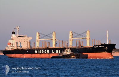
BUNUN JUSTICE
Cargo
Current Trip
PANJANG
| Time Travelled | 1 day |
|---|---|
| Remaining Time | --- |
| Distance Travelled | 0.48 nm |
| Remaining Distance | --- |
| AVG Speed | --- |
| MAX Speed | --- |
| AVG Wind | 2.2 knots |
| MAX Wind | 3 knots |
| MIN Temp | 23.2°C / 73.76°F |
| MAX Temp | 26.6°C / 79.88°F |
| Dybgang | 6.2 m |
| Position Modtaget | 7 d siden |
Current Position
| Longitude | --- |
|---|---|
| Latitude | --- |
| Status | Under way using engine |
| Fart | 14.3 Knots |
| Kurs | 302.1° |
| Område | Java Sea |
| Station | T-AIS |
| Position Modtaget | 7 d siden |
Info
Information
The current position of BUNUN JUSTICE is in Java Sea with coordinates -5.93072° / 105.69245° as reported on 2026-01-01 04:55 by AIS to our vessel tracker app. The vessel's current speed is 14.3 Knots
The vessel BUNUN JUSTICE (IMO: 9732448, MMSI: 352834000) is a Cargo It's sailing under the flag of [PA] Panama.
In this page you can find informations about the vessels current position, last detected port calls, and current voyage information. If the vessels is not in coverage by AIS you will find the latest position.
The current position of BUNUN JUSTICE is detected by our AIS receivers and we are not responsible for the reliability of the data. The last position was recorded while the vessel was in Coverage by the Ais receivers of our vessel tracking app.
The current draught of BUNUN JUSTICE as reported by AIS is 6.2 meters
Weather
| Temperature | 23.7°C / 74.66°F |
|---|---|
| Wind Speed | 2 knots |
| Direction | 318° NW |
| Pressure | 1012.2 hPa |
| Humidity | 91.5 % |
| Cloud Coverage | 100 % |
Featured Company
Last Port Calls
| Port | Arrival | Departure | Time In Port |
|---|---|---|---|
| 2026-01-07 06:52 | 2026-01-07 07:03 | 11 m | |
| 2025-11-22 19:45 | 2025-11-26 06:52 | 3 d | |
| 2025-11-07 01:01 | 2025-11-11 19:46 | 4 d |
Most Visited Ports (Last year)
| Port | Arrivals | |
|---|---|---|
| 3 | ||
| 2 | ||
| 1 | ||
| 1 | ||
| 1 | ||
| 1 |
Last Trips
| Origin | Departure | Destination | Arrival | Distance | |
|---|---|---|---|---|---|
| 2025-11-26 06:52 | 2026-01-07 06:52 | 6086.83 nm | |||
| 2025-11-11 19:46 | 2025-11-22 19:45 | 1172.32 nm | |||
| 2025-09-18 16:51 | 2025-11-07 01:01 | 8005.57 nm |
Events
| Tid | Hændelsen | Detaljer | Position / Dest | Info |
|---|---|---|---|---|
| 2026-01-07 00:23 | STOP Sejllads | 2.84 nm, East of PANJANG |
-5.46939 / 105.31947
PANJANG
|
Fart: 0.3 kn Kurs: 275° |
| 2026-01-07 00:03 | Afsejlet fra sidste havn |
|
-5.46671 / 105.31486
PANJANG
|
Fart: 4.8 kn Kurs: 85° |
| 2026-01-06 23:52 | Skibe i havn |
|
-5.46592 / 105.30344
[ID] PANJANG
|
Fart: 4.7 kn Kurs: 36° |
| 2026-01-06 23:28 | START Sejllads | 1.89 nm, South East of PANJANG |
-5.49019 / 105.29057
PANJANG
|
Fart: 4.9 kn Kurs: 23° |
| 2026-01-01 08:22 | STOP Sejllads | 1.93 nm, South East of PANJANG |
-5.49416 / 105.28488
PANJANG
|
Fart: 0.1 kn Kurs: 95° |
| 2026-01-01 05:03 | Status er ændret | Default Under way using engine |
-5.91166 / 105.66735
PANJANG
|
Fart: 14.3 kn Kurs: 302.1° |
| 2026-01-01 04:55 | Udenfor Dækning |
-5.93072 / 105.69245
Java Sea
PANJANG
|
Fart: 14.3 kn Kurs: 302.1° |
|
| 2026-01-01 02:40 | Ændre havområde | Indonesian part of the Java Sea Malaysian part of the South China Sea |
-5.55770 / 106.01538
Java Sea
PANJANG
|
Fart: 13.7 kn Kurs: 213.8° |
| 2026-01-01 02:28 | Status er ændret | Under way using engine Default |
-5.52179 / 106.03879
PANJANG
|
Fart: 13.6 kn Kurs: 211° |
| 2026-01-01 02:15 | Indenfor Dækning |
-5.52604 / 106.03616
South China Sea
PANJANG
|
Fart: 13.6 kn Kurs: 211° |