

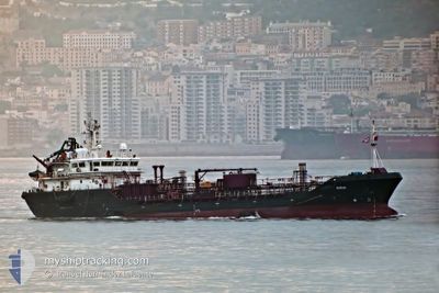
BUNKER BAY
Oil/Chemical Tanker

Current Trip
| Trip Time | 1 day |
|---|---|
| Trip Distance | 164.95 nm |
| AVG Speed | 5.3 Knots |
| MAX Speed | 8.5 Knots |
| Dybgang | 4.9 m |
| AVG Wind | 16.9 knots |
| MAX Wind | 25.7 knots |
| MIN Temp | 11°C / 51.8°F |
| MAX Temp | 16.3°C / 61.34°F |
| Position Modtaget | 9 d siden |
Current Position
| Longitude | --- |
|---|---|
| Latitude | --- |
| Status | Under way using engine |
| Fart | 7.4 Knots |
| Kurs | 328.4° |
| Område | North Atlantic Ocean |
| Station | T-AIS |
| Position Modtaget | 9 d siden |
Information
The current position of BUNKER BAY is in North Atlantic Ocean with coordinates 36.81970° / -6.34916° as reported on 2025-03-19 02:59 by AIS to our vessel tracker app. The vessel's current speed is 7.4 Knots and is currently inside the port of SEVILLA.
The vessel BUNKER BAY (IMO: 9377092, MMSI: 224448000) is a Oil/Chemical Tanker that was built in 2006 ( 19 år gamle ). It's sailing under the flag of [ES] Spain.
In this page you can find informations about the vessels current position, last detected port calls, and current voyage information. If the vessels is not in coverage by AIS you will find the latest position.
The current position of BUNKER BAY is detected by our AIS receivers and we are not responsible for the reliability of the data. The last position was recorded while the vessel was in Coverage by the Ais receivers of our vessel tracking app.
The current draught of BUNKER BAY as reported by AIS is 4.9 meters
Weather
| Temperature | 19.1°C / 66.38°F |
|---|---|
| Wind Speed | 5 knots |
| Direction | 166° SSE |
| Pressure | 1013.9 hPa |
| Humidity | 61.4 % |
| Cloud Coverage | 93 % |


Featured Company
Last Port Calls
| Port | Arrival | Departure | Time In Port |
|---|---|---|---|
| 2025-03-19 11:10 | |||
| 2025-03-16 23:41 | 2025-03-18 04:42 | 1 d | |
| 2025-03-14 23:24 | 2025-03-16 12:52 | 1 d | |
| 2025-03-14 02:47 | 2025-03-14 16:15 | 13 h | |
| 2025-03-12 20:40 | 2025-03-14 02:22 | 1 d | |
| 2025-03-12 09:36 | 2025-03-12 20:37 | 11 h | |
| 2025-03-12 09:05 | 2025-03-12 09:10 | 4 m | |
| 2025-03-12 00:33 | 2025-03-12 08:51 | 8 h | |
| 2025-03-10 08:56 | 2025-03-11 17:34 | 1 d | |
| 2025-03-08 19:50 | 2025-03-09 22:23 | 1 d |
Last Trips
| Origin | Departure | Destination | Arrival | Distance | |
|---|---|---|---|---|---|
| 2025-03-18 04:42 | 2025-03-19 11:10 | 164.95 nm | |||
| 2025-03-16 12:52 | 2025-03-16 23:41 | 8.99 nm | |||
| 2025-03-14 16:15 | 2025-03-14 23:24 | 4.52 nm | |||
| 2025-03-14 02:22 | 2025-03-14 02:47 | 0.87 nm | |||
| 2025-03-12 20:37 | 2025-03-12 20:40 | 0.37 nm | |||
| 2025-03-12 09:10 | 2025-03-12 09:36 | 3.87 nm | |||
| 2025-03-12 08:51 | 2025-03-12 09:05 | 1.57 nm | |||
| 2025-03-11 17:34 | 2025-03-12 00:33 | 4.26 nm | |||
| 2025-03-09 22:23 | 2025-03-10 08:56 | 5.74 nm | |||
| 2025-03-08 08:48 | 2025-03-08 19:50 | 6.60 nm |
Events
| Tid | Hændelsen | Detaljer | Position / Dest | Info |
|---|---|---|---|---|
| 2025-03-19 10:26 | STOP Sejllads |
37.31911 / -6.00603
[ES] SEVILLA
|
Fart: Kurs: 66° |
|
| 2025-03-19 10:10 | Skibe i havn |
|
37.31564 / -6.01460
[ES] SEVILLA
|
Fart: 3.7 kn Kurs: 40° |
| 2025-03-19 03:07 | Status er ændret | Default Under way using engine |
36.83364 / -6.35599
CHIPIONA
|
Fart: 7.4 kn Kurs: 328.4° |
| 2025-03-19 02:59 | Udenfor Dækning |
36.81970 / -6.34916
North Atlantic Ocean
CHIPIONA
|
Fart: 7.4 kn Kurs: 328.4° |
|
| 2025-03-19 02:21 | Status er ændret | Under way using engine Default |
36.77642 / -6.40577
CHIPIONA
|
Fart: 7.5 kn Kurs: 72° |
| 2025-03-19 02:18 | Status er ændret | Default Under way using engine |
36.77446 / -6.41308
CHIPIONA
|
Fart: 7.3 kn Kurs: 60.9° |
| 2025-03-19 02:10 | Ændre havområde | Spanish part of the North Atlantic Ocean Spanish part of the Strait of Gibraltar |
36.76808 / -6.43183
North Atlantic Ocean
CHIPIONA
|
Fart: 7.7 kn Kurs: 56.9° |
| 2025-03-19 02:09 | Status er ændret | Under way using engine Default |
36.76772 / -6.43256
CHIPIONA
|
Fart: 5.7 kn Kurs: 67° |
| 2025-03-19 02:05 | Indenfor Dækning |
36.76808 / -6.43183
North Atlantic Ocean
CHIPIONA
|
Fart: 7.7 kn Kurs: 56.9° |