
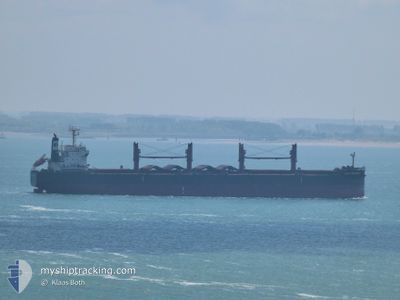
BULK FRIENDSHIP
Cargo
Current Trip
| Time Travelled | 9 days |
|---|---|
| Remaining Time | --- |
| Distance Travelled | 1800.90 nm |
| Remaining Distance | --- |
| AVG Speed | 9.3 Knots |
| MAX Speed | 9.3 Knots |
| AVG Wind | 12.2 knots |
| MAX Wind | 24 knots |
| MIN Temp | 27.3°C / 81.14°F |
| MAX Temp | 34.5°C / 94.1°F |
| Dybgang | 11.9 m |
| Position Modtaget | 5 d siden |
Current Position
| Longitude | 57.26861° |
|---|---|
| Latitude | 24.78798° |
| Status | Under way using engine |
| Fart | 10.9 Knots |
| Kurs | 121.3° |
| Område | Gulf of Oman |
| Station | T-AIS |
| Position Modtaget | 5 d siden |
Info
Information
The current position of BULK FRIENDSHIP is in Gulf of Oman with coordinates 24.78798° / 57.26861° as reported on 2024-05-26 15:55 by AIS to our vessel tracker app. The vessel's current speed is 10.9 Knots and is heading at the port of TAKORADI. The estimated time of arrival as calculated by MyShipTracking vessel tracking app is 2024-06-22 12:00 LT
The vessel BULK FRIENDSHIP (IMO: 9496977, MMSI: 353421000) is a Cargo It's sailing under the flag of [PA] Panama.
In this page you can find informations about the vessels current position, last detected port calls, and current voyage information. If the vessels is not in coverage by AIS you will find the latest position.
The current position of BULK FRIENDSHIP is detected by our AIS receivers and we are not responsible for the reliability of the data. The last position was recorded while the vessel was in Coverage by the Ais receivers of our vessel tracking app.
The current draught of BULK FRIENDSHIP as reported by AIS is 11.9 meters
Weather
| Temperature | 29.2°C / 84.56°F |
|---|---|
| Wind Speed | 15 knots |
| Direction | 269° W |
| Pressure | 1012.2 hPa |
| Humidity | 74.1 % |
| Cloud Coverage | 66 % |
Featured Company
Last Port Calls
| Port | Arrival | Departure | Time In Port |
|---|---|---|---|
| 2024-05-17 00:05 | 2024-05-22 21:08 | 5 d | |
| 2024-05-13 09:44 | 2024-05-15 06:32 | 1 d | |
| 2024-04-28 08:43 | 2024-05-03 19:22 | 5 d |
Most Visited Ports (Last year)
| Port | Arrivals | |
|---|---|---|
| 2 | ||
| 1 | ||
| 1 | ||
| 1 | ||
| 1 | ||
| 1 |
Last Trips
| Origin | Departure | Destination | Arrival | Distance | |
|---|---|---|---|---|---|
| 2024-05-15 06:32 | 2024-05-17 00:05 | 509.58 nm | |||
| 2024-05-03 19:22 | 2024-05-13 09:44 | 2650.64 nm | |||
| 2024-03-12 07:17 | 2024-04-28 08:43 | 7923.01 nm |
Events
| Tid | Hændelsen | Detaljer | Position / Dest | Info |
|---|---|---|---|---|
| 2024-05-26 16:01 | Status er ændret | Default Under way using engine |
24.77832 / 57.28580
GH TKD
|
Fart: 10.9 kn Kurs: 121.3° |
| 2024-05-26 15:55 | Udenfor Dækning |
24.78798 / 57.26861
Gulf of Oman
GH TKD
|
Fart: 10.9 kn Kurs: 121.3° |
|
| 2024-05-26 15:02 | START Sejllads |
24.87089 / 57.11553
GH TKD
|
Fart: 5.6 kn Kurs: 139.3° |
|
| 2024-05-26 15:01 | STOP Sejllads |
24.87180 / 57.11375
GH TKD
|
Fart: Kurs: 117° |
|
| 2024-05-26 13:26 | Ændre havområde | Omani part of the Gulf of Oman United Arab Emirates part of the Gulf of Oman |
25.04887 / 56.86258
Gulf of Oman
GH TKD
|
Fart: 9.2 kn Kurs: 125.4° |
| 2024-05-26 12:52 | START Sejllads |
25.10481 / 56.76871
GH TKD
|
Fart: 10.5 kn Kurs: 123.7° |
|
| 2024-05-26 12:51 | STOP Sejllads |
25.10577 / 56.76671
GH TKD
|
Fart: Kurs: 124° |
|
| 2024-05-26 10:45 | START Sejllads | 7.28 nm, East of FUJAIRAH |
25.18667 / 56.49136
GH TKD
|
Fart: 3.1 kn Kurs: 77° |
| 2024-05-26 10:29 | Dybgangen er ændret | 11.9 11.5 |
25.18675 / 56.48584
GH TKD
|
Fart: 0.2 kn Kurs: 118° |
| 2024-05-26 10:29 | ETA er ændret | 2024/06/22 12:00 2024/05/24 15:00 |
25.18675 / 56.48584
GH TKD
|
Fart: 0.2 kn Kurs: 118° |