
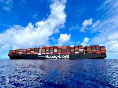
BRUSSELS EXPRESS
Cargo A
Current Trip
| Time Travelled | 25 days |
|---|---|
| Remaining Time | --- |
| Distance Travelled | 6140.82 nm |
| Remaining Distance | --- |
| AVG Speed | 11.5 Knots |
| MAX Speed | 20.8 Knots |
| AVG Wind | 9 knots |
| MAX Wind | 40 knots |
| MIN Temp | 10.2°C / 50.36°F |
| MAX Temp | 27.4°C / 81.32°F |
| Dybgang | 12 m |
| Position Modtaget | 2 d siden |
Current Position
| Longitude | --- |
|---|---|
| Latitude | --- |
| Status | Under way using engine |
| Fart | 19 Knots |
| Kurs | 168.3° |
| Område | North Atlantic Ocean |
| Station | T-AIS |
| Position Modtaget | 2 d siden |
Info
Information
The current position of BRUSSELS EXPRESS is in North Atlantic Ocean with coordinates 12.83997° / -18.01011° as reported on 2026-01-06 09:27 by AIS to our vessel tracker app. The vessel's current speed is 19 Knots and is heading at the port of COLOMBO. The estimated time of arrival as calculated by MyShipTracking vessel tracking app is 2026-01-25 00:00 LT
The vessel BRUSSELS EXPRESS (IMO: 9708784, MMSI: 211108000) is a Cargo A It's sailing under the flag of [DE] Germany.
In this page you can find informations about the vessels current position, last detected port calls, and current voyage information. If the vessels is not in coverage by AIS you will find the latest position.
The current position of BRUSSELS EXPRESS is detected by our AIS receivers and we are not responsible for the reliability of the data. The last position was recorded while the vessel was in Coverage by the Ais receivers of our vessel tracking app.
The current draught of BRUSSELS EXPRESS as reported by AIS is 12 meters
Weather
| Temperature | 25.7°C / 78.26°F |
|---|---|
| Wind Speed | 10 knots |
| Direction | 143° SE |
| Pressure | 1012 hPa |
| Humidity | 81.4 % |
| Cloud Coverage | 20 % |
Featured Company
Last Port Calls
| Port | Arrival | Departure | Time In Port |
|---|---|---|---|
| 2025-12-21 15:17 | 2025-12-23 11:22 | 1 d | |
| 2025-12-12 03:20 | 2025-12-14 11:11 | 2 d | |
| 2025-12-07 01:41 | 2025-12-09 09:42 | 2 d | |
| 2025-12-01 08:21 | 2025-12-02 11:36 | 1 d | |
| 2025-11-02 09:39 |
Most Visited Ports (Last year)
| Port | Arrivals | |
|---|---|---|
| 4 | ||
| 3 | ||
| 3 | ||
| 2 | ||
| 2 | ||
| 2 |
Last Trips
| Origin | Departure | Destination | Arrival | Distance | |
|---|---|---|---|---|---|
| 2025-12-14 11:11 | 2025-12-21 15:17 | 1367.83 nm | |||
| 2025-12-09 09:42 | 2025-12-12 03:20 | 140.66 nm | |||
| 2025-11-02 09:39 | 2025-12-07 01:41 | 13983.51 nm | |||
| 2025-11-02 09:39 | 2025-12-01 08:21 | 12674.94 nm |
Events
| Tid | Hændelsen | Detaljer | Position / Dest | Info |
|---|---|---|---|---|
| 2026-01-06 09:32 | Status er ændret | Default Under way using engine |
12.81013 / -18.00415
GIGIB > LKCMB
|
Fart: 19 kn Kurs: 168.3° |
| 2026-01-06 09:27 | Udenfor Dækning |
12.83997 / -18.01011
North Atlantic Ocean
GIGIB > LKCMB
|
Fart: 19 kn Kurs: 168.3° |
|
| 2026-01-06 09:25 | Status er ændret | Under way using engine Default |
12.85041 / -18.01221
GIGIB > LKCMB
|
Fart: 19 kn Kurs: 168° |
| 2026-01-06 09:17 | Status er ændret | Default Under way using engine |
12.88982 / -18.02027
GIGIB > LKCMB
|
Fart: 18.9 kn Kurs: 169.1° |
| 2026-01-06 09:07 | Ændre havområde | Senegalese part of the North Atlantic Ocean Gambian part of the North Atlantic Ocean |
12.94098 / -18.03026
North Atlantic Ocean
GIGIB > LKCMB
|
Fart: 18.9 kn Kurs: 169.1° |
| 2026-01-06 09:07 | Status er ændret | Under way using engine Default |
12.94098 / -18.03026
GIGIB > LKCMB
|
Fart: 19.1 kn Kurs: 171° |
| 2026-01-06 08:55 | Indenfor Dækning |
12.94098 / -18.03026
North Atlantic Ocean
GIGIB > LKCMB
|
Fart: 18.9 kn Kurs: 169.1° |
|
| 2026-01-06 07:44 | Status er ændret | Default Under way using engine |
13.37627 / -18.12388
GIGIB > LKCMB
|
Fart: 19.3 kn Kurs: 167.7° |
| 2026-01-06 07:39 | Udenfor Dækning |
13.39892 / -18.12865
North Atlantic Ocean
GIGIB > LKCMB
|
Fart: 19.3 kn Kurs: 167.7° |
|
| 2026-01-06 07:06 | Ændre havområde | Gambian part of the North Atlantic Ocean Senegalese part of the North Atlantic Ocean |
13.57514 / -18.16816
North Atlantic Ocean
GIGIB > LKCMB
|
Fart: 18.9 kn Kurs: 165.7° |