

BRUCE
Cargo

Current Trip
| Time Travelled | 10 days |
|---|---|
| Remaining Time | --- |
| Distance Travelled | 3140.99 nm |
| Remaining Distance | --- |
| AVG Speed | 13 Knots |
| MAX Speed | 17 Knots |
| AVG Wind | 13.6 knots |
| MAX Wind | 31 knots |
| MIN Temp | 6.1°C / 42.98°F |
| MAX Temp | 28.9°C / 84.02°F |
| Dybgang | 7.6 m |
| Position Modtaget | 2 d siden |
Current Position
| Longitude | --- |
|---|---|
| Latitude | --- |
| Status | Under way using engine |
| Fart | 15.2 Knots |
| Kurs | 313.4° |
| Område | Malacca Strait |
| Station | T-AIS |
| Position Modtaget | 2 d siden |
Information
The current position of BRUCE is in Malacca Strait with coordinates 1.24804° / 103.39011° as reported on 2025-02-23 17:42 by AIS to our vessel tracker app. The vessel's current speed is 15.2 Knots and is heading at the port of LAS PALMAS. The estimated time of arrival as calculated by MyShipTracking vessel tracking app is 2025-03-27 10:00 LT
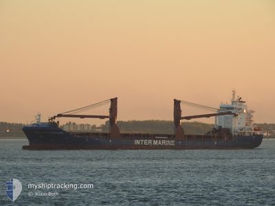
The vessel BRUCE (IMO: 9741140, MMSI: 636093060) is a Cargo It's sailing under the flag of [LR] Liberia.
In this page you can find informations about the vessels current position, last detected port calls, and current voyage information. If the vessels is not in coverage by AIS you will find the latest position.
The current position of BRUCE is detected by our AIS receivers and we are not responsible for the reliability of the data. The last position was recorded while the vessel was in Coverage by the Ais receivers of our vessel tracking app.
The current draught of BRUCE as reported by AIS is 7.6 meters
Weather
| Temperature | 28°C / 82.4°F |
|---|---|
| Wind Speed | 7 knots |
| Direction | 119° ESE |
| Pressure | 1013.3 hPa |
| Humidity | 77 % |
| Cloud Coverage | 100 % |


Featured Company
Last Port Calls
| Port | Arrival | Departure | Time In Port |
|---|---|---|---|
| 2025-02-11 11:03 | 2025-02-15 12:13 | 4 d | |
| 2025-02-10 03:57 | 2025-02-11 09:33 | 1 d | |
| 2025-02-04 08:05 | 2025-02-05 04:57 | 20 h | |
| 2025-01-11 19:11 | 2025-01-12 08:23 | 13 h | |
| 2025-01-04 09:28 | 2025-01-06 08:27 | 1 d | |
| 2024-12-16 15:36 | 2024-12-17 16:12 | 1 d | |
| 2024-12-15 15:47 | 2024-12-16 14:25 | 22 h | |
| 2024-12-15 00:52 | 2024-12-15 01:45 | 53 m | |
| 2024-12-13 03:29 | 2024-12-13 04:05 | 36 m | |
| 2024-12-11 20:53 | 2024-12-12 19:38 | 22 h |
Last Trips
| Origin | Departure | Destination | Arrival | Distance | |
|---|---|---|---|---|---|
| 2025-02-11 17:33 | 2025-02-11 19:03 | 12.87 nm | |||
| 2025-02-05 12:57 | 2025-02-10 11:57 | 1011.06 nm | |||
| 2025-01-12 10:23 | 2025-02-04 16:05 | 7214.60 nm | |||
| 2025-01-06 09:27 | 2025-01-11 21:11 | 1653.73 nm | |||
| 2024-12-17 16:12 | 2025-01-04 10:28 | 5319.35 nm | |||
| 2024-12-16 14:25 | 2024-12-16 15:36 | 10.51 nm | |||
| 2024-12-15 01:45 | 2024-12-15 15:47 | 5.18 nm | |||
| 2024-12-13 05:05 | 2024-12-15 00:52 | 440.94 nm | |||
| 2024-12-12 20:38 | 2024-12-13 04:29 | 83.41 nm | |||
| 2024-12-11 15:36 | 2024-12-11 21:53 | 81.23 nm |
Events
| Tid | Hændelsen | Detaljer | Position / Dest | Info |
|---|---|---|---|---|
| 2025-02-23 17:49 | Status er ændret | Default Under way using engine |
1.26951 / 103.36787
ES LPA
|
Fart: 15.2 kn Kurs: 313.4° |
| 2025-02-23 17:42 | Ændre havområde | Malaysian part of the Malacca Strait Indonesian part of the Malacca Strait |
1.24804 / 103.39011
Malacca Strait
|
Fart: 15.2 kn Kurs: 313.4° |
| 2025-02-23 17:42 | Udenfor Dækning |
1.24804 / 103.39011
Malacca Strait
|
Fart: 15.2 kn Kurs: 313.4° |
|
| 2025-02-23 17:39 | Ændre havområde | Indonesian part of the Malacca Strait Malaysian part of the Malacca Strait |
1.24038 / 103.39919
Malacca Strait
|
Fart: 15.3 kn Kurs: 304.3° |
| 2025-02-23 17:39 | Status er ændret | Under way using engine Default |
1.24038 / 103.39919
ES LPA
|
Fart: 15.3 kn Kurs: 300° |
| 2025-02-23 17:37 | Status er ændret | Default Under way using engine |
1.23629 / 103.40567
ES LPA
|
Fart: 15.2 kn Kurs: 288.6° |
| 2025-02-23 17:24 | Ændre havområde | Malaysian part of the Malacca Strait Malaysian part of the Singapore Strait |
1.21747 / 103.45790
Malacca Strait
|
Fart: 15 kn Kurs: 286.3° |
| 2025-02-23 16:55 | Ændre havområde | Malaysian part of the Singapore Strait Indonesian part of the Singapore Strait |
1.18929 / 103.57488
Singapore Strait
|
Fart: 15.2 kn Kurs: 281.1° |
| 2025-02-23 16:19 | Ændre havområde | Indonesian part of the Singapore Strait Singaporean part of the Singapore Strait |
1.14885 / 103.71379
Singapore Strait
|
Fart: 14.5 kn Kurs: 296.2° |
| 2025-02-23 15:08 | START Sejllads | 1.91 nm, North East of SINGAPORE |
1.27010 / 103.88382
ES LPA
|
Fart: 3.1 kn Kurs: 135° |