
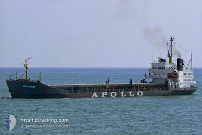
BRAVE WARRIOR
Bulk Carrier
Current Trip
| Trip Time | 4 days |
|---|---|
| Trip Distance | 613.94 nm |
| AVG Speed | 8.8 Knots |
| MAX Speed | 11.7 Knots |
| Dybgang | 4.2 m |
| AVG Wind | 9.1 knots |
| MAX Wind | 19.8 knots |
| MIN Temp | 13°C / 55.4°F |
| MAX Temp | 15.3°C / 59.54°F |
| Position Modtaget | 27 d siden |
Current Position
| Longitude | --- |
|---|---|
| Latitude | --- |
| Status | Under way using engine |
| Fart | 10.9 Knots |
| Kurs | 238.3° |
| Område | Mediterranean Sea - Eastern Basin |
| Station | T-AIS |
| Position Modtaget | 27 d siden |
Info
Information
The current position of BRAVE WARRIOR is in Mediterranean Sea - Eastern Basin with coordinates 33.78452° / 34.88309° as reported on 2025-01-21 09:45 by AIS to our vessel tracker app. The vessel's current speed is 10.9 Knots and is currently inside the port of EL DEKHEILA.
The vessel BRAVE WARRIOR (IMO: 7208728, MMSI: 450542000) is a Bulk Carrier that was built in 1972 ( 53 år gamle ). It's sailing under the flag of [LB] Lebanon.
In this page you can find informations about the vessels current position, last detected port calls, and current voyage information. If the vessels is not in coverage by AIS you will find the latest position.
The current position of BRAVE WARRIOR is detected by our AIS receivers and we are not responsible for the reliability of the data. The last position was recorded while the vessel was in Coverage by the Ais receivers of our vessel tracking app.
The current draught of BRAVE WARRIOR as reported by AIS is 4.2 meters
Weather
| Temperature | 15°C / 59°F |
|---|---|
| Wind Speed | 6 knots |
| Direction | 41° NE |
| Pressure | 1023.5 hPa |
| Humidity | 56.6 % |
| Cloud Coverage | 44 % |
Featured Company
Last Port Calls
| Port | Arrival | Departure | Time In Port |
|---|---|---|---|
| 2025-02-14 08:57 | |||
| 2025-02-01 17:38 | 2025-02-09 15:24 | 7 d | |
| 2025-01-23 09:41 | 2025-01-29 11:59 | 6 d | |
| 2025-01-10 04:49 | 2025-01-21 06:30 | 11 d | |
| 2025-01-06 14:53 | 2025-01-09 10:08 | 2 d | |
| 2024-12-08 00:12 | 2024-12-14 18:47 | 6 d |
Last Trips
| Origin | Departure | Destination | Arrival | Distance | |
|---|---|---|---|---|---|
| 2025-02-09 17:24 | 2025-02-14 10:57 | 613.94 nm | |||
| 2025-01-29 13:59 | 2025-02-01 19:38 | 600.08 nm | |||
| 2025-01-21 08:30 | 2025-01-23 11:41 | 347.72 nm | |||
| 2025-01-09 12:08 | 2025-01-10 06:49 | 118.06 nm | |||
| 2024-12-14 20:47 | 2025-01-06 16:53 | 1112.01 nm | |||
| 2024-11-26 18:31 | 2024-12-08 02:12 | 1280.42 nm |
Events
| Tid | Hændelsen | Detaljer | Position / Dest | Info |
|---|---|---|---|---|
| 2025-02-14 09:37 | STOP Sejllads |
31.13557 / 29.79371
[EG] EL DEKHEILA
|
Fart: Kurs: 174° |
|
| 2025-02-14 08:57 | Skibe i havn |
|
31.15254 / 29.80831
[EG] EL DEKHEILA
|
Fart: 6.4 kn Kurs: 171° |
| 2025-02-14 08:30 | START Sejllads | 2.69 nm, North West of EL DEKHEILA |
31.18523 / 29.77961
EGALY
|
Fart: 6.7 kn Kurs: 124° |
| 2025-02-13 23:02 | STOP Sejllads | 4.55 nm, North West of EL DEKHEILA |
31.20386 / 29.74818
EGALY
|
Fart: 0.2 kn Kurs: 351° |
| 2025-02-11 05:20 | START Sejllads | 3.58 nm, North West of BENGHAZI |
32.13939 / 19.98406
EGALY
|
Fart: 4.1 kn Kurs: 15° |
| 2025-02-10 16:20 | STOP Sejllads | 3.58 nm, North West of BENGHAZI |
32.13684 / 19.98161
EGALY
|
Fart: 0.3 kn Kurs: 32° |
| 2025-02-09 20:07 | STOP Sejllads | 3.6 nm, North West of BENGHAZI |
32.13702 / 19.98123
EGALY
|
Fart: 0.1 kn Kurs: 58° |
| 2025-02-09 15:55 | STOP Sejllads | 3.57 nm, North West of BENGHAZI |
32.13676 / 19.98162
EGALY
|
Fart: 0.3 kn Kurs: 56° |
| 2025-02-09 15:24 | Afsejlet fra sidste havn |
|
32.11693 / 20.01744
EGALY
|
Fart: 3.7 kn Kurs: 355° |