
BORE SONG
Ro-Ro Cargo
Current Trip
| Trip Time | --- |
|---|---|
| Trip Distance | --- |
| AVG Speed | --- |
| MAX Speed | --- |
| Dybgang | --- |
| AVG Wind | --- |
| MAX Wind | --- |
| MIN Temp | --- |
| MAX Temp | --- |
| Position Modtaget | 1 m siden |
Current Position
| Longitude | --- |
|---|---|
| Latitude | --- |
| Status | Under way using engine |
| Fart | 6.4 Knots |
| Kurs | 266° |
| Område | Irish Sea and St. George's Channel |
| Station | T-AIS |
| Position Modtaget | 1 m siden |
Info
Information
The current position of BORE SONG is in Irish Sea and St. George's Channel with coordinates 53.34419° / -6.18186° as reported on 2025-03-18 01:35 by AIS to our vessel tracker app. The vessel's current speed is 6.4 Knots and is currently inside the port of DUBLIN.
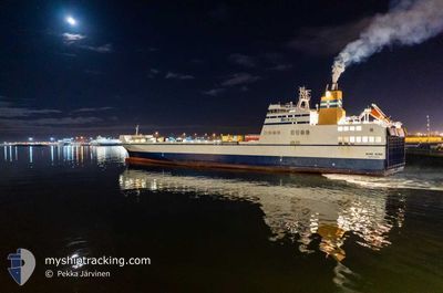
The vessel BORE SONG (IMO: 9443566, MMSI: 244130690) is a Ro-Ro Cargo that was built in 2011 ( 14 år gamle ). It's sailing under the flag of [NL] Netherlands.
In this page you can find informations about the vessels current position, last detected port calls, and current voyage information. If the vessels is not in coverage by AIS you will find the latest position.
The current position of BORE SONG is detected by our AIS receivers and we are not responsible for the reliability of the data. The last position was recorded while the vessel was in Coverage by the Ais receivers of our vessel tracking app.
The current draught of BORE SONG as reported by AIS is 6.1 meters
Weather
| Temperature | 3.4°C / 38.12°F |
|---|---|
| Wind Speed | 7 knots |
| Direction | 127° SE |
| Pressure | 1025.6 hPa |
| Humidity | 82.9 % |
| Cloud Coverage | 100 % |
Featured Company
Last Port Calls
| Port | Arrival | Departure | Time In Port |
|---|---|---|---|
| 2025-03-18 01:35 | |||
| 2025-03-17 13:37 | 2025-03-17 17:19 | 3 h | |
| 2025-03-17 01:38 | 2025-03-17 05:25 | 3 h | |
| 2025-03-15 13:42 | 2025-03-16 17:23 | 1 d | |
| 2025-03-15 01:26 | 2025-03-15 05:47 | 4 h | |
| 2025-03-14 14:20 | 2025-03-14 17:23 | 3 h | |
| 2025-03-14 01:34 | 2025-03-14 05:52 | 4 h | |
| 2025-03-13 13:41 | 2025-03-13 17:21 | 3 h | |
| 2025-03-13 01:29 | 2025-03-13 05:52 | 4 h | |
| 2025-03-12 13:38 | 2025-03-12 17:44 | 4 h |
Most Visited Ports (Last year)
| Port | Arrivals | |
|---|---|---|
| 294 | ||
| 280 | ||
| 4 |
Last Trips
| Origin | Departure | Destination | Arrival | Distance | |
|---|---|---|---|---|---|
| 2025-03-17 05:25 | 2025-03-17 13:37 | 119.73 nm | |||
| 2025-03-16 17:23 | 2025-03-17 01:38 | 120.76 nm | |||
| 2025-03-15 05:47 | 2025-03-15 13:42 | 120.45 nm | |||
| 2025-03-14 17:23 | 2025-03-15 01:26 | 120.35 nm | |||
| 2025-03-14 05:52 | 2025-03-14 14:20 | 119.76 nm | |||
| 2025-03-13 17:21 | 2025-03-14 01:34 | 120.40 nm | |||
| 2025-03-13 05:52 | 2025-03-13 13:41 | 120.87 nm | |||
| 2025-03-12 17:44 | 2025-03-13 01:29 | 120.42 nm | |||
| 2025-03-12 06:21 | 2025-03-12 13:38 | 120.04 nm | |||
| 2025-03-11 17:33 | 2025-03-12 01:44 | 120.22 nm |
Events
| Tid | Hændelsen | Detaljer | Position / Dest | Info |
|---|---|---|---|---|
| 2025-03-18 01:35 | Skibe i havn |
|
53.34421 / -6.18133
[IE] DUBLIN
|
Fart: 6.9 kn Kurs: 267.8° |
| 2025-03-17 23:29 | Status er ændret | Under way using engine Default |
53.49727 / -5.39044
DUBLIN <-> LIVERPOOL
|
Fart: 14.5 kn Kurs: 253° |
| 2025-03-17 23:28 | Status er ændret | Default Under way using engine |
53.49850 / -5.38339
DUBLIN <-> LIVERPOOL
|
Fart: 14.5 kn Kurs: 253.7° |
| 2025-03-17 23:27 | Status er ændret | Under way using engine Default |
53.49896 / -5.38069
DUBLIN <-> LIVERPOOL
|
Fart: 14.5 kn Kurs: 253° |
| 2025-03-17 23:24 | Status er ændret | Default Under way using engine |
53.50306 / -5.35740
DUBLIN <-> LIVERPOOL
|
Fart: 14.4 kn Kurs: 253.1° |
| 2025-03-17 23:18 | Fundet i havområde | Irish part of the Irish Sea and St. George's Channel |
53.50914 / -5.32259
Irish Sea and St. George's Channel
|
Fart: 14.4 kn Kurs: 253.1° |
| 2025-03-17 23:14 | Status er ændret | Under way using engine Default |
53.51125 / -5.29047
DUBLIN <-> LIVERPOOL
|
Fart: 14.6 kn Kurs: 266° |
| 2025-03-17 23:00 | Indenfor Dækning |
53.51125 / -5.29047
Irish Sea and St. George's Channel
|
Fart: 14.6 kn Kurs: 265.6° |
|
| 2025-03-17 21:28 | Status er ændret | Default Under way using engine |
53.56723 / -4.62920
DUBLIN <-> LIVERPOOL
|
Fart: 13.4 kn Kurs: 274.2° |
| 2025-03-17 21:21 | Udenfor Dækning |
53.56889 / -4.59043
Irish Sea and St. George's Channel
|
Fart: 13.4 kn Kurs: 274.2° |