
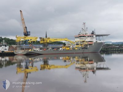
BOKA NORTHERN OCEAN
Offshore Supply Ship
Current Trip
| Time Travelled | 14 days |
|---|---|
| Remaining Time | --- |
| Distance Travelled | 474.35 nm |
| Remaining Distance | --- |
| AVG Speed | 9 Knots |
| MAX Speed | 13.5 Knots |
| AVG Wind | 10.4 knots |
| MAX Wind | 26 knots |
| MIN Temp | 2.4°C / 36.32°F |
| MAX Temp | 9.4°C / 48.92°F |
| Dybgang | 6.4 m |
| Position Modtaget | 1 m siden |
Current Position
| Longitude | --- |
|---|---|
| Latitude | --- |
| Status | Moored |
| Fart | |
| Kurs | 80° |
| Område | North Sea |
| Station | T-AIS |
| Position Modtaget | 1 m siden |
Info
Information
The current position of BOKA NORTHERN OCEAN is in North Sea with coordinates 57.13546° / -2.05291° as reported on 2025-03-18 05:38 by AIS to our vessel tracker app. The vessel's current speed is 0 Knots
The vessel BOKA NORTHERN OCEAN (IMO: 9433183, MMSI: 229021000) is a Offshore Supply Ship that was built in 2012 ( 13 år gamle ). It's sailing under the flag of [MT] Malta.
In this page you can find informations about the vessels current position, last detected port calls, and current voyage information. If the vessels is not in coverage by AIS you will find the latest position.
The current position of BOKA NORTHERN OCEAN is detected by our AIS receivers and we are not responsible for the reliability of the data. The last position was recorded while the vessel was in Coverage by the Ais receivers of our vessel tracking app.
The current draught of BOKA NORTHERN OCEAN as reported by AIS is 6.4 meters
Weather
| Temperature | 4.7°C / 40.46°F |
|---|---|
| Wind Speed | 13 knots |
| Direction | 196° SSW |
| Pressure | 1029.1 hPa |
| Humidity | 74 % |
| Cloud Coverage | 45 % |
Featured Company
Last Port Calls
| Port | Arrival | Departure | Time In Port |
|---|---|---|---|
| 2025-03-03 08:04 |
Most Visited Ports (Last year)
| Port | Arrivals | |
|---|---|---|
| 6 | ||
| 3 | ||
| 2 | ||
| 2 | ||
| 1 | ||
| 1 |
Last Trips
| Origin | Departure | Destination | Arrival | Distance |
|---|
Events
| Tid | Hændelsen | Detaljer | Position / Dest | Info |
|---|---|---|---|---|
| 2025-03-10 10:09 | Status er ændret | Moored Under way using engine |
57.13548 / -2.05290
ABERDEEN
|
Fart: Kurs: 81° |
| 2025-03-10 08:11 | STOP Sejllads | 0.87 nm, South East of ABERDEEN |
57.13405 / -2.05385
ABERDEEN
|
Fart: 0.2 kn Kurs: 18° |
| 2025-03-10 06:26 | Status er ændret | Under way using engine Restricted manoeuverability |
57.04218 / -1.79771
ABERDEEN
|
Fart: 10.9 kn Kurs: 326.2° |
| 2025-03-10 06:21 | START Sejllads | 11.55 nm, South East of ABERDEEN |
57.03093 / -1.78819
ABERDEEN
|
Fart: 3.4 kn Kurs: 339° |
| 2025-03-09 14:23 | Status er ændret | Restricted manoeuverability Under way using engine |
57.03034 / -1.78809
ABERDEEN
|
Fart: 0.1 kn Kurs: 3° |
| 2025-03-09 09:26 | STOP Sejllads | 11.54 nm, South East of ABERDEEN |
57.02694 / -1.79388
ABERDEEN
|
Fart: 0.3 kn Kurs: 328° |
| 2025-03-09 09:21 | START Sejllads | 11.51 nm, South East of ABERDEEN |
57.03003 / -1.79095
ABERDEEN
|
Fart: 3.8 kn Kurs: 302° |
| 2025-03-09 05:56 | STOP Sejllads | 11.48 nm, South East of ABERDEEN |
57.03182 / -1.78974
ABERDEEN
|
Fart: 0.3 kn Kurs: 344° |
| 2025-03-08 22:07 | Destination er ændret | ABERDEEN DP TRIAL LOC. |
55.61384 / -.62918
ABERDEEN
|
Fart: 12.8 kn Kurs: 335.7° |
| 2025-03-08 22:07 | ETA er ændret | 2025/03/09 06:00 2025/03/08 07:00 |
55.61384 / -.62918
ABERDEEN
|
Fart: 12.8 kn Kurs: 335.7° |