
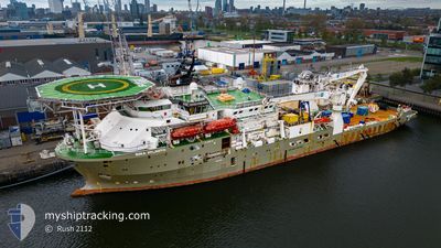
BOKA ATLANTIS
Diving Support Vessel
Current Trip
| Time Travelled | 27 days |
|---|---|
| Remaining Time | --- |
| Distance Travelled | 1279.60 nm |
| Remaining Distance | --- |
| AVG Speed | 9.2 Knots |
| MAX Speed | 13.1 Knots |
| AVG Wind | 15.6 knots |
| MAX Wind | 32.5 knots |
| MIN Temp | 4.5°C / 40.1°F |
| MAX Temp | 7.5°C / 45.5°F |
| Dybgang | 6.4 m |
| Position Modtaget | 2 m siden |
Current Position
| Longitude | --- |
|---|---|
| Latitude | --- |
| Status | Moored |
| Fart | |
| Kurs | 82° |
| Område | North Sea |
| Station | T-AIS |
| Position Modtaget | 2 m siden |
Info
Information
The current position of BOKA ATLANTIS is in North Sea with coordinates 57.13529° / -2.05525° as reported on 2025-02-17 00:41 by AIS to our vessel tracker app. The vessel's current speed is 0 Knots
The vessel BOKA ATLANTIS (IMO: 9441221, MMSI: 538003646) is a Diving Support Vessel that was built in 2011 ( 14 år gamle ). It's sailing under the flag of [MH] Marshall Is.
In this page you can find informations about the vessels current position, last detected port calls, and current voyage information. If the vessels is not in coverage by AIS you will find the latest position.
The current position of BOKA ATLANTIS is detected by our AIS receivers and we are not responsible for the reliability of the data. The last position was recorded while the vessel was in Coverage by the Ais receivers of our vessel tracking app.
The current draught of BOKA ATLANTIS as reported by AIS is 6.4 meters
Weather
| Temperature | 3.4°C / 38.12°F |
|---|---|
| Wind Speed | 22 knots |
| Direction | 157° SSE |
| Pressure | 1023.9 hPa |
| Humidity | 94.1 % |
| Cloud Coverage | 100 % |
Featured Company
Last Port Calls
| Port | Arrival | Departure | Time In Port |
|---|---|---|---|
| 2025-01-12 12:25 | 2025-01-20 19:19 | 8 d | |
| 2025-01-07 20:57 |
Last Trips
| Origin | Departure | Destination | Arrival | Distance | |
|---|---|---|---|---|---|
| 2025-01-07 21:57 | 2025-01-12 12:25 | 392.22 nm |
Events
| Tid | Hændelsen | Detaljer | Position / Dest | Info |
|---|---|---|---|---|
| 2025-02-08 01:02 | Status er ændret | Moored Under way using engine |
57.13529 / -2.05542
ABERDEEN
|
Fart: Kurs: 82° |
| 2025-02-08 00:41 | STOP Sejllads | 0.81 nm, South East of ABERDEEN |
57.13389 / -2.05637
ABERDEEN
|
Fart: 0.3 kn Kurs: 24° |
| 2025-02-07 22:32 | ETA er ændret | 2025/02/08 00:01 2025/02/07 23:59 |
57.03296 / -1.74728
ABERDEEN
|
Fart: 9.7 kn Kurs: 318.5° |
| 2025-02-07 21:20 | Indenfor Dækning |
56.87179 / -1.51264
North Sea
ABERDEEN
|
Fart: 10.3 kn Kurs: 323.7° |
|
| 2025-02-07 04:25 | Udenfor Dækning |
54.40901 / 1.60930
North Sea
ABERDEEN
|
Fart: 11.6 kn Kurs: 323.3° |
|
| 2025-02-07 01:59 | Destination er ændret | ABERDEEN LOGS FIELD |
54.08566 / 2.15674
ABERDEEN
|
Fart: 10.9 kn Kurs: 325.6° |
| 2025-02-07 01:59 | ETA er ændret | 2025/02/07 23:59 2025/02/04 15:00 |
54.08566 / 2.15674
ABERDEEN
|
Fart: 10.9 kn Kurs: 325.6° |
| 2025-02-07 00:48 | Indenfor Dækning |
53.90680 / 2.34141
North Sea
|
Fart: 10.5 kn Kurs: 329.3° |