

BOAT BLESSING
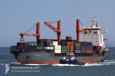
Container Ship

Current Trip
IQUQA
| Time Travelled | 14 h, 50 mins |
|---|---|
| Remaining Time | --- |
| Distance Travelled | 35.78 nm |
| Remaining Distance | --- |
| AVG Speed | 6.3 Knots |
| MAX Speed | 10.9 Knots |
| AVG Wind | 7.4 knots |
| MAX Wind | 12.8 knots |
| MIN Temp | 21.7°C / 71.06°F |
| MAX Temp | 24.3°C / 75.74°F |
| Dybgang | 10.2 m |
| Position Modtaget | 1 m siden |
Current Position
| Longitude | --- |
|---|---|
| Latitude | --- |
| Status | At anchor |
| Fart | 0.2 Knots |
| Kurs | 284° |
| Område | Persian Gulf |
| Station | T-AIS |
| Position Modtaget | 1 m siden |
Information
The current position of BOAT BLESSING is in Persian Gulf with coordinates 25.42993° / 55.04156° as reported on 2025-03-29 16:44 by AIS to our vessel tracker app. The vessel's current speed is 0.2 Knots
The vessel BOAT BLESSING (IMO: 9134684, MMSI: 351218000) is a Container Ship that was built in 1997 ( 28 år gamle ). It's sailing under the flag of [PA] Panama.
In this page you can find informations about the vessels current position, last detected port calls, and current voyage information. If the vessels is not in coverage by AIS you will find the latest position.
The current position of BOAT BLESSING is detected by our AIS receivers and we are not responsible for the reliability of the data. The last position was recorded while the vessel was in Coverage by the Ais receivers of our vessel tracking app.
The current draught of BOAT BLESSING as reported by AIS is 10.2 meters
Weather
| Temperature | 23.8°C / 74.84°F |
|---|---|
| Wind Speed | 10 knots |
| Direction | 343° NNW |
| Pressure | 1012.1 hPa |
| Humidity | 69.4 % |
| Cloud Coverage | 1 % |


Featured Company
Last Port Calls
| Port | Arrival | Departure | Time In Port |
|---|---|---|---|
| 2025-03-27 17:10 | 2025-03-29 05:56 | 1 d | |
| 2025-03-21 21:52 | 2025-03-22 13:24 | 15 h | |
| 2025-03-17 18:41 | 2025-03-18 13:42 | 19 h | |
| 2025-03-10 00:45 | 2025-03-11 04:24 | 1 d |
Last Trips
| Origin | Departure | Destination | Arrival | Distance | |
|---|---|---|---|---|---|
| 2025-03-22 13:24 | 2025-03-27 17:10 | 1223.38 nm | |||
| 2025-03-18 13:42 | 2025-03-21 21:52 | 428.35 nm | |||
| 2025-03-11 04:24 | 2025-03-17 18:41 | 947.74 nm | |||
| 2024-12-31 14:43 | 2025-03-10 00:45 | 399.46 nm |
Events
| Tid | Hændelsen | Detaljer | Position / Dest | Info |
|---|---|---|---|---|
| 2025-03-29 13:55 | Status er ændret | At anchor Default |
25.43138 / 55.04055
IQUQA
|
Fart: Kurs: 113° |
| 2025-03-29 13:26 | Status er ændret | Default At anchor |
25.43129 / 55.04053
IQUQA
|
Fart: 0.1 kn Kurs: 113° |
| 2025-03-29 12:41 | Indenfor Dækning |
25.43149 / 55.04074
Persian Gulf
IQUQA
|
Fart: 0.1 kn Kurs: 29.6° |
|
| 2025-03-29 11:07 | Udenfor Dækning |
25.43094 / 55.03872
Persian Gulf
IQUQA
|
Fart: Kurs: 257° |
|
| 2025-03-29 09:16 | Status er ændret | At anchor Default |
25.43008 / 55.03807
IQUQA
|
Fart: 0.1 kn Kurs: 73° |
| 2025-03-29 09:07 | Status er ændret | Default At anchor |
25.42976 / 55.03807
IQUQA
|
Fart: 0.2 kn Kurs: 84° |
| 2025-03-29 08:55 | STOP Sejllads | 15.95 nm, North West of DUBAI |
25.42947 / 55.03878
IQUQA
|
Fart: 0.2 kn Kurs: 82° |
| 2025-03-29 08:35 | Status er ændret | At anchor Under way using engine |
25.41755 / 55.02517
IQUQA
|
Fart: 6.4 kn Kurs: 30.2° |
| 2025-03-29 07:38 | START Sejllads | 15.18 nm, North West of JUMEIRAH |
25.33070 / 54.99770
IQUQA
|
Fart: 3.1 kn Kurs: 243° |
| 2025-03-29 07:09 | STOP Sejllads | 15.24 nm, North West of JUMEIRAH |
25.33504 / 54.99905
IQUQA
|
Fart: 0.3 kn Kurs: 171° |