
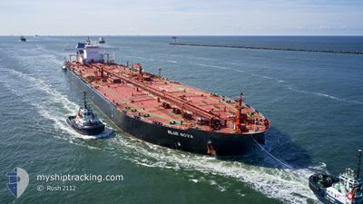
BLUE NOVA
Tanker
Current Trip
| Time Travelled | 12 days |
|---|---|
| Remaining Time | --- |
| Distance Travelled | 2644.79 nm |
| Remaining Distance | --- |
| AVG Speed | 11.1 Knots |
| MAX Speed | 15.2 Knots |
| AVG Wind | 10.2 knots |
| MAX Wind | 21.1 knots |
| MIN Temp | 15.3°C / 59.54°F |
| MAX Temp | 23.5°C / 74.3°F |
| Dybgang | 11 m |
| Position Modtaget | 3 d siden |
Current Position
| Longitude | -5.54293° |
|---|---|
| Latitude | 35.98497° |
| Status | Under way using engine |
| Fart | 11.6 Knots |
| Kurs | 253° |
| Område | Strait of Gibraltar |
| Station | T-AIS |
| Position Modtaget | 3 d siden |
Info
Information
The current position of BLUE NOVA is in Strait of Gibraltar with coordinates 35.98497° / -5.54293° as reported on 2024-06-05 07:17 by AIS to our vessel tracker app. The vessel's current speed is 11.6 Knots and is heading at the port of GEORGETOWN. The estimated time of arrival as calculated by MyShipTracking vessel tracking app is 2024-06-15 01:00 LT
The vessel BLUE NOVA (IMO: 9534846, MMSI: 636018114) is a Tanker It's sailing under the flag of [LR] Liberia.
In this page you can find informations about the vessels current position, last detected port calls, and current voyage information. If the vessels is not in coverage by AIS you will find the latest position.
The current position of BLUE NOVA is detected by our AIS receivers and we are not responsible for the reliability of the data. The last position was recorded while the vessel was in Coverage by the Ais receivers of our vessel tracking app.
The current draught of BLUE NOVA as reported by AIS is 11 meters
Weather
| Temperature | 23.6°C / 74.48°F |
|---|---|
| Wind Speed | --- |
| Direction | 344° NNW |
| Pressure | 1018.6 hPa |
| Humidity | 65.3 % |
| Cloud Coverage | 97 % |
Featured Company
Last Port Calls
| Port | Arrival | Departure | Time In Port |
|---|---|---|---|
| 2024-05-26 19:01 | 2024-05-28 06:28 | 1 d | |
| 2024-05-05 12:46 | 2024-05-07 13:34 | 2 d | |
| 2024-04-14 16:20 | 2024-04-16 21:15 | 2 d |
Most Visited Ports (Last year)
| Port | Arrivals | |
|---|---|---|
| 4 | ||
| 3 | ||
| 1 | ||
| 1 | ||
| 1 | ||
| 1 |
Last Trips
| Origin | Departure | Destination | Arrival | Distance | |
|---|---|---|---|---|---|
| 2024-05-07 13:34 | 2024-05-26 19:01 | 4824.72 nm | |||
| 2024-04-16 21:15 | 2024-05-05 12:46 | 5275.82 nm |
Events
| Tid | Hændelsen | Detaljer | Position / Dest | Info |
|---|---|---|---|---|
| 2024-06-05 07:21 | Status er ændret | Default Under way using engine |
35.98067 / -5.55950
GYGEO
|
Fart: 11.6 kn Kurs: 253° |
| 2024-06-05 07:17 | Udenfor Dækning |
35.98497 / -5.54293
Strait of Gibraltar
GYGEO
|
Fart: 11.6 kn Kurs: 253° |
|
| 2024-06-05 06:18 | Destination er ændret | GYGEO ESALG |
36.07474 / -5.39809
GYGEO
|
Fart: 6.2 kn Kurs: 162° |
| 2024-06-05 06:18 | ETA er ændret | 2024/06/15 05:00 2025/04/06 22:00 |
36.07474 / -5.39809
GYGEO
|
Fart: 6.2 kn Kurs: 162° |
| 2024-06-05 06:13 | Status er ændret | Under way using engine At anchor |
36.08045 / -5.40119
ESALG
|
Fart: 3.1 kn Kurs: 146° |
| 2024-06-05 06:13 | START Sejllads | 3.49 nm, South of ALGECIRAS |
36.08062 / -5.40131
ESALG
|
Fart: 3.2 kn Kurs: 145° |
| 2024-06-05 02:49 | Status er ændret | At anchor Default |
36.07934 / -5.40466
ESALG
|
Fart: 0.1 kn Kurs: 337° |
| 2024-06-05 02:43 | Status er ændret | Default At anchor |
36.07927 / -5.40470
ESALG
|
Fart: 0.1 kn Kurs: 337° |
| 2024-06-04 21:23 | Status er ændret | At anchor Under way using engine |
36.08299 / -5.40768
ESALG
|
Fart: 0.3 kn Kurs: 99° |
| 2024-06-04 21:20 | STOP Sejllads | 3.26 nm, South of ALGECIRAS |
36.08314 / -5.40746
ESALG
|
Fart: 0.3 kn Kurs: 95° |