
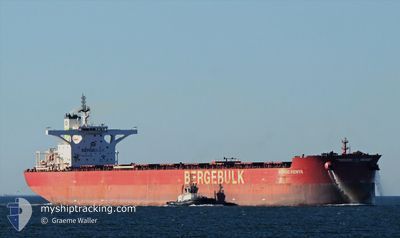
BERGE KENYA
Cargo
Current Trip
AU PHE>CN QIN
| Time Travelled | 9 days |
|---|---|
| Remaining Time | --- |
| Distance Travelled | 2365.48 nm |
| Remaining Distance | --- |
| AVG Speed | 10.4 Knots |
| MAX Speed | 13.5 Knots |
| AVG Wind | 8.9 knots |
| MAX Wind | 20 knots |
| MIN Temp | 25.8°C / 78.44°F |
| MAX Temp | 31.6°C / 88.88°F |
| Dybgang | 18.6 m |
| Position Modtaget | 8 d siden |
Current Position
| Longitude | 117.62473° |
|---|---|
| Latitude | -16.62295° |
| Status | Under way using engine |
| Fart | 10.4 Knots |
| Kurs | 347.5° |
| Område | Indian Ocean |
| Station | T-AIS |
| Position Modtaget | 8 d siden |
Info
Information
The current position of BERGE KENYA is in Indian Ocean with coordinates -16.62295° / 117.62473° as reported on 2024-04-25 10:16 by AIS to our vessel tracker app. The vessel's current speed is 10.4 Knots
The vessel BERGE KENYA (IMO: 9843388, MMSI: 232024252) is a Cargo It's sailing under the flag of [GB] United Kingdom.
In this page you can find informations about the vessels current position, last detected port calls, and current voyage information. If the vessels is not in coverage by AIS you will find the latest position.
The current position of BERGE KENYA is detected by our AIS receivers and we are not responsible for the reliability of the data. The last position was recorded while the vessel was in Coverage by the Ais receivers of our vessel tracking app.
The current draught of BERGE KENYA as reported by AIS is 18.6 meters
Weather
| Temperature | 30.2°C / 86.36°F |
|---|---|
| Wind Speed | 10 knots |
| Direction | 302° WNW |
| Pressure | 1006.9 hPa |
| Humidity | 73.5 % |
| Cloud Coverage | 5 % |
Featured Company
Last Port Calls
| Port | Arrival | Departure | Time In Port |
|---|---|---|---|
| 2024-04-22 17:11 | 2024-04-24 13:50 | 1 d | |
| 2024-04-04 08:25 | 2024-04-06 14:21 | 2 d | |
| 2024-03-15 23:04 | 2024-03-17 06:44 | 1 d | |
| 2024-03-02 04:04 |
Most Visited Ports (Last year)
| Port | Arrivals | |
|---|---|---|
| 10 | ||
| 2 | ||
| 1 | ||
| 1 | ||
| 1 | ||
| 1 |
Last Trips
| Origin | Departure | Destination | Arrival | Distance | |
|---|---|---|---|---|---|
| 2024-04-06 22:21 | 2024-04-23 01:11 | 3944.53 nm | |||
| 2024-03-17 14:44 | 2024-04-04 16:25 | 3924.54 nm | |||
| 2024-03-02 12:04 | 2024-03-16 07:04 | 3640.64 nm |
Events
| Tid | Hændelsen | Detaljer | Position / Dest | Info |
|---|---|---|---|---|
| 2024-04-25 10:23 | Status er ændret | Default Under way using engine |
-16.60202 / 117.61980
AU PHE>CN QIN
|
Fart: 10.4 kn Kurs: 347.5° |
| 2024-04-25 10:16 | Udenfor Dækning |
-16.62295 / 117.62473
Indian Ocean
AU PHE>CN QIN
|
Fart: 10.4 kn Kurs: 347.5° |
|
| 2024-04-25 09:37 | Status er ændret | Under way using engine Default |
-16.73454 / 117.65157
AU PHE>CN QIN
|
Fart: 10.6 kn Kurs: 343° |
| 2024-04-25 09:26 | Indenfor Dækning |
-16.72599 / 117.64904
Indian Ocean
AU PHE>CN QIN
|
Fart: 10.6 kn Kurs: 344.9° |
|
| 2024-04-25 07:55 | Status er ændret | Default Under way using engine |
-17.02918 / 117.73360
AU PHE>CN QIN
|
Fart: 10.6 kn Kurs: 343.6° |
| 2024-04-25 07:50 | Udenfor Dækning |
-17.04488 / 117.73797
Indian Ocean
AU PHE>CN QIN
|
Fart: 10.6 kn Kurs: 343.6° |
|
| 2024-04-25 07:16 | Status er ændret | Under way using engine Default |
-17.14099 / 117.76359
AU PHE>CN QIN
|
Fart: 10.6 kn Kurs: 348° |
| 2024-04-25 07:16 | Indenfor Dækning |
-17.14099 / 117.76359
Indian Ocean
AU PHE>CN QIN
|
Fart: 10.4 kn Kurs: 348.2° |
|
| 2024-04-24 22:31 | Status er ændret | Default Under way using engine |
-18.72473 / 118.15987
AU PHE>CN QIN
|
Fart: 11.9 kn Kurs: 344.9° |
| 2024-04-24 22:25 | Udenfor Dækning |
-18.74441 / 118.16557
Indian Ocean
AU PHE>CN QIN
|
Fart: 11.9 kn Kurs: 344.9° |