
BEIJING
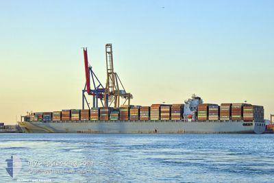
Container Ship
Current Trip
| Time Travelled | 7 days |
|---|---|
| Remaining Time | --- |
| Distance Travelled | 2907.24 nm |
| Remaining Distance | --- |
| AVG Speed | 17.2 Knots |
| MAX Speed | 20.8 Knots |
| AVG Wind | 19.3 knots |
| MAX Wind | 35.3 knots |
| MIN Temp | -2.1°C / 28.22°F |
| MAX Temp | 8.2°C / 46.76°F |
| Dybgang | 14.4 m |
| Position Modtaget | 4 d siden |
Current Position
| Longitude | --- |
|---|---|
| Latitude | --- |
| Status | Under way using engine |
| Fart | 19.1 Knots |
| Kurs | 95° |
| Område | North Pacific Ocean |
| Station | T-AIS |
| Position Modtaget | 4 d siden |
Info
Information
The current position of BEIJING is in North Pacific Ocean with coordinates 41.63203° / 141.67557° as reported on 2025-02-26 02:42 by AIS to our vessel tracker app. The vessel's current speed is 19.1 Knots and is heading at the port of MANZANILLO. The estimated time of arrival as calculated by MyShipTracking vessel tracking app is 2025-03-11 22:00 LT
The vessel BEIJING (IMO: 9308508, MMSI: 256937000) is a Container Ship that was built in 2006 ( 19 år gamle ). It's sailing under the flag of [MT] Malta.
In this page you can find informations about the vessels current position, last detected port calls, and current voyage information. If the vessels is not in coverage by AIS you will find the latest position.
The current position of BEIJING is detected by our AIS receivers and we are not responsible for the reliability of the data. The last position was recorded while the vessel was in Coverage by the Ais receivers of our vessel tracking app.
The current draught of BEIJING as reported by AIS is 14.4 meters
Weather
| Temperature | --- |
|---|---|
| Wind Speed | --- |
| Direction | --- |
| Pressure | --- |
| Humidity | --- |
| Cloud Coverage | --- |
Featured Company
Last Port Calls
| Port | Arrival | Departure | Time In Port |
|---|---|---|---|
| 2025-02-23 15:38 | 2025-02-23 16:05 | 27 m | |
| 2025-02-22 18:08 | |||
| 2025-02-17 10:29 | 2025-02-18 06:29 | 20 h | |
| 2025-02-12 01:14 | 2025-02-13 02:48 | 1 d | |
| 2025-02-07 03:58 | 2025-02-07 22:06 | 18 h | |
| 2025-02-02 02:19 | 2025-02-03 03:59 | 1 d | |
| 2025-01-24 01:55 | 2025-01-24 11:32 | 9 h | |
| 2025-01-21 05:27 | 2025-01-22 18:39 | 1 d | |
| 2025-01-13 10:53 | 2025-01-13 22:09 | 11 h | |
| 2025-01-11 11:56 | 2025-01-12 06:11 | 18 h |
Most Visited Ports (Last year)
| Port | Arrivals | |
|---|---|---|
| 8 | ||
| 6 | ||
| 5 | ||
| 5 | ||
| 4 | ||
| 4 |
Last Trips
| Origin | Departure | Destination | Arrival | Distance | |
|---|---|---|---|---|---|
| 2025-02-18 06:29 | 2025-02-23 15:38 | 785.35 nm | |||
| 2025-02-18 06:29 | 2025-02-22 18:08 | 785.15 nm | |||
| 2025-02-13 02:48 | 2025-02-17 10:29 | 1276.02 nm | |||
| 2025-02-07 22:06 | 2025-02-12 01:14 | 1464.48 nm | |||
| 2025-02-03 03:59 | 2025-02-07 03:58 | 1636.89 nm | |||
| 2025-01-24 11:32 | 2025-02-02 02:19 | 1877.68 nm | |||
| 2025-01-22 18:39 | 2025-01-24 01:55 | 179.78 nm | |||
| 2025-01-13 22:09 | 2025-01-21 05:27 | 2368.59 nm | |||
| 2025-01-12 06:11 | 2025-01-13 10:53 | 197.93 nm | |||
| 2025-01-07 13:53 | 2025-01-11 11:56 | 1454.89 nm |
Events
| Tid | Hændelsen | Detaljer | Position / Dest | Info |
|---|---|---|---|---|
| 2025-02-26 02:49 | Status er ændret | Default Under way using engine |
41.62783 / 141.72849
MXZLO
|
Fart: 19.1 kn Kurs: 95° |
| 2025-02-26 02:42 | Udenfor Dækning |
41.63203 / 141.67557
North Pacific Ocean
MXZLO
|
Fart: 19.1 kn Kurs: 95° |
|
| 2025-02-26 02:40 | Status er ændret | Under way using engine Default |
41.63278 / 141.66438
MXZLO
|
Fart: 19.2 kn Kurs: 95° |
| 2025-02-26 02:38 | Status er ændret | Default Under way using engine |
41.63373 / 141.64729
MXZLO
|
Fart: 19.3 kn Kurs: 94° |
| 2025-02-26 01:47 | Ændre havområde | Japanese part of the North Pacific Ocean Japanese part of the Japan Sea |
41.64017 / 141.29165
North Pacific Ocean
MXZLO
|
Fart: 17.8 kn Kurs: 82° |
| 2025-02-25 23:18 | Status er ændret | Under way using engine Default |
41.36457 / 140.36123
MXZLO
|
Fart: 19.6 kn Kurs: 57° |
| 2025-02-25 23:11 | Status er ændret | Default Under way using engine |
41.34227 / 140.31511
MXZLO
|
Fart: 19.4 kn Kurs: 58° |
| 2025-02-25 23:00 | Status er ændret | Under way using engine Default |
41.31242 / 140.24933
MXZLO
|
Fart: 18.9 kn Kurs: 53° |
| 2025-02-25 22:33 | Status er ændret | Default Under way using engine |
41.22962 / 140.10054
MXZLO
|
Fart: 17.7 kn Kurs: 51° |
| 2025-02-25 21:28 | Ændre havområde | Japanese part of the Japan Sea Chinese part of the South China Sea |
41.02677 / 139.74553
Japan Sea
|
Fart: 18.8 kn Kurs: 53° |