
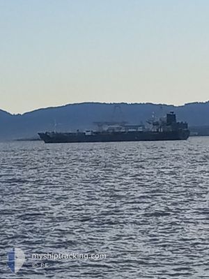
BEGONIA
Oil/Chemical Tanker
Current Trip
| Trip Time | 67 days |
|---|---|
| Trip Distance | 9708.79 nm |
| AVG Speed | 11 Knots |
| MAX Speed | 11 Knots |
| Dybgang | 9.6 m |
| AVG Wind | 16 knots |
| MAX Wind | 46 knots |
| MIN Temp | 5°C / 41°F |
| MAX Temp | 30.4°C / 86.72°F |
| Position Modtaget | 1 d siden |
Current Position
| Longitude | --- |
|---|---|
| Latitude | --- |
| Status | Under way using engine |
| Fart | 14.4 Knots |
| Kurs | 116.6° |
| Område | North Pacific Ocean |
| Station | T-AIS |
| Position Modtaget | 1 d siden |
Info
Information
The current position of BEGONIA is in North Pacific Ocean with coordinates 37.99237° / -121.40884° as reported on 2025-01-14 21:20 by AIS to our vessel tracker app. The vessel's current speed is 14.4 Knots and is currently inside the port of STOCKTON.
The vessel BEGONIA (IMO: 9287297, MMSI: 572572220) is a Oil/Chemical Tanker that was built in 2003 ( 22 år gamle ). It's sailing under the flag of [TV] Tuvalu.
In this page you can find informations about the vessels current position, last detected port calls, and current voyage information. If the vessels is not in coverage by AIS you will find the latest position.
The current position of BEGONIA is detected by our AIS receivers and we are not responsible for the reliability of the data. The last position was recorded while the vessel was in Coverage by the Ais receivers of our vessel tracking app.
The current draught of BEGONIA as reported by AIS is 9.6 meters
Weather
| Temperature | 15.9°C / 60.62°F |
|---|---|
| Wind Speed | 1 knots |
| Direction | 17° NNE |
| Pressure | 1022.9 hPa |
| Humidity | 35 % |
| Cloud Coverage | 1 % |
Featured Company
Most Visited Ports (Last year)
| Port | Arrivals | |
|---|---|---|
| 3 | ||
| 2 | ||
| 2 | ||
| 2 | ||
| 2 | ||
| 1 |
Events
| Tid | Hændelsen | Detaljer | Position / Dest | Info |
|---|---|---|---|---|
| 2025-01-14 21:39 | Status er ændret | Default Under way using engine |
37.95207 / -121.32076
[US] STOCKTON
|
Fart: 14.4 kn Kurs: 116.6° |
| 2025-01-14 21:39 | STOP Sejllads |
37.95207 / -121.32076
[US] STOCKTON
|
Fart: 0.1 kn Kurs: 134° |
|
| 2025-01-14 21:38 | Skibe i havn |
|
37.95207 / -121.32076
[US] STOCKTON
|
Fart: 14.4 kn Kurs: 116.6° |
| 2025-01-14 21:20 | Udenfor Dækning |
37.99237 / -121.40884
North Pacific Ocean
[US] STOCKTON
|
Fart: 14.4 kn Kurs: 116.6° |
|
| 2025-01-14 18:57 | Dybgangen er ændret | 9.6 0 |
38.09599 / -121.57880
US SCK
|
Fart: 20 kn Kurs: 129° |
| 2025-01-14 18:18 | Dybgangen er ændret | 0 9.6 |
38.07576 / -121.67786
|
Fart: 18.8 kn Kurs: 349.9° |
| 2025-01-14 18:16 | Status er ændret | Under way using engine Default |
38.07145 / -121.67691
US SCK
|
Fart: 9.2 kn Kurs: 2° |
| 2025-01-14 17:59 | Status er ændret | Default Under way using engine |
38.03577 / -121.70634
US SCK
|
Fart: 9.4 kn Kurs: 68.1° |
| 2025-01-14 17:51 | Status er ændret | Under way using engine Default |
38.03038 / -121.73019
US SCK
|
Fart: 9.6 kn Kurs: 93° |
| 2025-01-14 17:31 | Status er ændret | Default Under way using engine |
38.02383 / -121.79541
US SCK
|
Fart: 8.7 kn Kurs: 112.7° |