

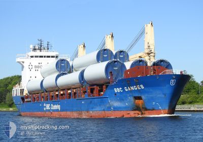
BBC GANGES
General Cargo

Current Trip
| Time Travelled | 8 days |
|---|---|
| Remaining Time | --- |
| Distance Travelled | 2572.12 nm |
| Remaining Distance | --- |
| AVG Speed | 11.7 Knots |
| MAX Speed | 14.1 Knots |
| AVG Wind | 11 knots |
| MAX Wind | 31 knots |
| MIN Temp | 14.1°C / 57.38°F |
| MAX Temp | 19.8°C / 67.64°F |
| Dybgang | 9.6 m |
| Position Modtaget | 1 h, 36 m siden |
Current Position
| Longitude | --- |
|---|---|
| Latitude | --- |
| Status | Under way using engine |
| Fart | 11.8 Knots |
| Kurs | 70.5° |
| Område | North Atlantic Ocean |
| Station | T-AIS |
| Position Modtaget | 1 h, 36 m siden |
Information
The current position of BBC GANGES is in North Atlantic Ocean with coordinates 41.32938° / -25.89802° as reported on 2025-03-28 18:11 by AIS to our vessel tracker app. The vessel's current speed is 11.8 Knots and is heading at the port of MONTOIR. The estimated time of arrival as calculated by MyShipTracking vessel tracking app is 2025-03-31 07:00 LT
The vessel BBC GANGES (IMO: 9508304, MMSI: 305529000) is a General Cargo that was built in 2010 ( 15 år gamle ). It's sailing under the flag of [AG] Antigua Barbuda.
In this page you can find informations about the vessels current position, last detected port calls, and current voyage information. If the vessels is not in coverage by AIS you will find the latest position.
The current position of BBC GANGES is detected by our AIS receivers and we are not responsible for the reliability of the data. The last position was recorded while the vessel was in Coverage by the Ais receivers of our vessel tracking app.
The current draught of BBC GANGES as reported by AIS is 9.6 meters
Weather
| Temperature | 15.6°C / 60.08°F |
|---|---|
| Wind Speed | 3 knots |
| Direction | 291° WNW |
| Pressure | 1029.1 hPa |
| Humidity | 80.4 % |
| Cloud Coverage | 100 % |


Featured Company
Last Port Calls
| Port | Arrival | Departure | Time In Port |
|---|---|---|---|
| 2025-03-18 15:15 | 2025-03-20 01:43 | 1 d | |
| 2025-03-03 22:19 | 2025-03-10 17:05 | 6 d | |
| 2025-02-26 04:07 | 2025-02-28 05:00 | 2 d | |
| 2025-02-22 00:03 | 2025-02-23 22:36 | 1 d | |
| 2025-02-18 01:10 | 2025-02-20 19:47 | 2 d | |
| 2025-02-02 12:48 | 2025-02-03 22:49 | 1 d | |
| 2025-01-21 15:41 | 2025-02-01 07:00 | 10 d | |
| 2025-01-04 11:41 | 2025-01-05 07:52 | 20 h |
Most Visited Ports (Last year)
| Port | Arrivals | |
|---|---|---|
| 2 | ||
| 1 | ||
| 1 | ||
| 1 | ||
| 1 | ||
| 1 |
Last Trips
| Origin | Departure | Destination | Arrival | Distance | |
|---|---|---|---|---|---|
| 2025-03-10 11:05 | 2025-03-18 11:15 | 1463.12 nm | |||
| 2025-02-27 23:00 | 2025-03-03 16:19 | 1103.51 nm | |||
| 2025-02-23 16:36 | 2025-02-25 22:07 | 438.92 nm | |||
| 2025-02-20 13:47 | 2025-02-21 18:03 | 312.05 nm | |||
| 2025-02-03 17:49 | 2025-02-17 19:10 | 3264.18 nm | |||
| 2025-02-01 04:00 | 2025-02-02 07:48 | 335.76 nm | |||
| 2025-01-05 02:52 | 2025-01-21 12:41 | 1071.51 nm | |||
| 2024-12-15 07:14 | 2025-01-04 06:41 | 4618.91 nm |
Events
| Tid | Hændelsen | Detaljer | Position / Dest | Info |
|---|---|---|---|---|
| 2025-03-28 18:19 | Status er ændret | Default Under way using engine |
41.33744 / -25.86523
FR MTX
|
Fart: 11.8 kn Kurs: 70.5° |
| 2025-03-28 18:11 | Udenfor Dækning |
41.32938 / -25.89802
North Atlantic Ocean
FR MTX
|
Fart: 11.8 kn Kurs: 70.5° |
|
| 2025-03-28 16:23 | Status er ændret | Under way using engine Default |
41.21712 / -26.36387
FR MTX
|
Fart: 12.6 kn Kurs: 73° |
| 2025-03-28 16:23 | Indenfor Dækning |
41.21872 / -26.35647
North Atlantic Ocean
FR MTX
|
Fart: 12.6 kn Kurs: 74.3° |
|
| 2025-03-28 00:04 | Status er ændret | Default Under way using engine |
40.11886 / -30.58759
FR MTX
|
Fart: 12.6 kn Kurs: 70.3° |
| 2025-03-28 00:02 | Udenfor Dækning |
40.11686 / -30.59482
North Atlantic Ocean
FR MTX
|
Fart: 12.6 kn Kurs: 70.3° |
|
| 2025-03-28 00:00 | Status er ændret | Under way using engine Default |
40.11407 / -30.60496
FR MTX
|
Fart: 12.6 kn Kurs: 72° |
| 2025-03-27 23:41 | Status er ændret | Default Under way using engine |
40.09274 / -30.68572
FR MTX
|
Fart: 12.6 kn Kurs: 72.4° |
| 2025-03-27 22:56 | Status er ændret | Under way using engine Default |
40.04179 / -30.88151
FR MTX
|
Fart: 12.9 kn Kurs: 72° |
| 2025-03-27 22:51 | Status er ændret | Default Under way using engine |
40.03589 / -30.90449
FR MTX
|
Fart: 12.8 kn Kurs: 72.9° |